Death Valley National Park Map
Heat defines this vast desert. In fact, summer temperatures here regularly exceed 120°F. This makes it one of the hottest places on Earth.
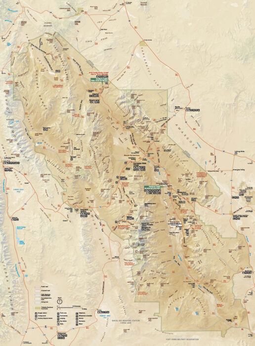
Heat defines this vast desert. In fact, summer temperatures here regularly exceed 120°F. This makes it one of the hottest places on Earth.
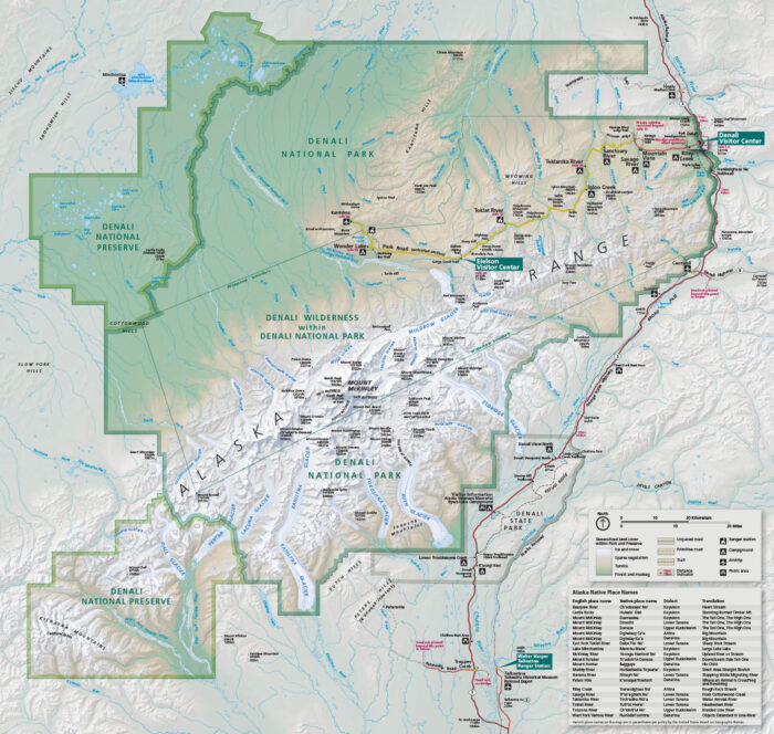
In central Alaska, Denali rises over everything. Our park map shows the roads, trails, campgrounds, overlooks, and mountain glaciers.
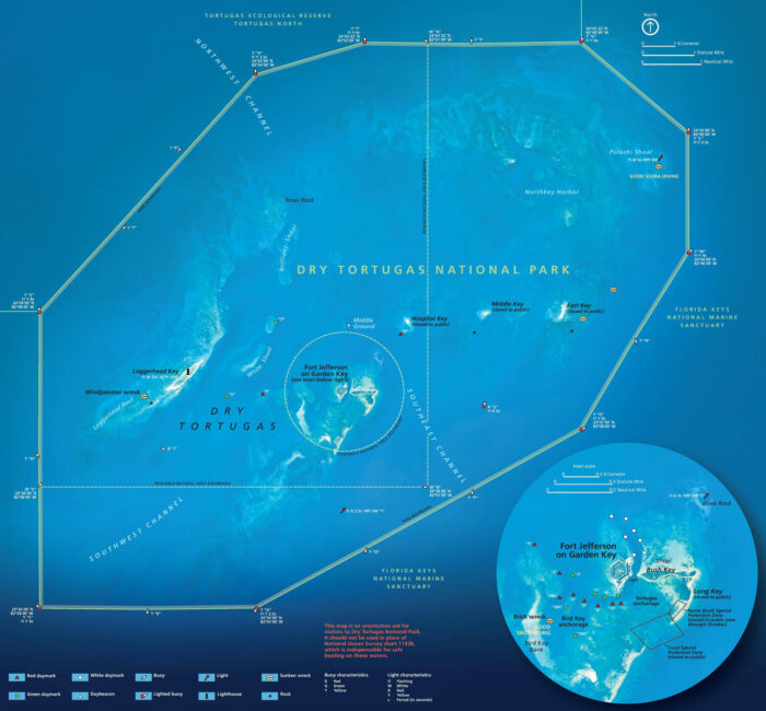
Dry Tortugas feels like a world offshore. Located west of Key West, it’s known for Fort Jefferson, coral reefs, and bright turquoise water.
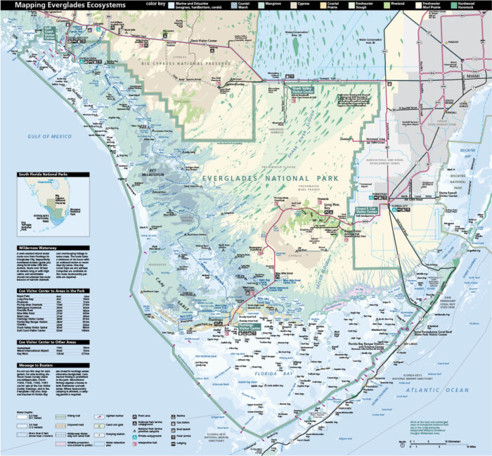
In southern Florida, you can find Everglades National Park with its coastal environment. Our park map shows roads, picnic areas and ecosystems.
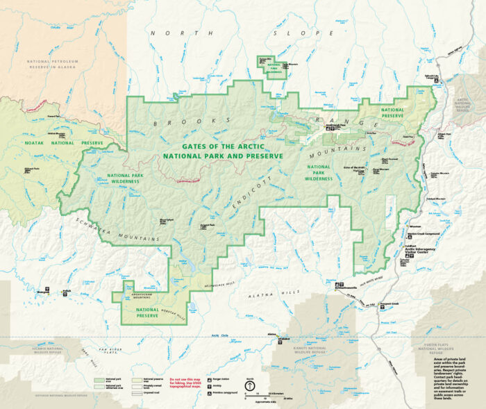
Set entirely above the Arctic Circle in northern Alaska, our national park map marks rivers, lakes, routes, and the continental divide.
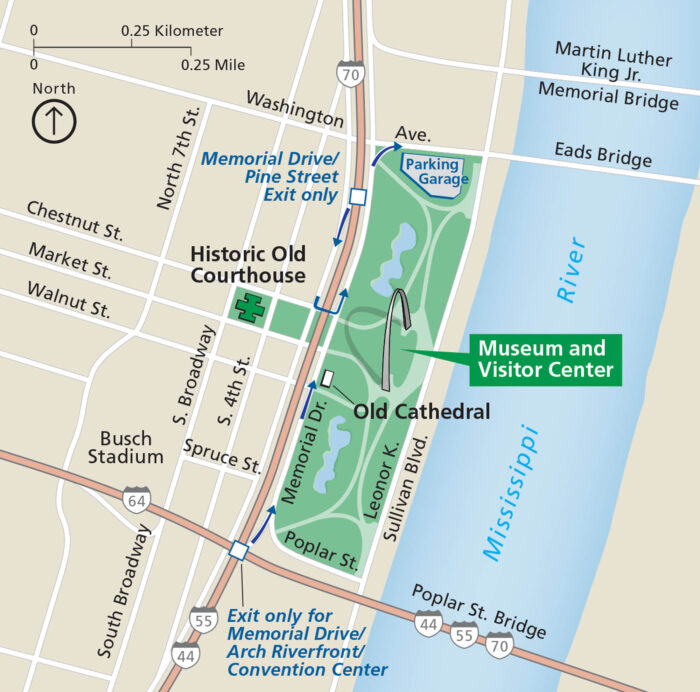
Gateway Arch National Park centers on one shining landmark. Our national park map shows paths, museums, and roads.
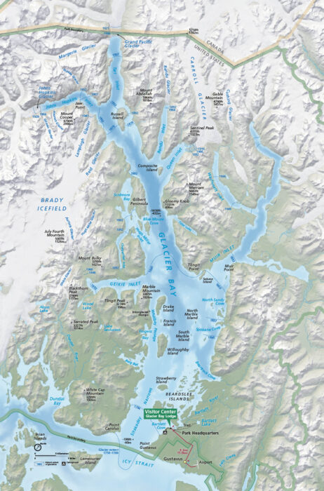
Wilderness and water rule here. Our map of Glacier Bay National Park highlights mountain peaks, bays, coves and Glacier Bay Lodge.
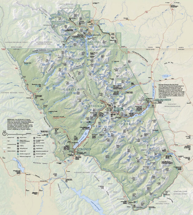
Our map of Glacier National Park shows roads, trails, overlooks, and campgrounds. It’s located along Montana’s northern edge.
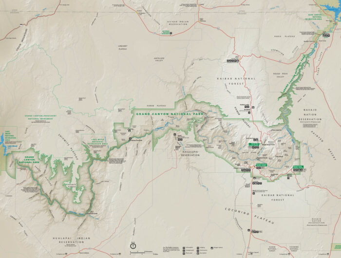
Grand Canyon’s layered rock plunge into one of the deepest gorges on Earth. See its roads, trails, and overlooks with our park map.
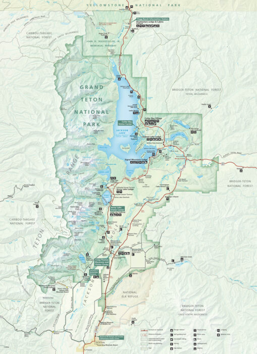
Grand Teton National Park impresses instantly. Sitting in northwestern Wyoming, our map shows trails, campgrounds, and major roads.
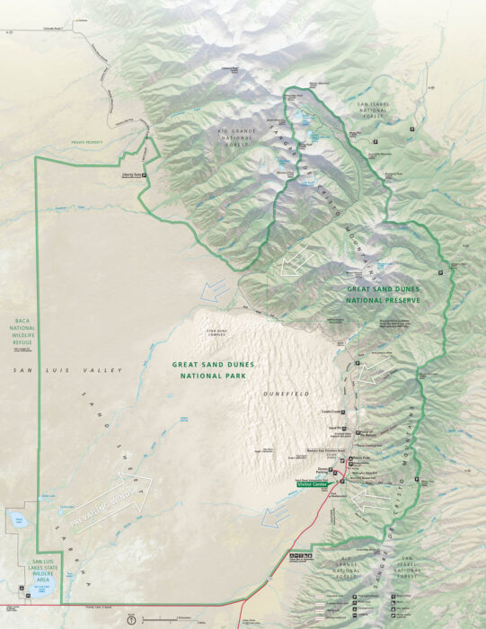
Our map of Great Sand Dunes National Park and Preserve shows roads, trails, dunes, campgrounds, and visitor centers.
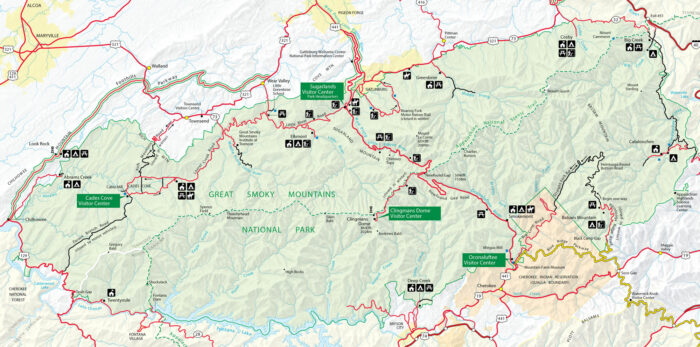
Our Great Smoky Mountains National Park map shows roads, trails, overlooks, and campgrounds so you can explore every corner.
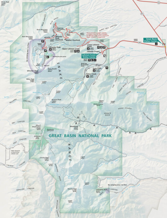
Great Basin rises in eastern Nevada with caves, high desert, and Wheeler Peak. Our map highlights roads, trails, campgrounds, and topography.
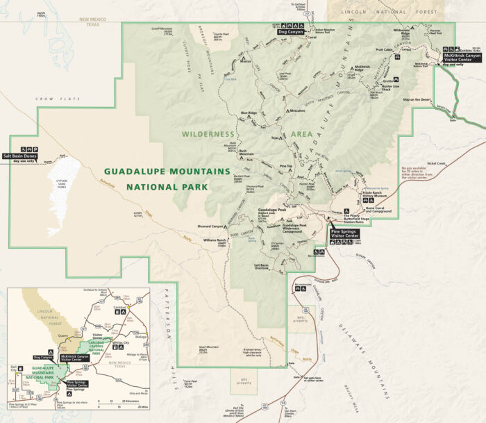
Guadalupe Mountains National Park is on the border of Texas and New Mexico. Our park map shows roads, trails, campgrounds and terrain.
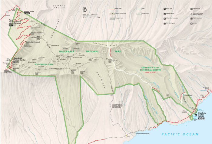
Haleakala National Park rises high above Maui with its summit and coastal area. Use our map to see visitor centers, roads, and trails.