Great Smoky Mountains National Park Map
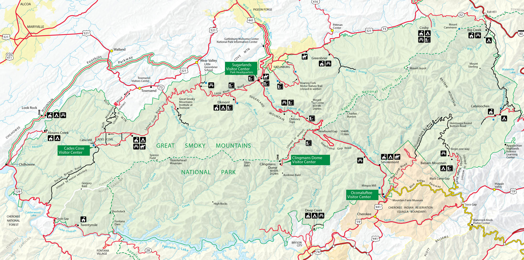
Great Smoky Mountains National Park sits on the Tennessee-North Carolina border. The park stretches through valleys, waterfalls, and those famous misty peaks. Our park map shows roads, trails, overlooks, and campgrounds so you can explore every corner.
Map Information
On the Map
Highways: US Hwy 441, US Hwy 321, US Hwy 129, US Hwy 19, State Rte 73, State Rte 32, State Rte 28 Major Roads: Newfound Gap Rd, Blue Ridge Pkwy, Little River Rd, Laurel Creek Rd, Cades Cove Loop Rd, Roaring Fork Motor Nature Trail, Greenbrier Rd, Balsam Mountain Rd, Heintooga Ridge Rd, Foothills Pkwy Lakes/Creeks: Fontana Lake, Little River, Oconaluftee River, Pigeon River, Abrams Creek, Hazel Creek, Eagle Creek, Forney Creek, Noland Creek, Deep Creek, Raven Fork, Cataloochee Creek Parks: Great Smoky Mountains National Park, Cherokee Indian Reservation, Nantahala National Forest Visitor Centers: Sugarlands Visitor Center, Oconaluftee Visitor Center, Cades Cove Visitor Center, Clingmans Dome Visitor Center Cities/Towns: Gatlinburg, Cherokee, Townsend, Bryson City, Pigeon Forge, Cosby, Maryville Campgrounds/Park Sites: Elkmont, Smokemont, Cades Cove, Deep Creek, Cosby, Greenbrier, Abrams Creek, Balsam Mountain, Big Creek, Cataloochee, Twenty Mile Other Landmarks: Clingmans Dome, Mount Le Conte, Newfound Gap, Mount Guyot, Gregory Bald, Chimney Tops, Charlies Bunion, Mingus Mill, Mountain Farm MuseumNational Park Maps
Find maps of green spaces and national parks near you.


