Great Sand Dunes National Park and Preserve Map
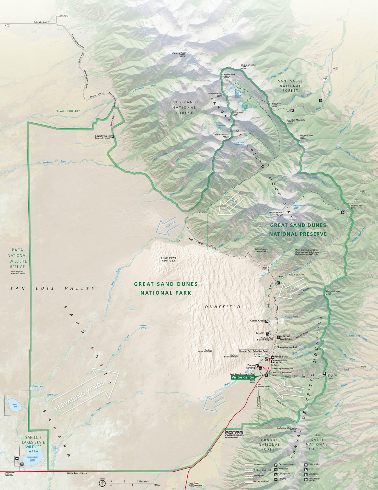
Our map of Great Sand Dunes National Park and Preserve shows roads, trails, dunes, campgrounds, and visitor centers. This national park is unique because it rises suddenly from the Colorado plains with towering dunes and wide mountain backdrops.
Map Information
On the Map
Highways: State Rte 150 Major Roads: Medano Pass Primitive Rd, Lane 6 North, Colorado Rd T Creeks/Lakes: Medano Creek, Sand Creek, Little Medano Creek, Upper Sand Creek Lake, Lower Sand Creek Lake, Little Sand Creek, Dollar Lake, Cold Creek Parks: Great Sand Dunes National Park, Great Sand Dunes National Preserve, Rio Grande National Forest, San Isabel National Forest, San Luis Lakes State Wildlife Area, Baca National Wildlife Refuge Campgrounds/Park Sites: Pinyon Flats Campground, Medano Creek Primitive Campsites, Sand Pit, Castle Creek Other Landmarks: Sangre de Cristo Mountains, Dunefield, Star Dune Complex, Medano Pass, Mount Herard, Music Pass, Cleveland Peak, Tijeras Peak, Sand Sheer, Sabkha, Point of No ReturnNational Park Maps
Find maps of green spaces and national parks near you.


