Haleakala National Park Map
Haleakala National Park rises high above Maui. The park covers both the summit and the rugged coastal Kipahulu area. Use our map to see visitor centers, roads, and trails.
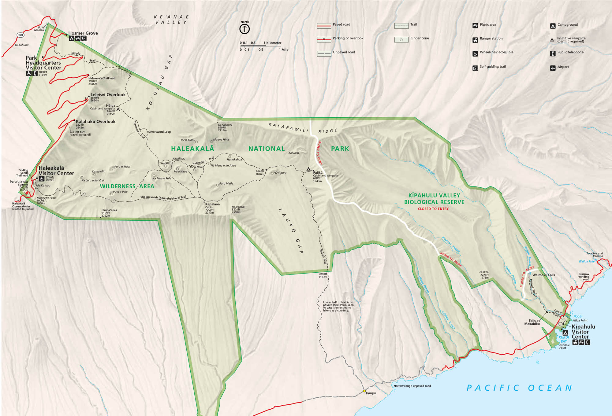
Map Information
On the Map
Parks: Haleakalā National Park, Kipahulu Valley Biological Reserve Visitor Centers: Park Headquarters Visitor Center, Haleakalā Visitor Center, Kipahulu Visitor Center Highways: State Rte 31, State Rte 37, State Rte 377, State Rte 378, State Rte 360 Major Roads: Haleakalā Hwy, Hana Hwy, Piilani Hwy Streams and Reservoirs: Pacific Ocean, Palikea Stream, Pipiwai Stream, Kaukauai Stream, Oheo Gulch Cities/Towns: Hana, Kaupo, Kipahulu Campgrounds/Park Sites: Hosmer Grove Campground, Kipahulu Campground, Holua Cabin, Kapalaoa Cabin, Paliku Cabin Other Landmarks: Haleakalā Crater, Puu Ulaula Summit, Leleiwi Overlook, Kalahaku Overlook, Sliding Sands Trail, Kaupo Gap, Ko’olau Gap, Waimoku Falls, Seven Sacred PoolsNational Park Maps
Find maps of green spaces and national parks near you.


