Glacier Bay National Park and Preserve Map
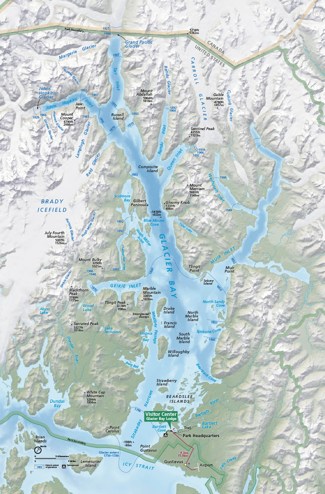
Wilderness and water rule here. Glacier Bay stretches across coastal Alaska with fjords, tidewater glaciers, and quiet inlets. Our map highlights mountain peaks, bays, coves and Glacier Bay Lodge.
Map Information
On the Map
Parks: Glacier Bay National Park and Preserve Visitor Centers: Visitor Center (Glacier Bay Lodge) Lakes/Bays: Glacier Bay, Icy Strait, Bartlett Lake, Abyss Lake, Lake Seclusion, Wood Lake, Tarr Inlet, Johns Hopkins Inlet, Muir Inlet, Wachusett Inlet, Queen Inlet, Rendu Inlet, Geikie Inlet, Scidmore Bay, Dundas Bay, Blue Mouse Cove Cities/Towns: Gustavus Islands/Glaciers: Margerie Glacier, Grand Pacific Glacier, Johns Hopkins Glacier, Lamplugh Glacier, Reid Glacier, Muir Glacier, Carroll Glacier, Brady Icefield, Beardslee Islands, Drake Island, Willoughby Island, Marble Islands, Russell Island Other Landmarks: Bartlett Cove, Park Headquarters, Airport, Point Gustavus, Inian Islands, Lemesurier IslandNational Park Maps
Find maps of green spaces and national parks near you.


