Guadalupe Mountains National Park Map
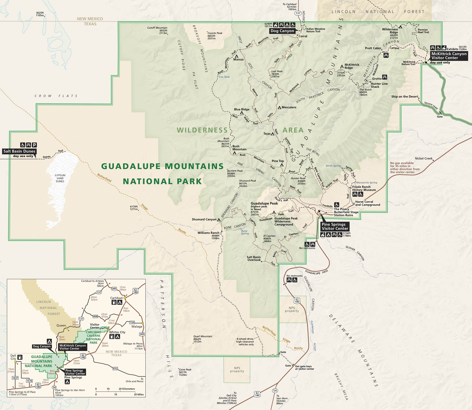
Guadalupe Mountains National Park stands tall on the border of Texas and New Mexico. Our park map shows roads, trails, campgrounds, and the terrain. This national park mixes canyons, cliffs, and the highest point in Texas.
Map Information
On the Map
Parks: Guadalupe Mountains National Park, Carlsbad Caverns National Park, Lincoln National Forest Visitor Centers: Pine Springs Visitor Center, McKittrick Canyon Visitor Center Highways: US Hwy 62, US Hwy 180, State Rte 137 Major Roads: Williams Ranch Rd Creeks/Springs: McKittrick Creek, Smith Spring, Choza Spring Cities/Towns: Whites City, Dell City, Queen Campgrounds/Park Sites: Pine Springs Campground, Dog Canyon Campground, Frijole Ranch History Museum, Pratt Cabin, Hunter Line Shack, Williams Ranch Other Landmarks: Guadalupe Peak, El Capitan, Salt Basin Dunes, McKittrick Canyon, The Bowl, Bush Mountain, Shumard Peak, Bartlett Peak, Hunter Peak, Smith Spring, Devil’s HallNational Park Maps
Find maps of green spaces and national parks near you.


