Home » State Maps » Arizona Population Map

Arizona Population Map

Arizona Population Density Map

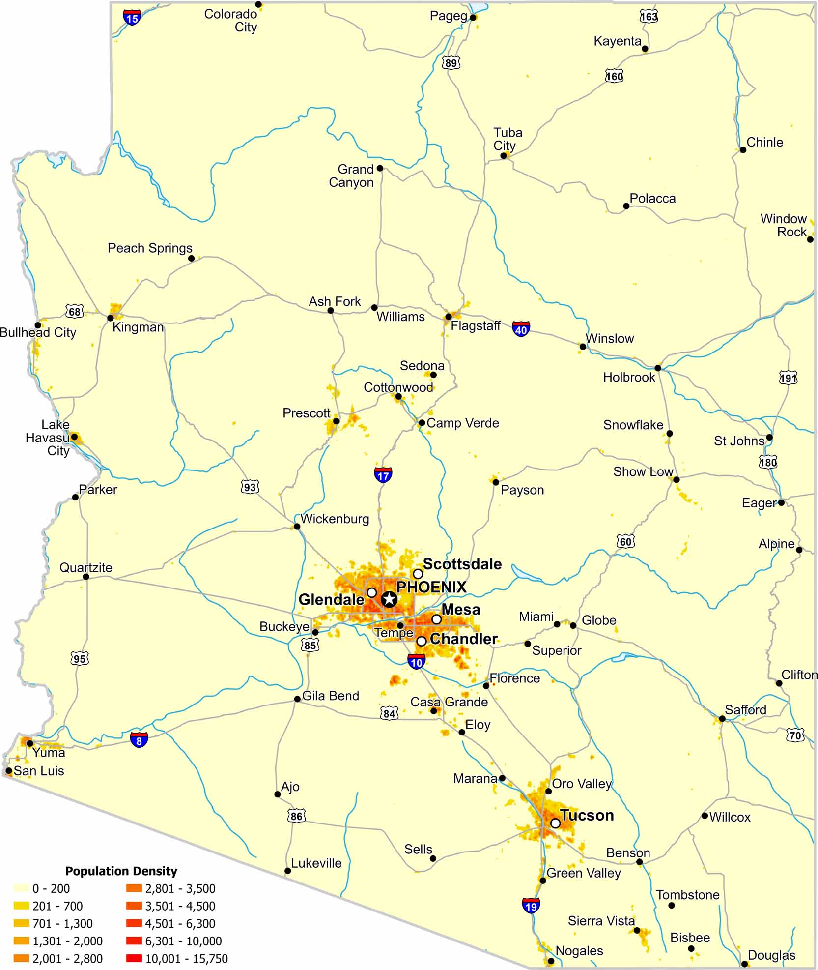
Much of Arizona’s population is concentrated in the south and central parts of the state. Check out our map to see wide stretches of sparsely populated land beyond those corridors.

Map Information

  • Population Density Map of Arizona
  • Data provided by NASA SEDAC Gridded Population of the World
  • Free for personal and commercial purpose. Attribution is required. How to attribute?

On the Map

Arizona Location Map
State Capital: Phoenix Major Cities: Chandler, Glendale, Mesa, Scottsdale, Tucson Cities and Towns: Ajo, Alpine, Ash Fork, Benson, Bisbee, Buckeye, Bullhead City, Camp Verde, Casa Grande, Chinle, Clifton, Colorado City, Cottonwood, Douglas, Eager, Eloy, Flagstaff, Florence, Gila Bend, Globe, Grand Canyon, Green Valley, Holbrook, Kayenta, Kingman, Lake Havasu City, Lukeville, Marana, Miami, Nogales, Oro Valley, Pageg, Parker, Payson, Peach Springs, Polacca, Prescott, Quartzite, Safford, San Luis, Sedona, Sells, Show Low, Sierra Vista, Snowflake, St Johns, Superior, Tempe, Tombstone, Tuba City, Wickenburg, Willcox, Williams, Window Rock, Winslow, Yuma Interstate Highways: I-8, I-10, I-15, I-17, I-19, I-40 US Routes: U.S. 11, U.S. 29, U.S. 31, U.S. 43, U.S. 45, U.S. 72, U.S. 78, U.S. 80, U.S. 82, U.S. 84, U.S. 90, U.S. 98, U.S. 231, U.S. 278, U.S. 280, U.S. 331, U.S. 411, U.S. 431

Leave a Reply

Your email address will not be published. Required fields are marked *