Home » State Maps » Minnesota Lakes and Rivers Map

Minnesota Lakes and Rivers Map

Minnesota Lakes and Rivers Map

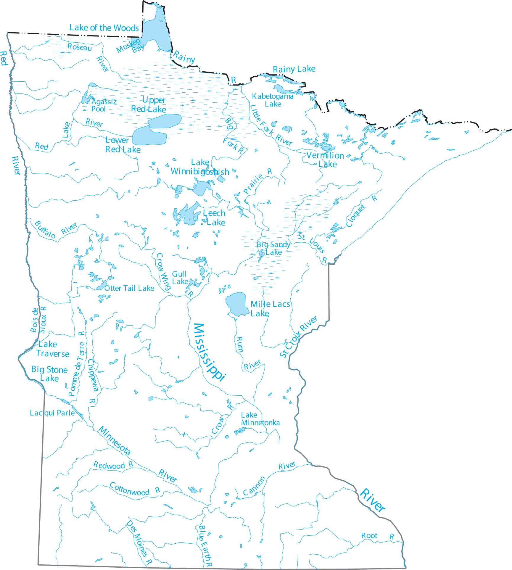
See how Minnesota earns its lake reputation as the “Land of 10,000 Lakes”. The Mississippi River begins here at Lake Itasca, and Lake Superior forms the northeastern border. You’ll also find the long path of the Minnesota River.

Map Information

  • Lakes and Rivers Map of Minnesota
  • Original map provided by National Map. Map updated by our team.
  • Free for personal and commercial purpose. Attribution is required. How to attribute?

On the Map

Minnesota Location Map
Lakes/Reservoirs: Agassiz Pool, Big Sandy Lake, Big Stone Lake, Gull Lake, Kabetogama Lake, Lac qui Parle, Lake Minnetonka, Lake of the Woods, Lake Superior, Lake Traverse, Lake Winnibigoshish, Leech Lake, Lower Red Lake, Mille Lacs Lake, Muskeg Bay, Otter Tail Lake, Rainy Lake, Red Lake, Upper Red Lake, Vermilion Lake Rivers and Streams: Big Fork River, Blue Earth River, Bois de Sioux River, Buffalo River, Cannon River, Chippewa River, Cloquet River, Cottonwood River, Crow River, Crow Wing River, Des Moines River, Little Fork River, Minnesota River, Mississippi River, Pomme de Terre River, Prairie River, Rainy River, Redwood River, Root River, Roseau River, Rum River, St Croix River, St Louis River

Leave a Reply

Your email address will not be published. Required fields are marked *