Connecticut Lakes and Rivers Map
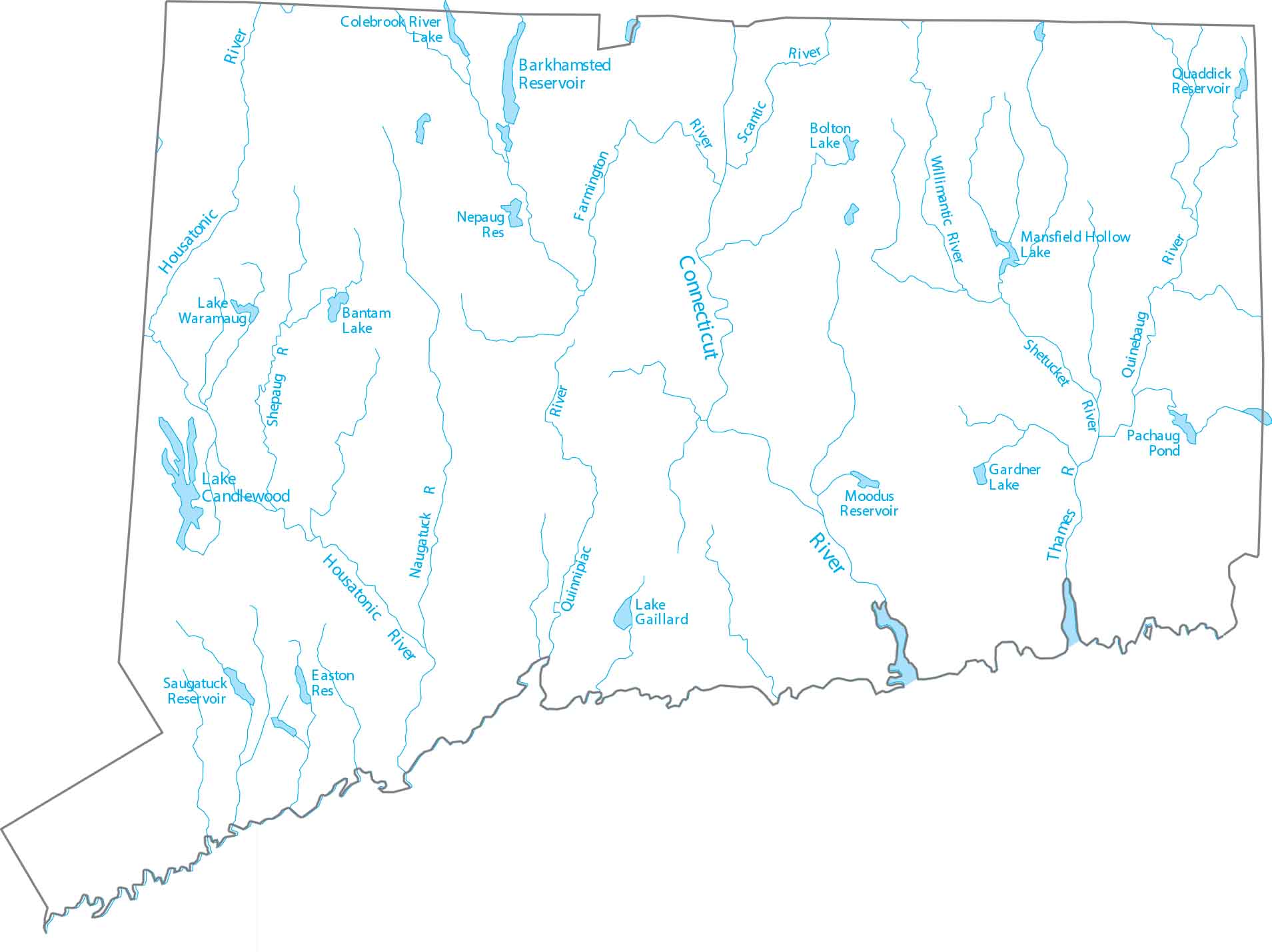
Connecticut is split down the middle by the Connecticut River, the longest waterway in the New England region. This river flows down the middle from Massachusetts to Long Island Sound. Our map of Connecticut highlights rivers and coastal lakes.
Map Information
On the Map
Lakes and Rivers State Maps
Select any state map below to view its lakes and rivers map.


Connecticut State Maps
Here’s your getaway to Connecticut geography


