Home » State Maps » Arkansas Lakes and Rivers Map

Arkansas Lakes and Rivers Map

Arkansas Lakes and Rivers Map

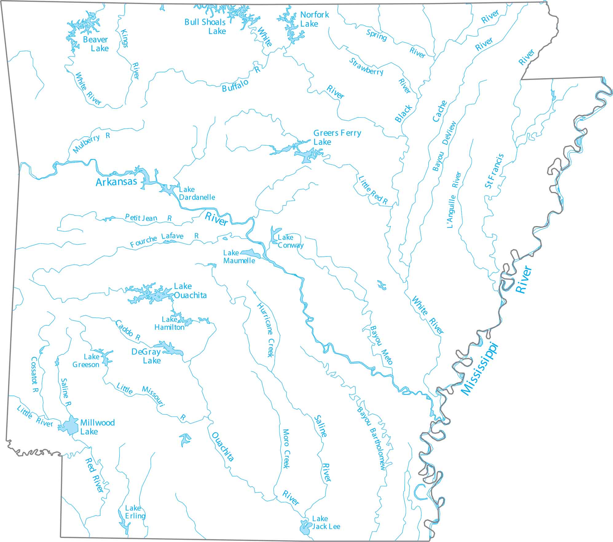
Familiarize yourself with Arkansas’ dense network of rivers. Our map shows the Arkansas River crossing the state and lakes tucked into the Ozarks. You’ll spot the Mississippi River forming the entire eastern boundary, where major rivers drain toward.

Map Information

  • Lakes and Rivers Map of Arkansas
  • Original map provided by National Map. Map updated by our team.
  • Free for personal and commercial purpose. Attribution is required. How to attribute?

On the Map

Arkansas Location Map
Lakes and Reservoirs: Beaver Lake, Bull Shoals Lake, DeGray Lake, Greers Ferry Lake, Lake Dardanelle, Lake Erling, Lake Greeson, Lake Hamilton, Lake Jack Lee, Lake Maumelle, Millwood Lake, Norfork Lake Rivers and Streams: Arkansas River, Black River, Cache River, Caddo River, Cossatot River, Fourche River, Hurricane Creek, Kings River, L’Anguille River, Lafave River, Little Missouri River, Little Red River, Mississippi River, Moro Creek, Mulberry River, Ouachita River, Petit Jean River, Red River, Saline River, Spring River, St. Francis River, Strawberry River, White Buffalo River, White River Bayous: Bayou Bartholomew, Bayou DeView River, Conway Bayou

Leave a Reply

Your email address will not be published. Required fields are marked *