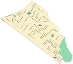
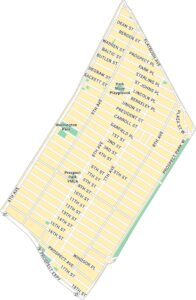
Crown Heights Map, New York
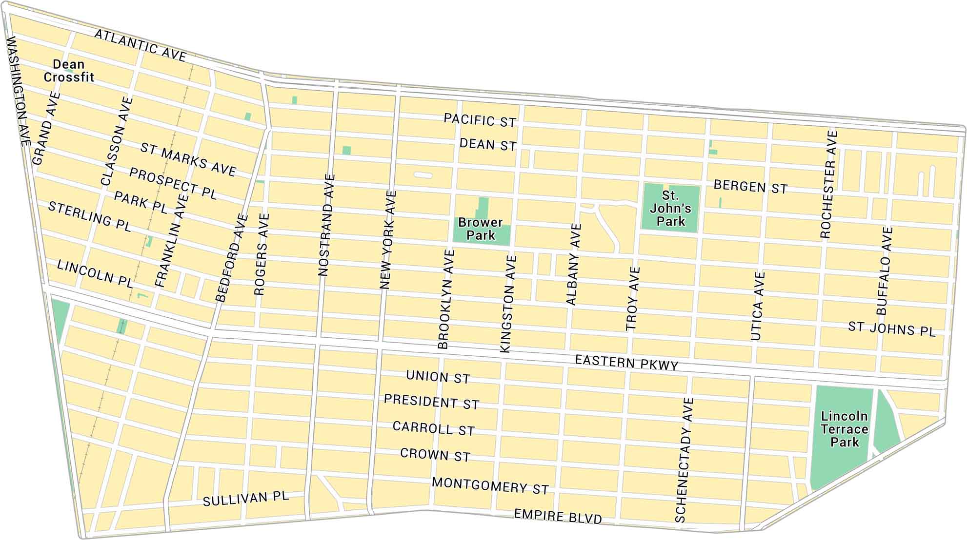
Here’s our map of Crown Heights covering this lively part of central Brooklyn. You’ll see main avenues and local parks stretching between Prospect Heights and Brownsville.
Map Information
Brooklyn Neighborhood Maps
See our neighborhood maps for a closer look of the city.
On the Map
Interstates/Highways: Eastern Pkwy Major Roads: Atlantic Ave, Empire Blvd, Bedford Ave, Nostrand Ave, Utica Ave, Washington Ave, Franklin Ave, Rogers Ave, Kingston Ave, Albany Ave, Troy Ave, Schenectady Ave, Rochester Ave, Buffalo Ave, New York Ave, Brooklyn Ave, St Johns Pl, President St, Union St Parks: St. John’s Park, Brower Park, Lincoln Terrace ParkCity Maps of New York
Here are the city maps that define New York


