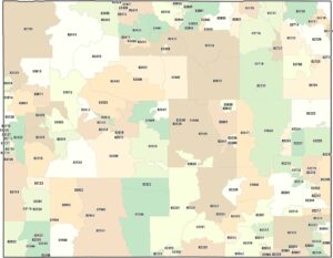
Wyoming Counties and Cities Map
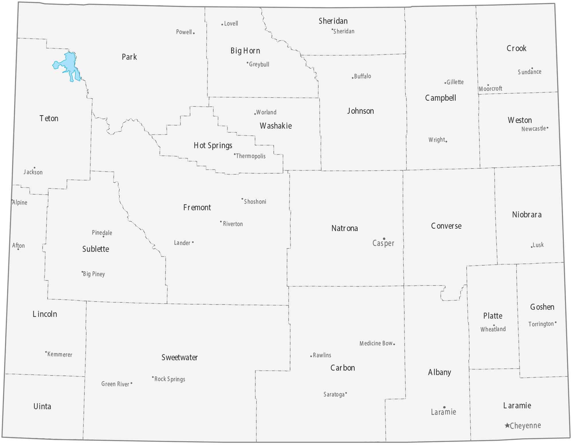
See how very large counties dominate the state of Wyoming on our map. Cities are few and widely spaced across the state with little interruption. Mountain ranges strongly influence county boundaries.
Map Information
On the Map
|
Name |
Population 2024 |
Total Area (sq mi) |
FIPS Code |
|
Albany County |
39,288 |
4,308.70 |
56-001 |
|
Big Horn County |
12,084 |
3,158.30 |
56-003 |
|
Campbell County |
47,946 |
4,806.30 |
56-005 |
|
Carbon County |
14,250 |
7,963.90 |
56-007 |
|
Converse County |
13,766 |
4,265.00 |
56-009 |
|
Crook County |
7,775 |
2,865.30 |
56-011 |
|
Fremont County |
39,721 |
9,265.70 |
56-013 |
|
Goshen County |
12,635 |
2,232.20 |
56-015 |
|
Hot Springs County |
4,625 |
2,006.40 |
56-017 |
|
Johnson County |
8,803 |
4,174.60 |
56-019 |
|
Laramie County |
101,783 |
2,687.50 |
56-021 |
|
Lincoln County |
21,000 |
4,094.60 |
56-023 |
|
Natrona County |
80,410 |
5,375.60 |
56-025 |
|
Niobrara County |
2,301 |
2,627.90 |
56-027 |
|
Park County |
31,082 |
6,965.10 |
56-029 |
|
Platte County |
8,512 |
2,110.80 |
56-031 |
|
Sheridan County |
32,978 |
2,526.40 |
56-033 |
|
Sublette County |
8,965 |
4,935.60 |
56-035 |
|
Sweetwater County |
41,273 |
10,491.10 |
56-037 |
|
Teton County |
23,272 |
4,217.20 |
56-039 |
|
Uinta County |
20,621 |
2,088.10 |
56-041 |
|
Washakie County |
7,662 |
2,242.70 |
56-043 |
|
Weston County |
6,866 |
2,400.00 |
56-045 |
Counties and Cities Maps
Select any state map below to view its counties and cities map.


Wyoming State Maps
Check out our maps across wide plains and peaks.