Virginia Precipitation Map
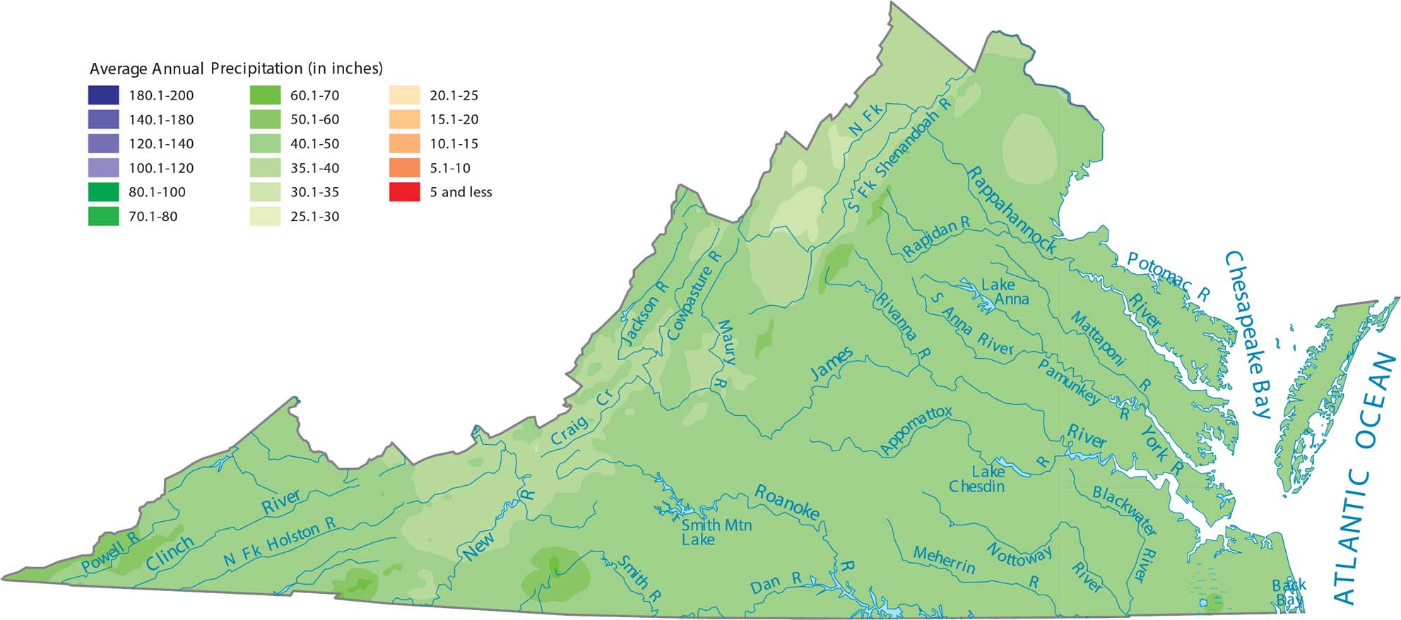
Virginia’s precipitation increases as you move from the coast inland toward the Blue Ridge Mountains. Then, it decreases in the valleys beyond. The mountains force Atlantic moisture upward, creating the wettest zone.
Map Information
State Precipitation Maps
Select any state map below to view its precipitation map.


Virginia State Maps
Spanning coasts and mountains, here are our maps of Virginia.


