Home » State Maps » Utah Population Map

Utah Population Map

Utah Population Density Map

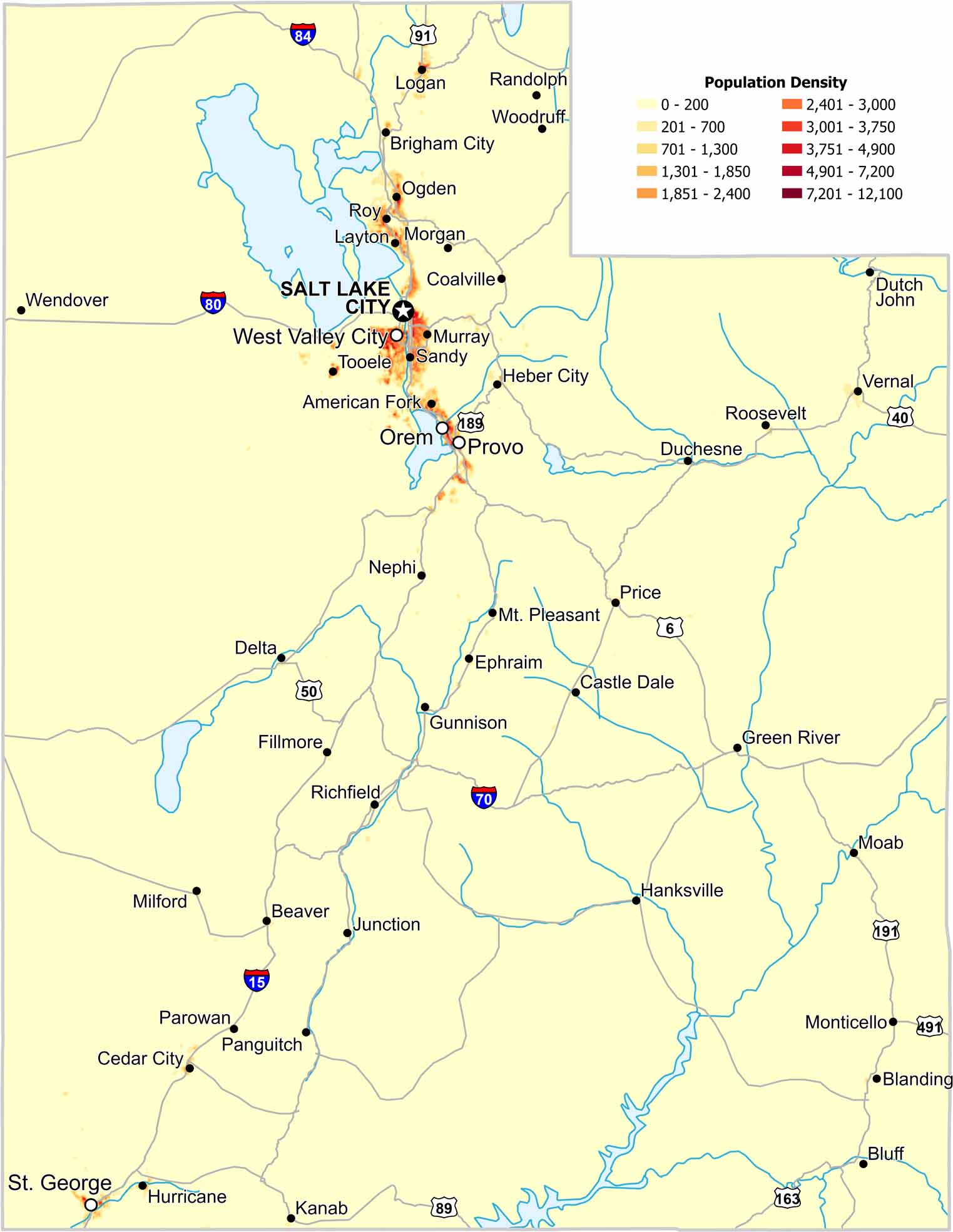
Most of Utah’s population lines a narrow band of valleys. Mountains rise quickly on either side of settled areas. Our population density map of Utah shows sharp edges between dense and empty regions. As you can see, terrain tightly controls growth.

Map Information

  • Population Density Map of Utah
  • Data provided by NASA SEDAC Gridded Population of the World
  • Free for personal and commercial purpose. Attribution is required. How to attribute?

On the Map

Utah Location Map
State Capital: Salt Lake City Major Cities: Orem, Provo, St. George, West Valley City Cities and Towns: American Fork, Beaver, Blanding, Bluff, Brigham City, Castle Dale, Cedar City, Coalville, Delta, Duchesne, Dutch John, Ephraim, Fillmore, Green River, Gunnison, Hanksville, Heber City, Hurricane, Junction, Kanab, Layton, Logan, Milford, Moab, Monticello, Morgan, Mt. Pleasant, Murray, Nephi, Ogden, Panguitch, Parowan, Price, Randolph, Richfield, Roosevelt, Roy, Sandy, Tooele, Vernal, Wendover, Woodruff Interstate Highways: I-15, I-70, I-80, I-84 US Routes: US-6, US-40, US-50, US-89, US-91, US-163, US-189, US-191, US-491

Leave a Reply

Your email address will not be published. Required fields are marked *