US Election 1884 Map
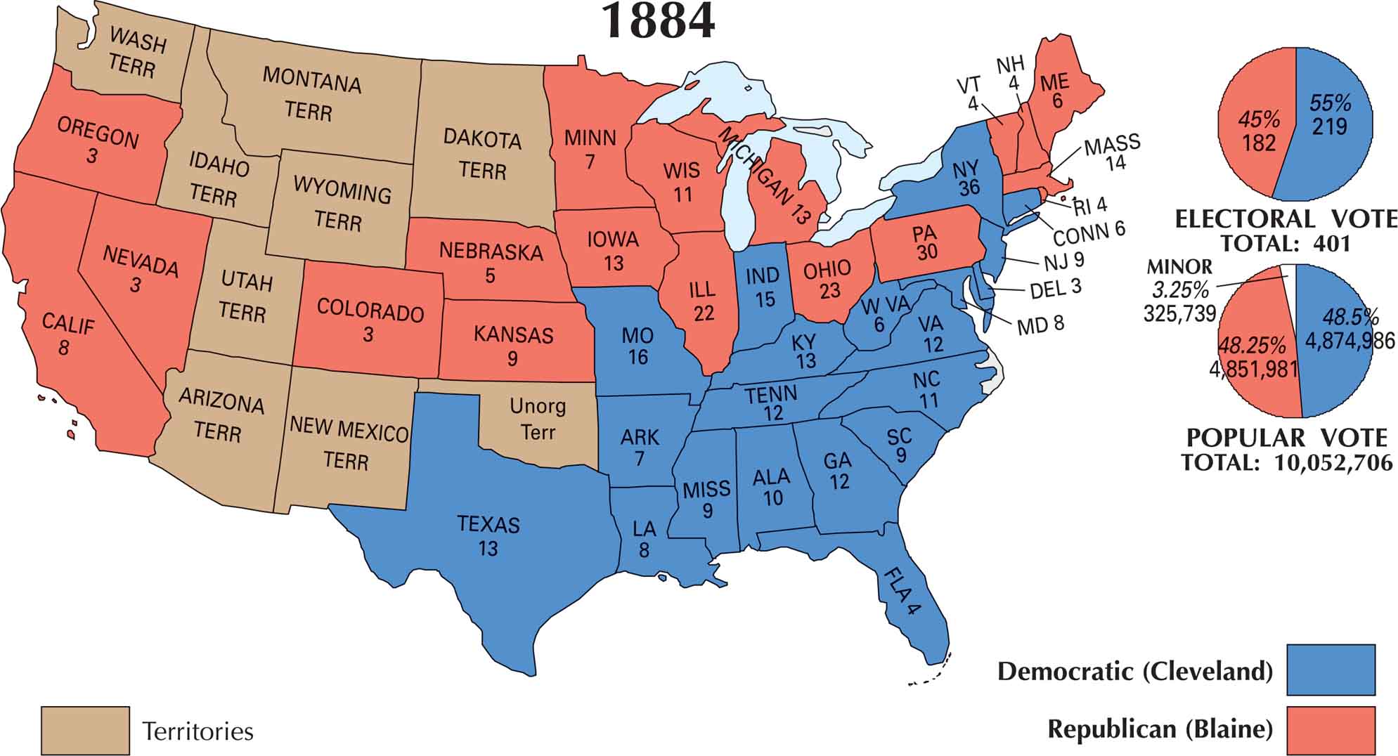
The 1884 election was a close contest. Democrat Grover Cleveland narrowly defeated Republican James G. Blaine, winning by just a handful of votes in New York. This state decided everything. On our U.S. election map of 1884, the North and Midwest leaned Republican, while the South held strong for the Democrats.
Map Information
US Election Maps
Click on a map below to check out the US election map and results.

Country Maps
Explore the geography that defines this nation.


