Wisconsin Outline Map
Our outline map of Wisconsin shows how water defines its borders. Much of its outline is shaped strongly by the Great Lakes and rivers.
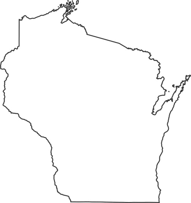
Our outline map of Wisconsin shows how water defines its borders. Much of its outline is shaped strongly by the Great Lakes and rivers.
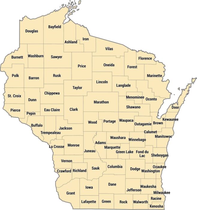
Our map of Wisconsin’s 72 counties shows them shifting in size, across its northern forests, central farmland, and Great Lakes shoreline.
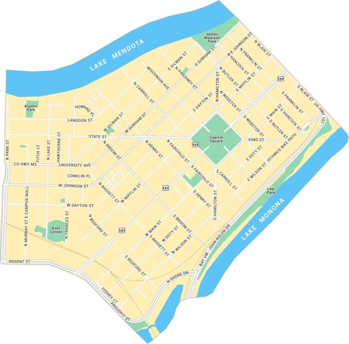
Our map of Downtown Madison shows the isthmus between Lake Mendota and Lake Monona. It lays out the Capitol Square, main streets, and parks.
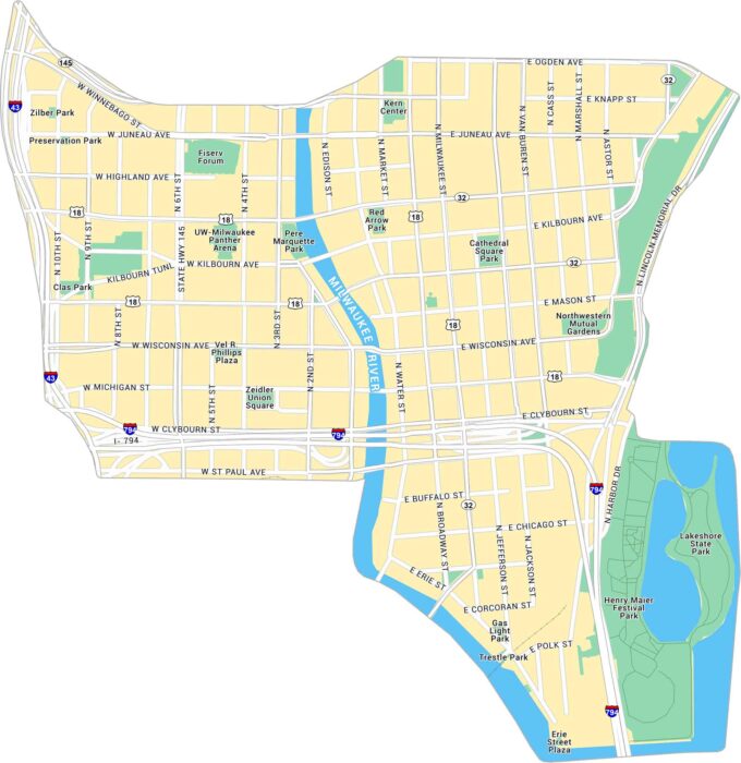
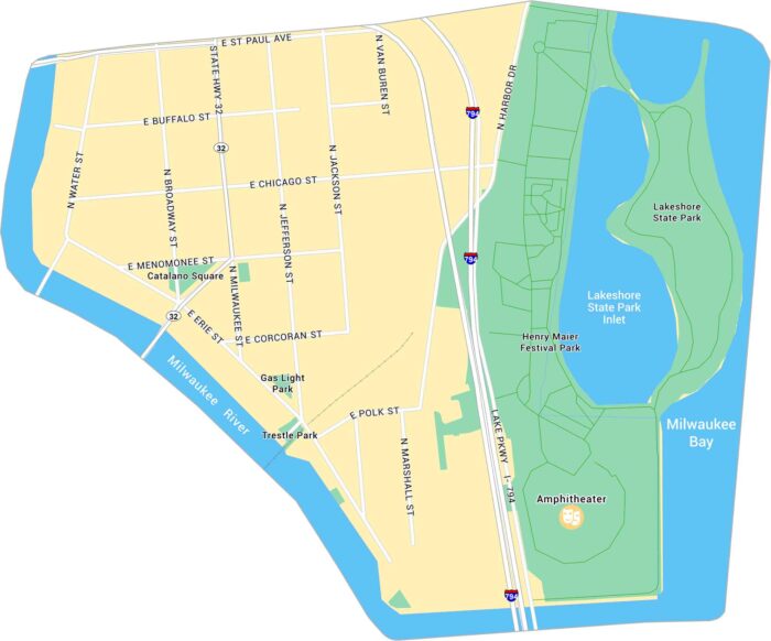
Downtown Milwaukee sits where the Milwaukee River meets Lake Michigan. Our map shows the riverwalk, main streets, and parks along the water.
Our map of Milwaukee’s Historic Third Ward highlights its riverwalks, lakeshore park, and proximity to Lake Michigan.
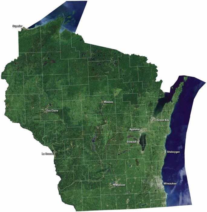
Wisconsin’s satellite map shows green farmland and rolling hills. The Great Lakes shine along the state’s edges including Lake Michigan.
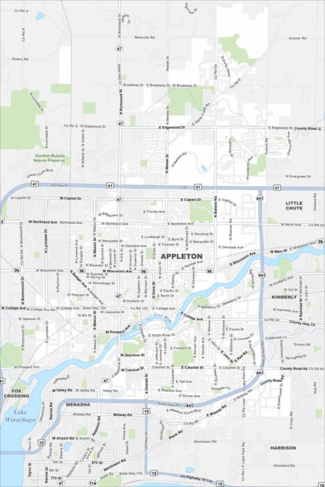
Here’s our map of Appleton, Wisconsin. Two major features are the Fox River and Lake Winnebago. You’ll also find roads, parks and lakes.
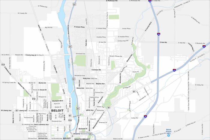
Here’s how to get around Bemidji with our city map. Beloit is on the southern border of Wisconsin along the Rock River.
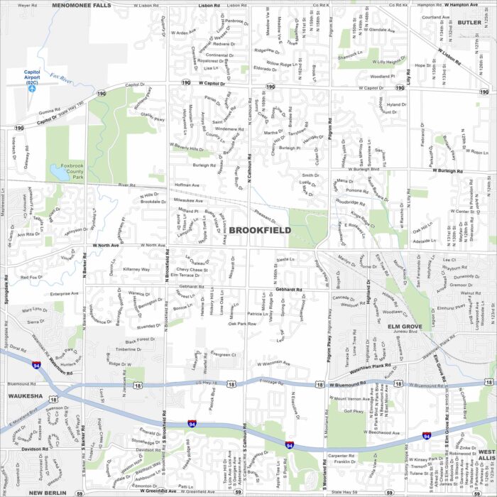
Our map of Brookfield highlights its highways, roads and parks. Green space spreads along its edges. It’s a western suburb of Milwaukee.
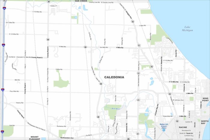
Caledonia is in southeastern Wisconsin along Lake Michigan. Our map shows rural stretches, highways, and its long shoreline.
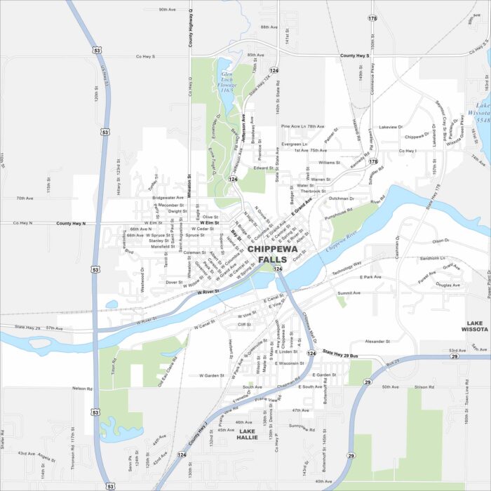
Chippewa Falls lies on the Chippewa River, with bridges tying together its neighborhoods. Lakes and forests spread north of the city.
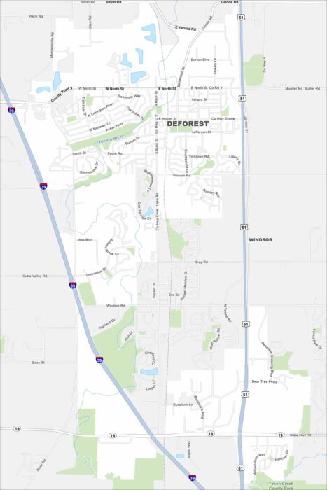
Our map of DeForest shows its highways, smaller roads, and nearby rivers. Just north of Madison, the village is surrounded by farmland.
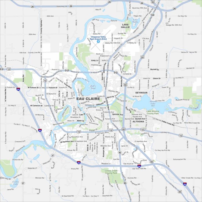
Our map of Eau Claire highlights the Chippewa and Eau Claire Rivers flowing together downtown. Trails and parks follow both waterways.
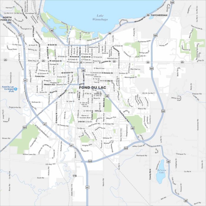
Fond du Lac is at the southern tip of Lake Winnebago. Streets spread out from the shoreline into farmland. The lakefront location is key.
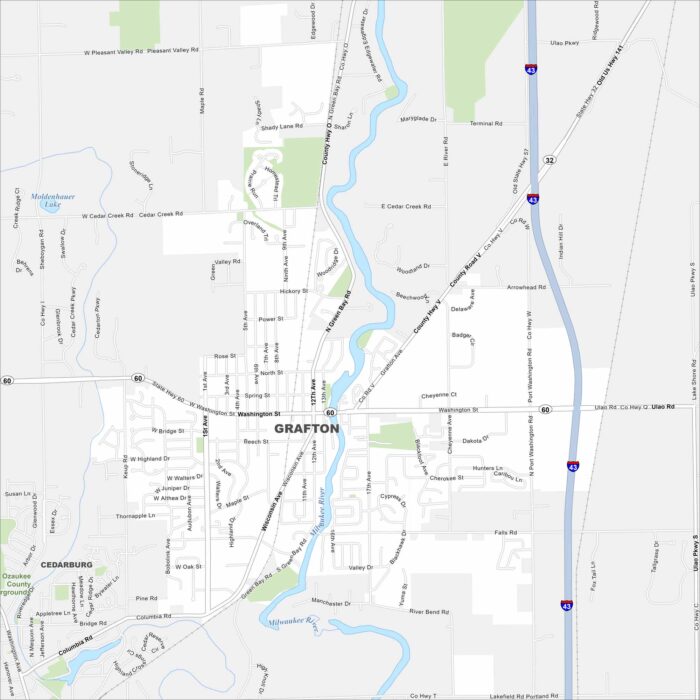
Our map of Grafton shows it north of Milwaukee along the Milwaukee River. The river winds through, shaping its layout.