Map of Beloit, Wisconsin
Here’s how to get around Bemidji with our city map. Beloit is on the southern border of Wisconsin along the Rock River.
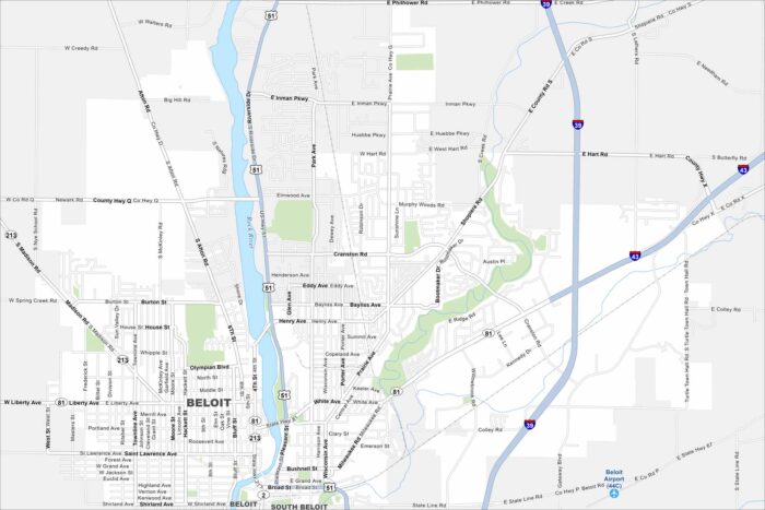
Here’s how to get around Bemidji with our city map. Beloit is on the southern border of Wisconsin along the Rock River.
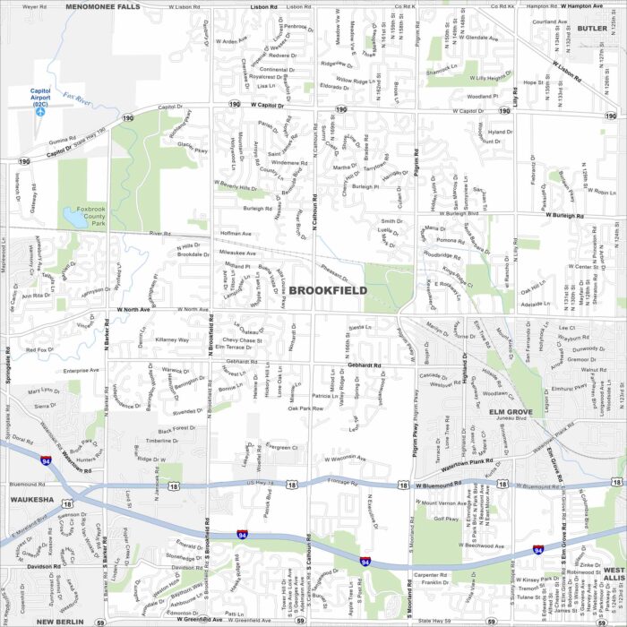
Our map of Brookfield highlights its highways, roads and parks. Green space spreads along its edges. It’s a western suburb of Milwaukee.
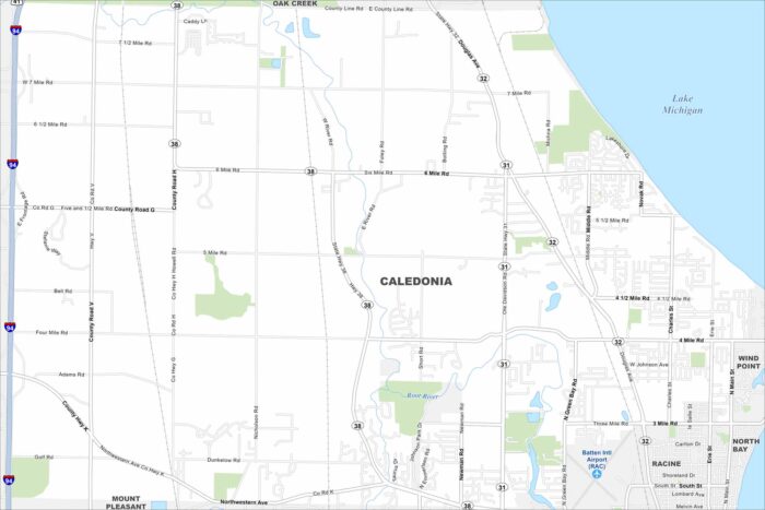
Caledonia is in southeastern Wisconsin along Lake Michigan. Our map shows rural stretches, highways, and its long shoreline.
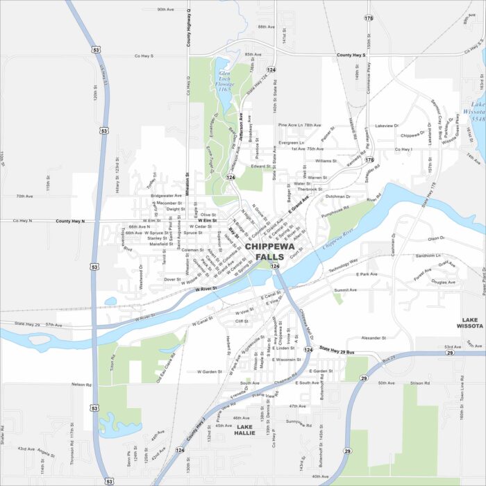
Chippewa Falls lies on the Chippewa River, with bridges tying together its neighborhoods. Lakes and forests spread north of the city.
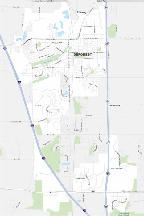
Our map of DeForest shows its highways, smaller roads, and nearby rivers. Just north of Madison, the village is surrounded by farmland.
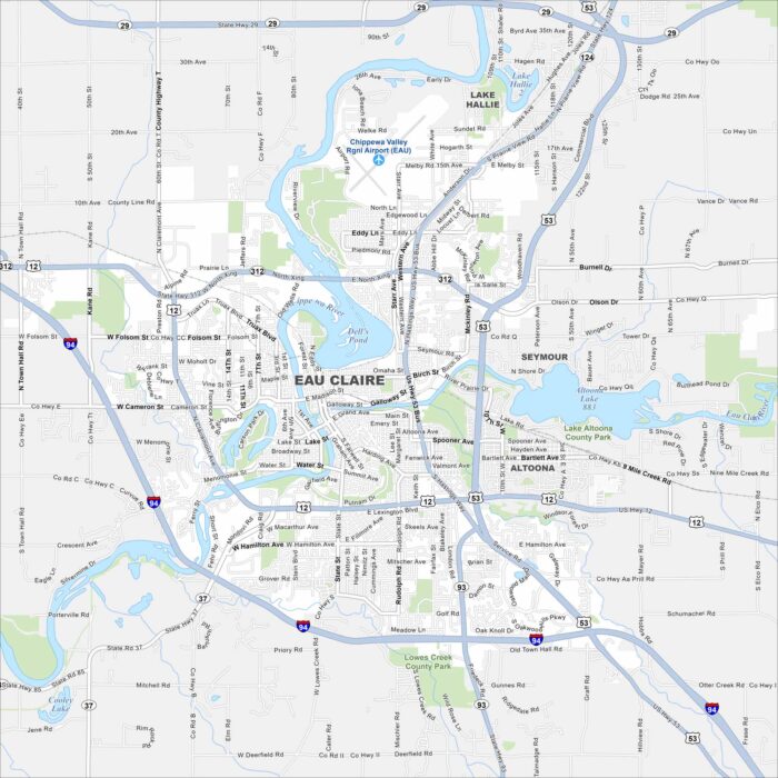
Our map of Eau Claire highlights the Chippewa and Eau Claire Rivers flowing together downtown. Trails and parks follow both waterways.
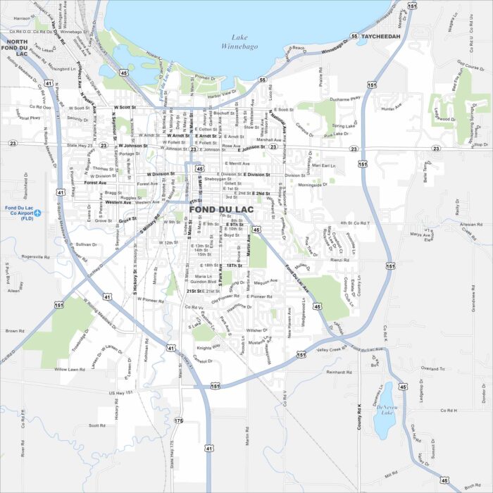
Fond du Lac is at the southern tip of Lake Winnebago. Streets spread out from the shoreline into farmland. The lakefront location is key.
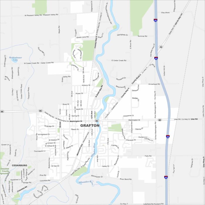
Our map of Grafton shows it north of Milwaukee along the Milwaukee River. The river winds through, shaping its layout.
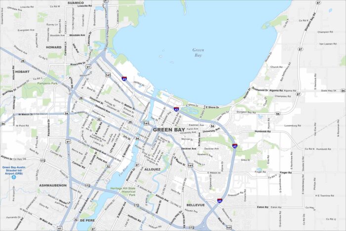
Our map of Green Bay shows it at the mouth of the Fox River. Green Bay defines its geography. But the Green Bay Packers is the lifeblood.
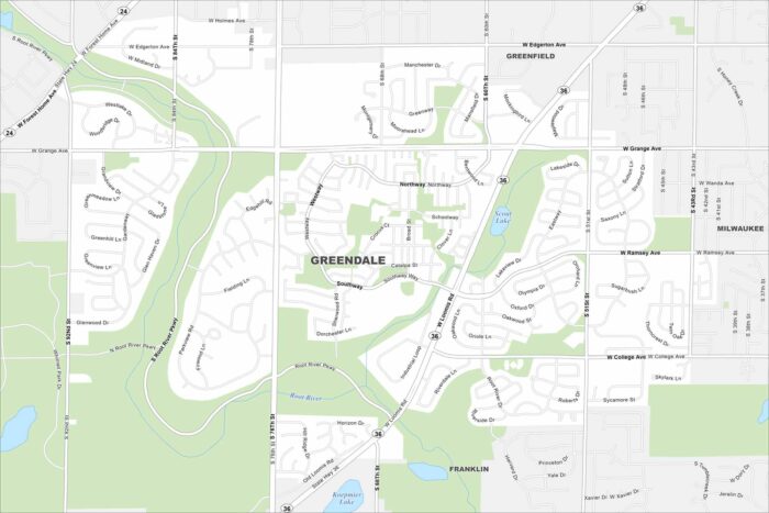
Greendale is a planned community just southwest of Milwaukee. Our map shows neat neighborhoods with parks and green space. Highways tie it directly into the metro area. Map Information On the Map Interstates/Highways: State Rte 36, State Rte 24 Major Roads: Loomis Rd, 76th St, 60th St, 92nd St, Forest Home Ave, Grange Ave, Ramsey…
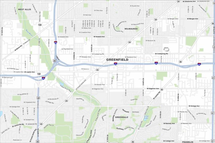
Our map of Greenfield highlights its spot south of Milwaukee. The street layout mixes older subdivisions with newer ones.
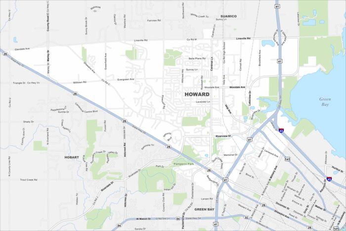
Howard sits along the bay near Green Bay itself. The map shows residential areas mixed with open land. Highways connect it into the city.
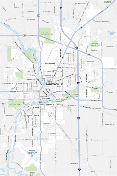
Janesville is built along the Rock River. The map shows parks and trails running beside the water. Highways connect it to Madison.
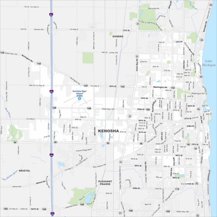
Kenosha sits along Lake Michigan’s shoreline. Highways stretch north toward Milwaukee and south to Chicago.
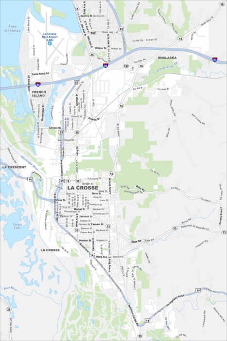
La Crosse, Wisconsin is perched along the Mississippi River. Our map highlights bluffs rising from the riverbanks.