Map of Madison, Wisconsin
Our map of Madison highlights its setting between Lake Mendota and Lake Monona. Highways wrap around the isthmus.
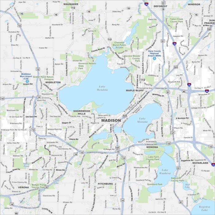
Our map of Madison highlights its setting between Lake Mendota and Lake Monona. Highways wrap around the isthmus.
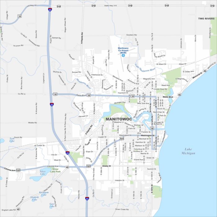
See Manitowoc, Wisconsin on our map along Lake Michigan. Highways connect the city to Green Bay and Milwaukee.
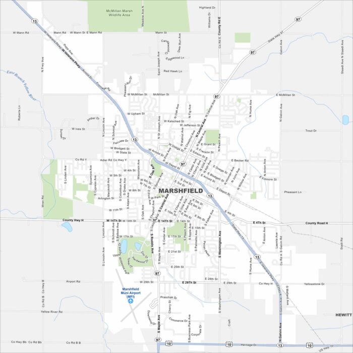
See Marshfield on our map, located in central Wisconsin. Our detailed map includes its roads, parks and waterways.
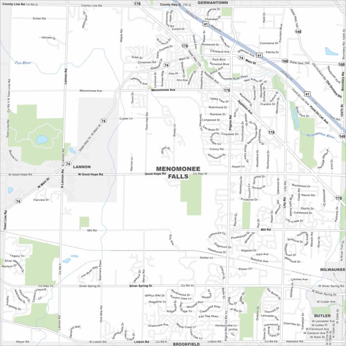
Our map of Menomonee Falls highlights its suburban layout northwest of Milwaukee. The village combines residential areas with light industry.
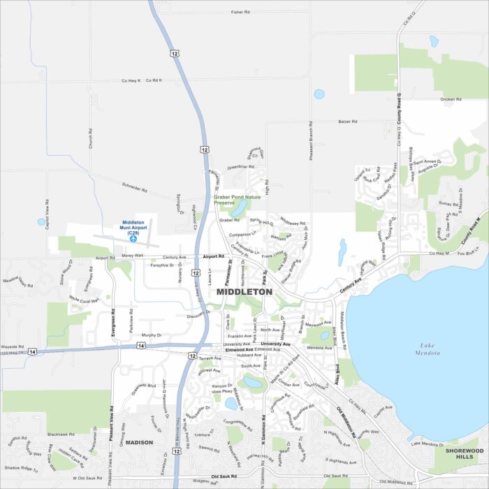
Check out Middleton, Wisconsin using our road map. The city sits just west of Madison, with Lake Mendota on the east side.
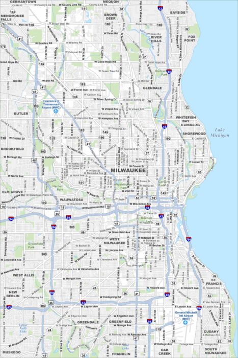
Our map of Milwaukee displays this city along Lake Michigan. The Milwaukee River cuts through downtown. Brewing heritage runs deep here.
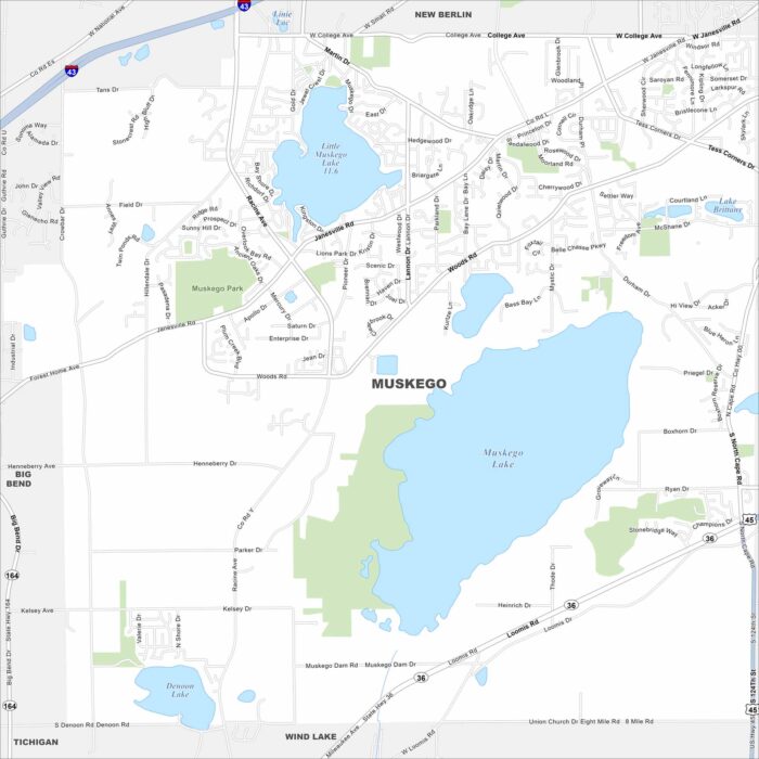
Our map of Muskego outlines a city southwest of Milwaukee. Lakes and wetlands break up much of the suburban layout.
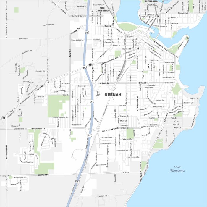
Our map of Neenah shows a city on Lake Winnebago. The Fox River runs through its center and has long defined the area.
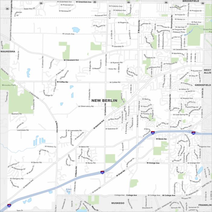
New Berlin sits between Milwaukee and Waukesha. This map highlights highways, roads and parks. It has grown as the greater Milwaukee area.
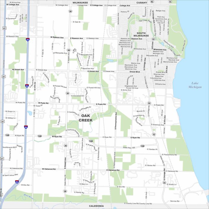
Oak Creek borders Lake Michigan just south of Milwaukee. The map shows a mix of suburban neighborhoods near the lakefront.
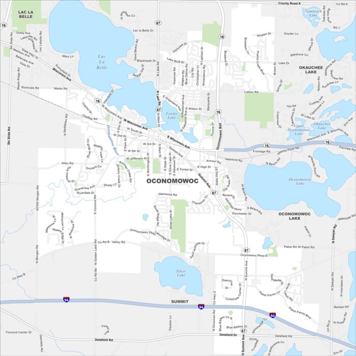
Our map of Oconomowoc highlights a small city surrounded by lakes. The downtown sits between Fowler Lake and Lac La Belle.
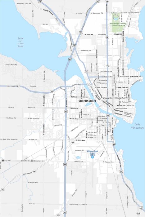
Oshkosh sits on Lake Winnebago with the Fox River flowing through it. Check out our map to see its riverfront, neighborhoods, and streets.
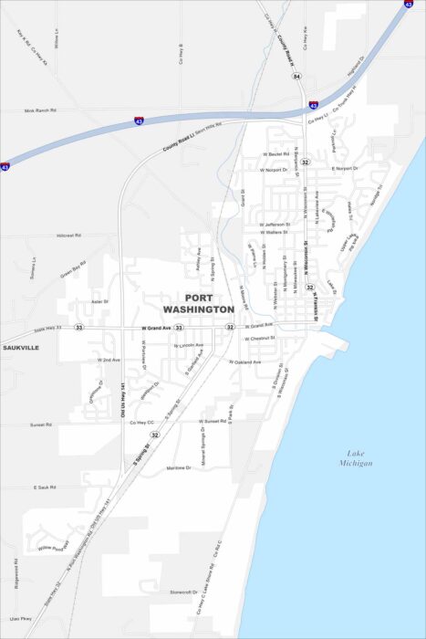
Our map of Port Washington highlights its streets along Lake Michigan. The downtown hugs the waterfront with marinas and historic buildings.
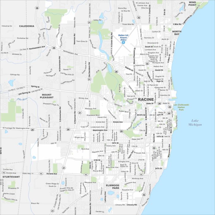
Racine lies on the shores of Lake Michigan. Our map lays out the city grid along the lakefront and beyond.
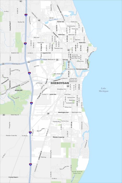
As you can see in our map, Sheboygan is all about lakefront living. Yep, Lake Michigan occupies the eastern part of the city.