Map of South Milwaukee, Wisconsin
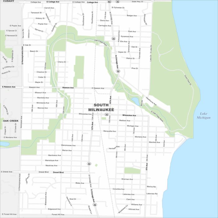
Our South Milwaukee map shows a city along Lake Michigan. It’s home to Grant Park, local events, and a proud community feel.
Our South Milwaukee map shows a city along Lake Michigan. It’s home to Grant Park, local events, and a proud community feel.
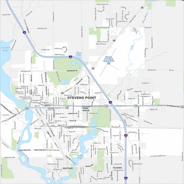
Here’s our map of Stevens Point along the Wisconsin River. The Wisconsin River loops the city with McDill Pond and Second Lake.
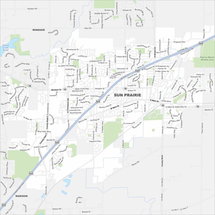
Our map of Sun Prairie helps you find your way around town. The community is known for its annual sweet corn festival and local energy.
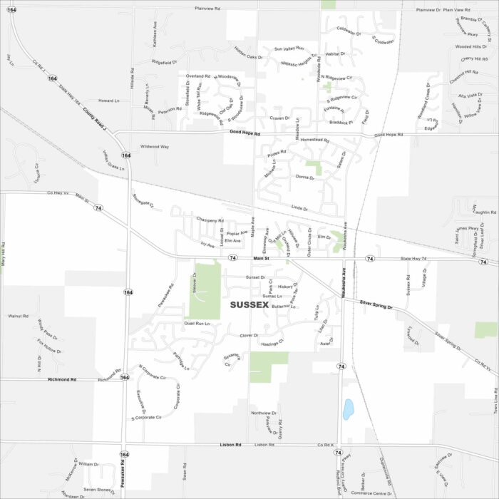
Our map of Sussex shows a quiet suburb outside Milwaukee. Families come here for its parks and small-town atmosphere.
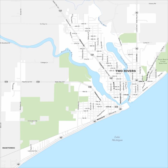
Here’s how to get around Two Rivers on Lake Michigan. Known as the “Coolest Coast”, it has sandy beaches and a maritime history.
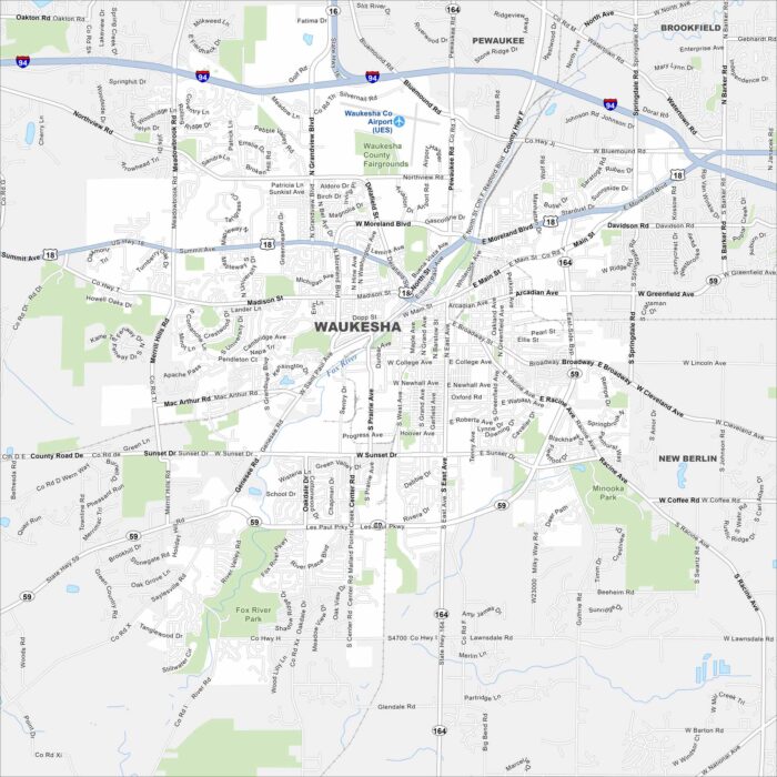
Here’s how to get around Waukesha, a city west of Milwaukee. Known for natural springs, it has a walkable downtown and plenty of parks.
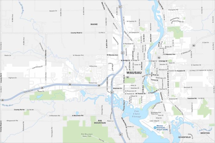
Want to see a map of Wausau, Wisconsin? Set along the Wisconsin River, it’s framed by Rib Mountain and outdoor recreation.
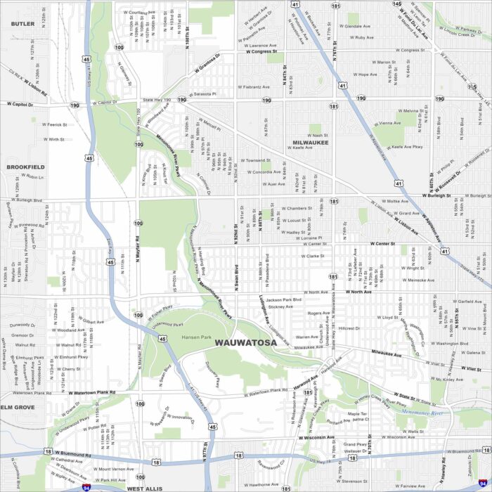
Our Wauwatosa map highlights this Milwaukee suburb. It blends historic neighborhoods with shopping districts and a medical hub.
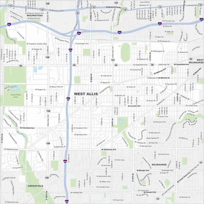
Our map of West Allis highlights this Milwaukee suburb’s busy streets. Once tied to industry, today it’s known for its fairs and shops.
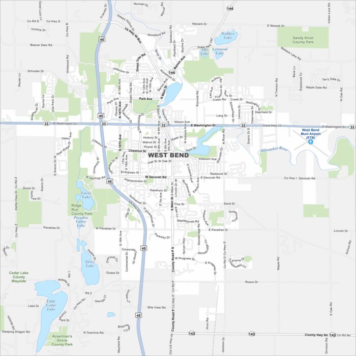
We’ve mapped out every major road in West Bend, north of Milwaukee. The city is close to the Kettle Moraine State Forest.
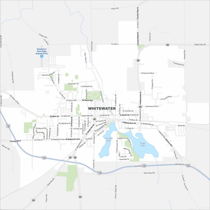
Familiarize yourself with Whitewater, home to the University of Wisconsin-Whitewater. It’s a college town surrounded by lakes and hills.
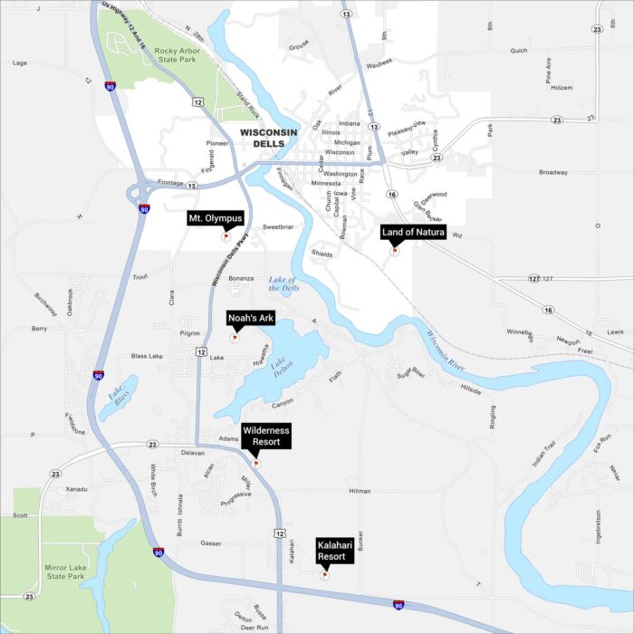
Wisconsin Dells is where fun fills every corner. Our map of Wisconsin Dells displays its waterparks, highways and lakes.
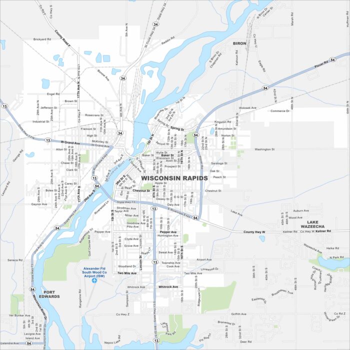
Looking for a map of Wisconsin Rapids? Look no further. The Wisconsin River runs right through the center of this paper-mill town.
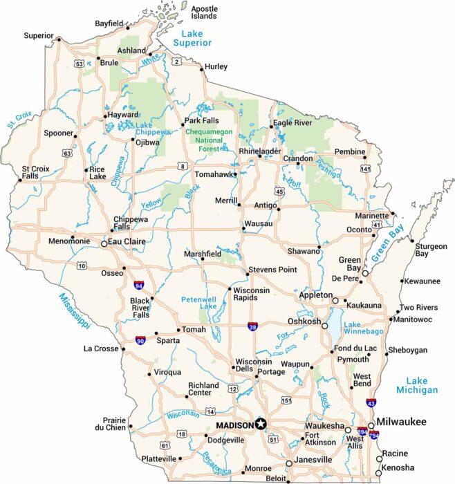
Get to know Wisconsin with our road map. It shows highways, rivers, and lakes. Cities like Milwaukee and Madison stand out as major cities.