Tennessee Outline Map
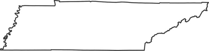
Our outline map of Tennessee shows its long and narrow shape across the bottom of the Appalachian region. The other borders angle slightly.
Our outline map of Tennessee shows its long and narrow shape across the bottom of the Appalachian region. The other borders angle slightly.

Tennessee’s 95 counties stretches from the Appalachians to the Mississippi River. The eastern mountain counties are completely different.
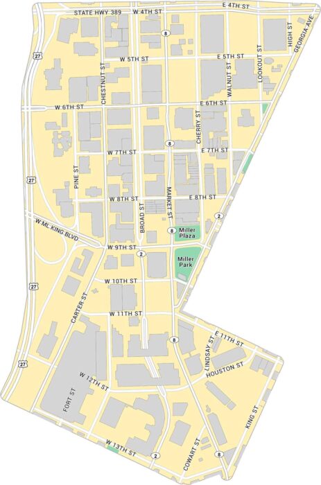
Here’s our map of Downtown Chattanooga located near the Tennessee River. It highlights key roads, local parks, and state highways.
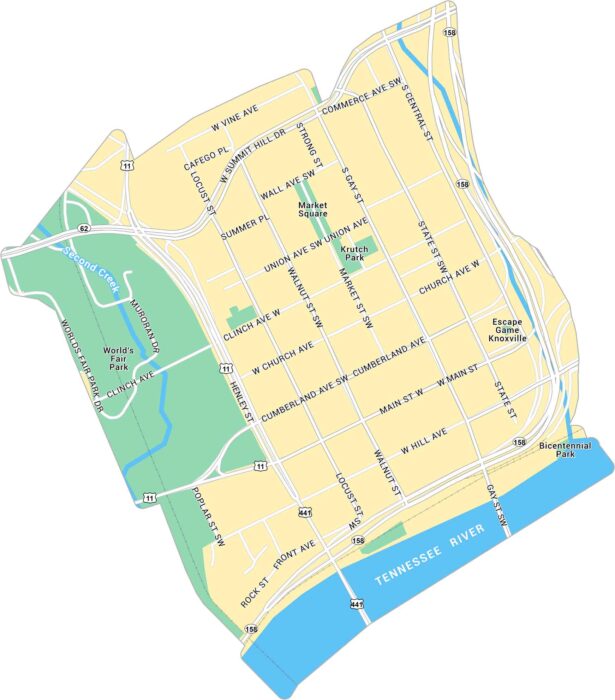
Our map of Downtown Knoxville shows the area around Market Square and the Tennessee River. It lays out main streets, parks, and routes.
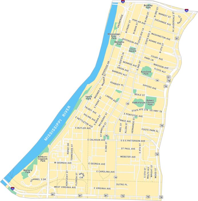
Learn more about Downtown Memphis with our road map. You’ll see the stretch along the Mississippi River and Beale Street.
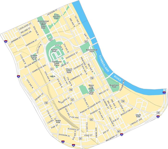
Downtown Nashville runs along the Cumberland River, packed with music venues, bridges, and bright streets that tie into the riverfront.
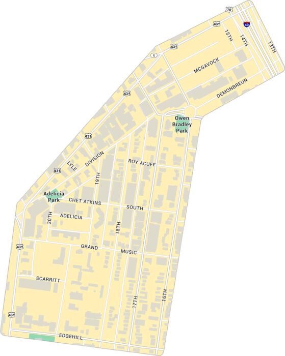
Our map of Music Row shows the Nashville neighborhood just southwest of downtown. It highlights key streets and nearby parks.
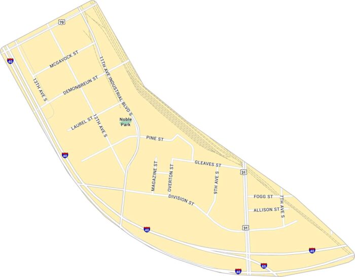
The Gulch is where old rail lines meet big-city energy. Our map of the Gulch shows its streets, highways and rail lines.
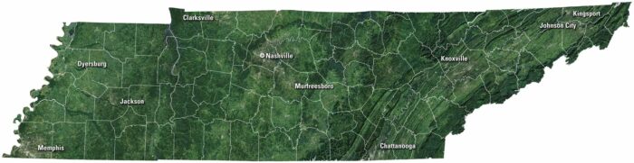
Tennessee rolls from the Smoky Mountains to the Mississippi River. Our satellite map of Tennessee shows cities like Nashville and Memphis.
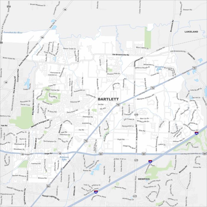
Get to know Bartlett, Tennessee. Find its main roads of this Tennessee community. Bartlett is just northeast of Memphis in Shelby County.
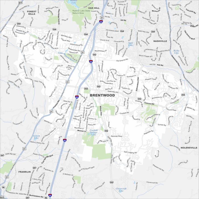
Explore Brentwood with our map. It’s known for large homes and green spaces. The city is close to Nashville but holds its own calm character.
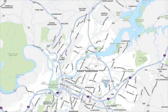
We’ve mapped Chattanooga with its many highways, bridges and riverbanks. The Tennessee River curves right through the city.
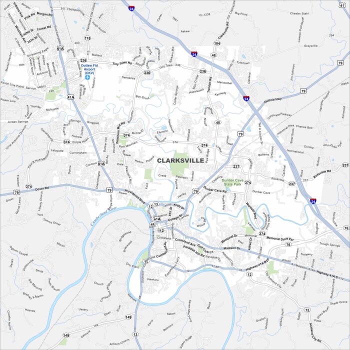
Our map of Clarksville highlights the Cumberland River as it bends through downtown. It’s home to Austin Peay State University.
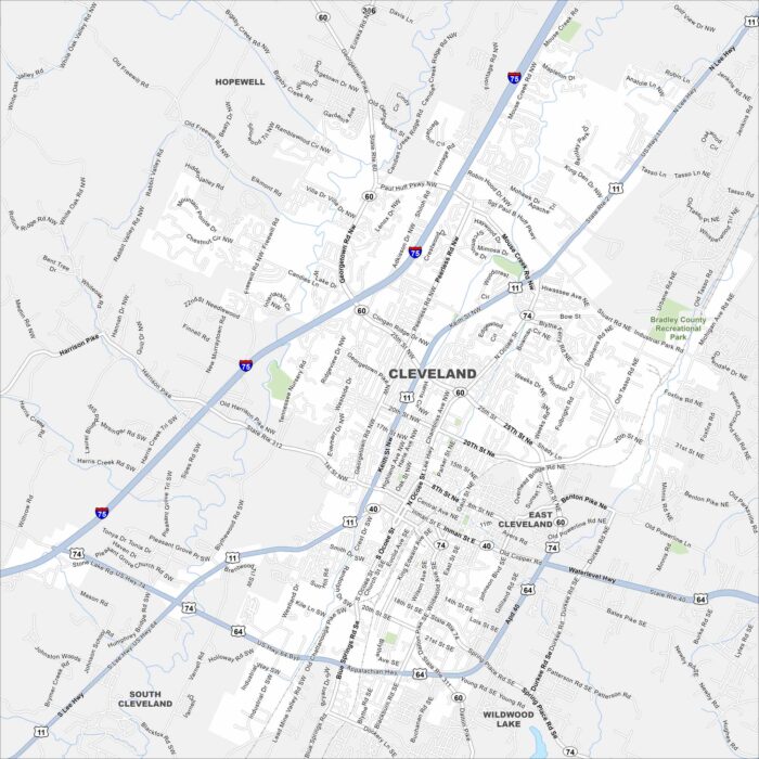
Our map of Cleveland displays its roads, streams, and green areas. It’s nestled in the foothills of the Appalachians.
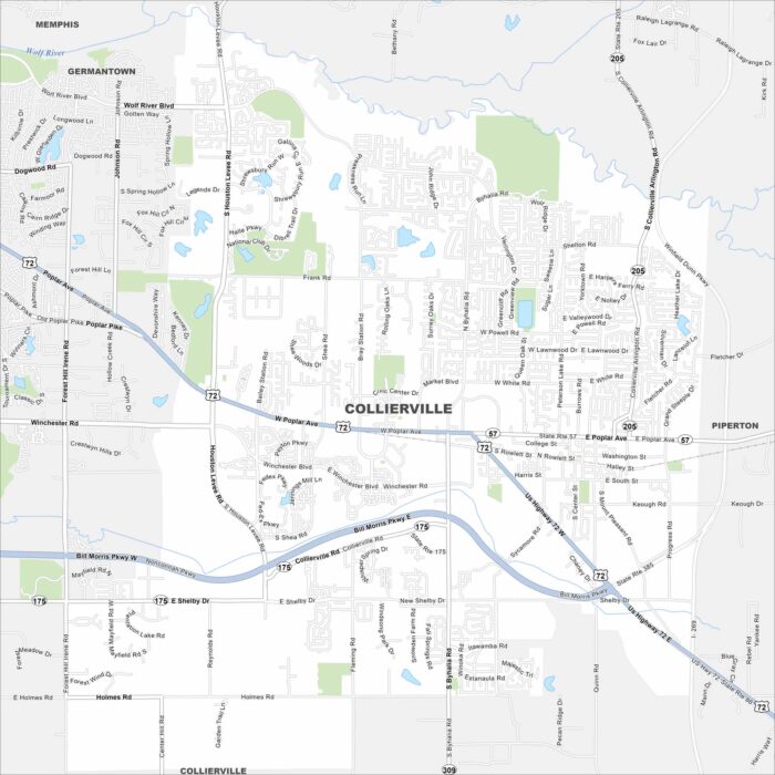
Our map of Collierville highlights its roads, highways, and historic square. It’s located east of Memphis with farmland stretching out.