Music Row Map, Nashville
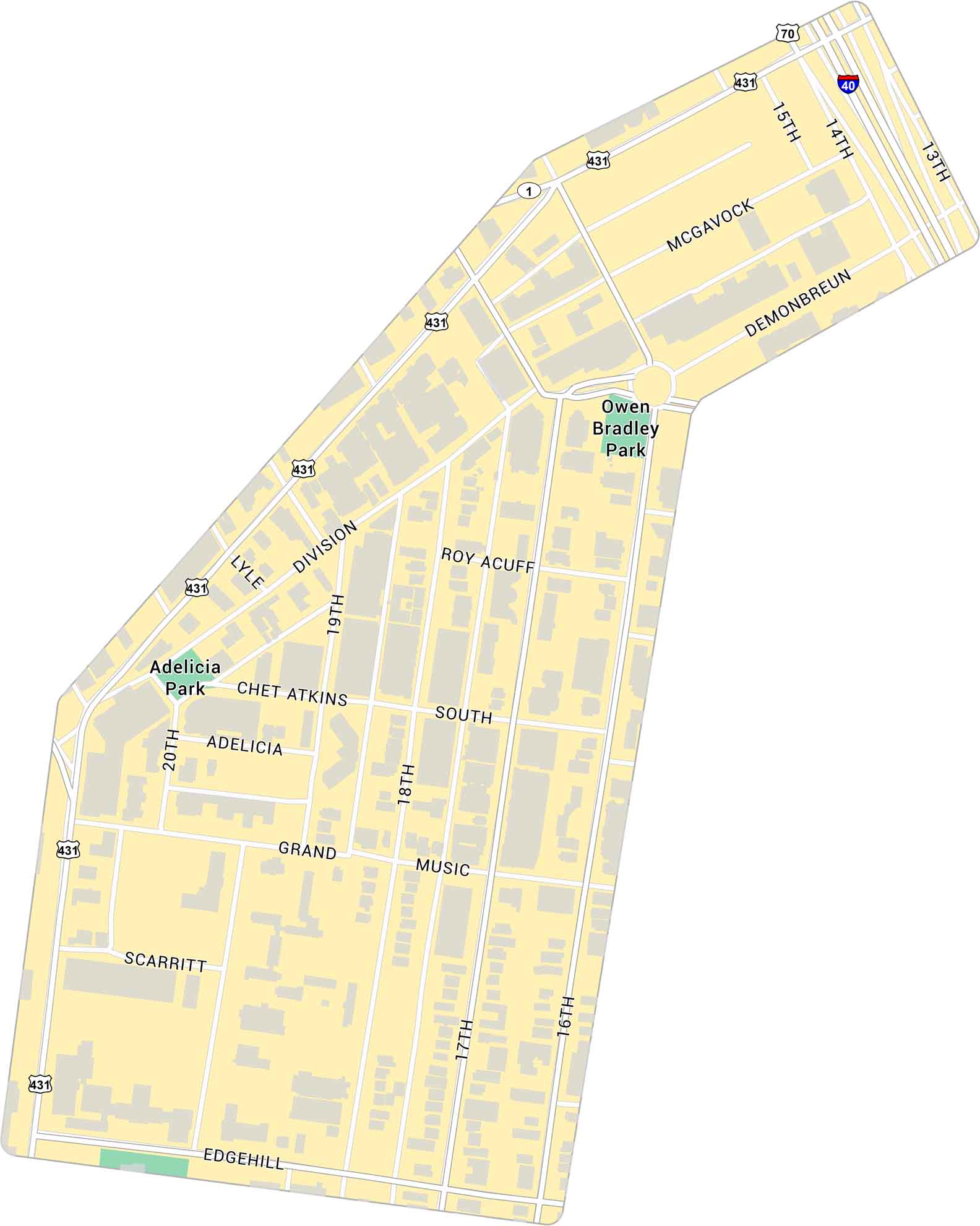
Our map of Music Row shows the Nashville neighborhood just southwest of downtown. It highlights key streets and nearby parks. This neighborhood is well-known for being a central area tied to the city’s music history and industry.
Map Information
Nashville Neighborhood Maps
See our neighborhood maps for a closer look of the city.
On the Map
Interstates/Highways: I-40, US Hwy 70, US Hwy 431, US Hwy 1 Major Roads: Division St, Music Sq, Demonbreun St, McGavock St, Grand Ave, Edgehill Ave, Roy Acuff Pl, Chet Atkins Pl, Adelicia St, Scarritt Pl, 13th Ave, 14th Ave, 15th Ave, 16th Ave, 17th Ave, 18th Ave, 19th Ave, 20th Ave, Lyle Ave Parks: Owen Bradley Park, Adelicia ParkCity Maps of Tennessee
Explore our Tennessee map collection


