Oklahoma Outline Map
Oklahoma is known for its long panhandle stretching west. Most borders in Oklahoma shift between straight lines and river bends.
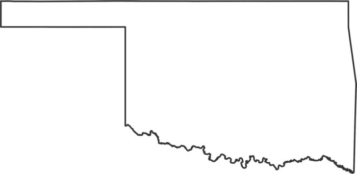
Oklahoma is known for its long panhandle stretching west. Most borders in Oklahoma shift between straight lines and river bends.

Oklahoma’s counties span prairie, hills, forests, and open spaces. Our county map highlights how the state stretches far to the west.
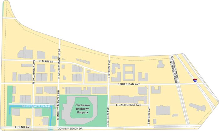
Our map of Bricktown shows the streets, warehouses, and nightlife district. It highlights the Bricktown Canal and Chickasaw Ballpark.
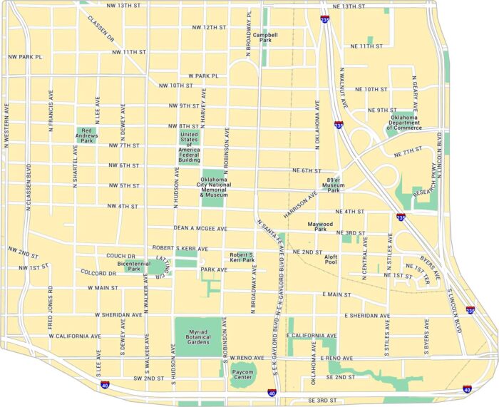
Downtown Oklahoma City sits at the center of the metro. Our map shows its main streets, parks, and the open spaces around Bricktown.
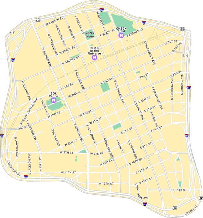
Our map of Downtown Tulsa shows the city center along the Arkansas River. It lays out main streets, parks, and attractions in Tulsa.
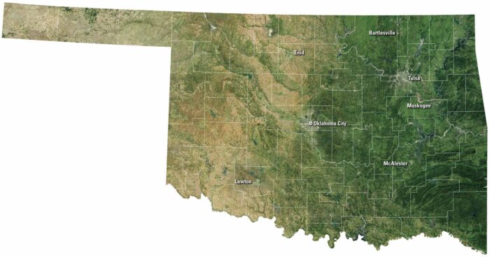
Our satellite map of Oklahoma shows prairies, rolling hills, and red earth. Tulsa and Oklahoma City stand out as hubs of culture and business.
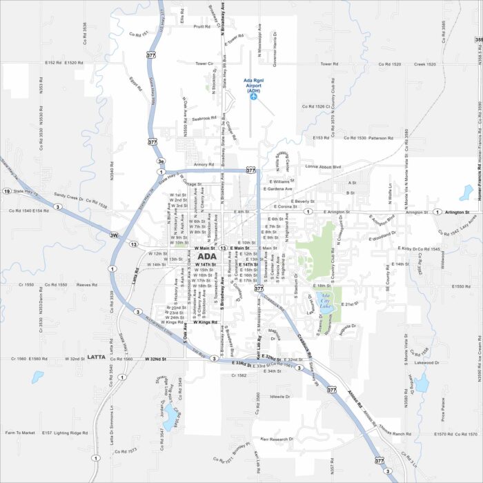
Ada is a compact city with roads crossing near the Canadian River basin. Our map shows its small-town core and Ada City Lake.
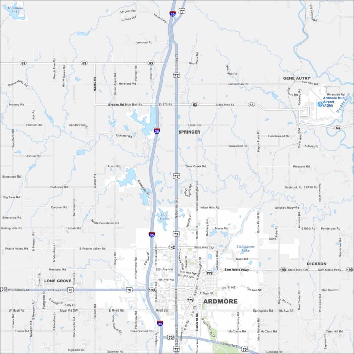
Our map of Ardmore shows its lakes, rivers, roads and parks. The city grew quite a bit as it’s positioned between Oklahoma City and Dallas.
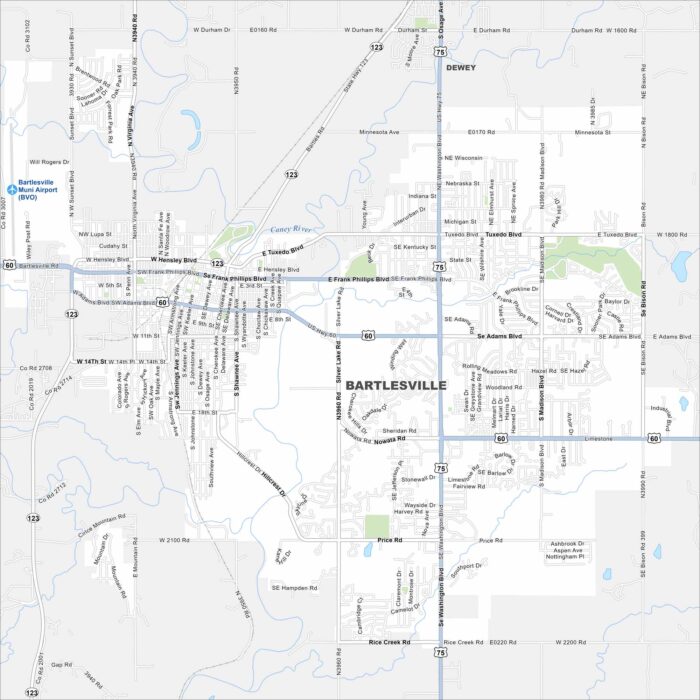
Bartlesville is shown with its highways, streets, and open parkland. You can follow the roads north of Tulsa. The city keeps a unique history.
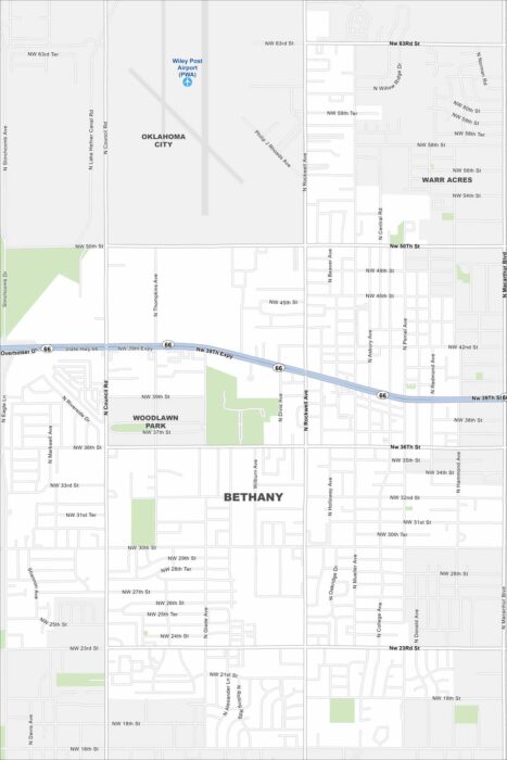
See Bethany on our map with highways and green spaces. It’s situated just west of Oklahoma City. The city is known for its Route 66 heritage.
Check out Broken Arrow on our map just outside Tulsa. This city has grown into one of the state’s largest suburbs. It’s family-focused.
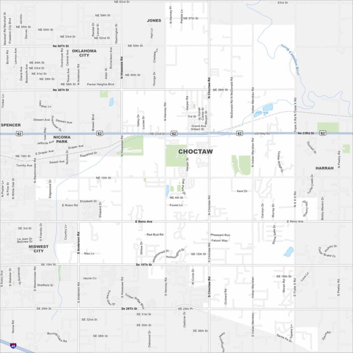
Our map of Choctaw highlights local roads, highways, and neighborhoods. You’ll find it east of Oklahoma City.
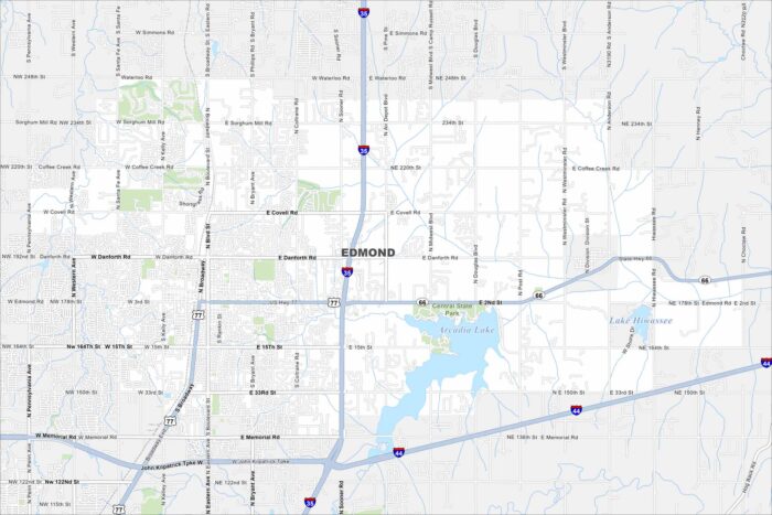
Our map of Edmond marks a large suburban area north of Oklahoma City. Arcadia Lake sits on the east side, great for outdoor activity.
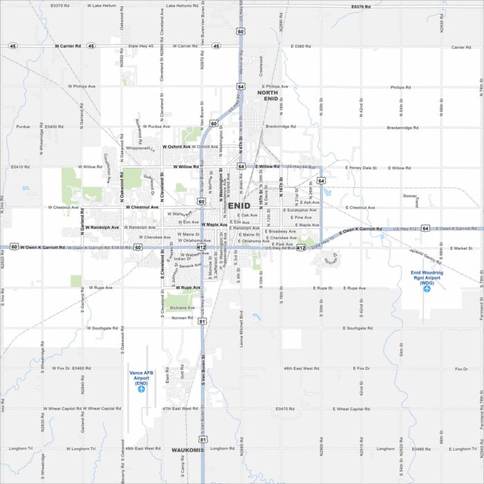
Enid spreads out in north-central Oklahoma’s flat plains. U.S. 60, 64, and 81 meet here. The wide grid of roads reflects its prairie setting.
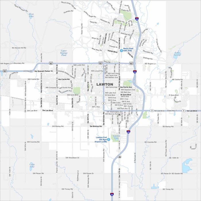
Our map of Lawton places it at the base of the Wichita Mountains. Fort Sill (Henry Post AAF) occupies a large section to the north.