Massachusetts Zip Code Map
Massachusetts zip codes are packed tight, especially near the coast. Our Massachusetts zip code map shows postal areas shrink around Boston.
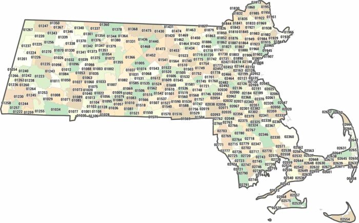
Massachusetts zip codes are packed tight, especially near the coast. Our Massachusetts zip code map shows postal areas shrink around Boston.
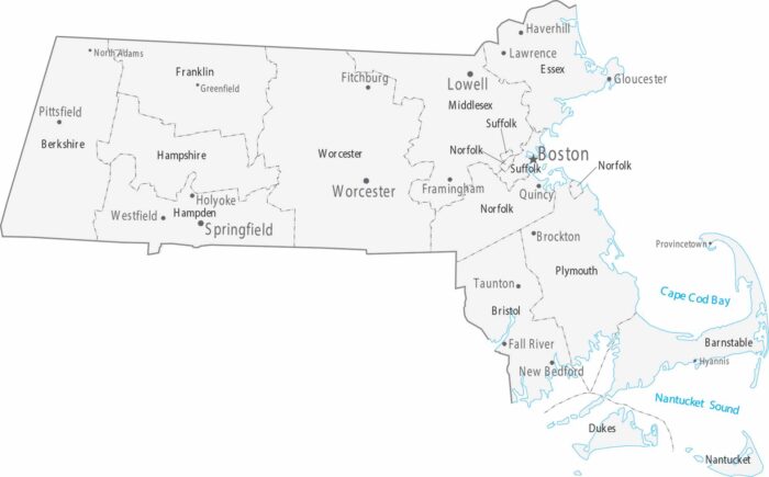
Our map shows Boston and its suburbs taking up most of the eastern part of the state. The counties are small and packed with cities.
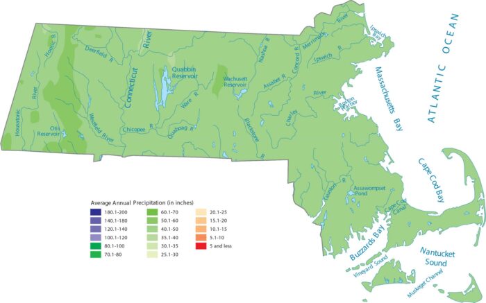
Massachusetts gets a steady supply of rain and snow coming off the ocean. Also, geography changes quickly from coast to mountains.
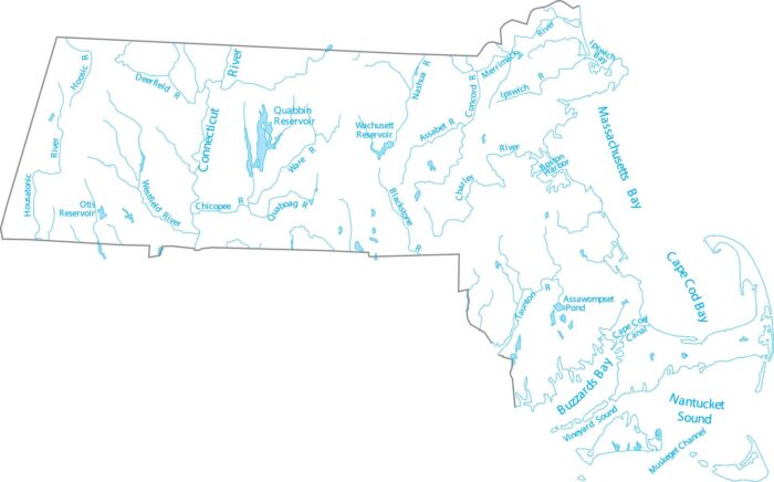
Massachusetts is in New England, where rivers run east and south to the Atlantic. Our map highlights the Connecticut River and lakes.
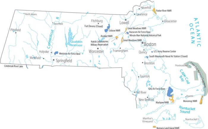
Our map shows how this tiny state crams an ocean, mountains, and a giant fishhook peninsula into one package with federal lands.
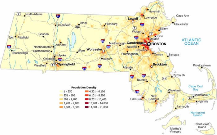
Eastern Massachusetts appears tightly packed on our population density map. Roads and cities overlap heavily on the map.
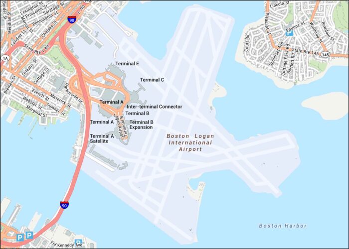
Get oriented with our Logan Airport map showing terminals. This airport sits along Boston Harbor, giving it a coastal setting.
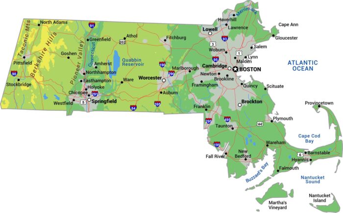
Get to know Massachusetts with our physical map. The Berkshire Hills bring real elevation to the west with the Taconic Range.
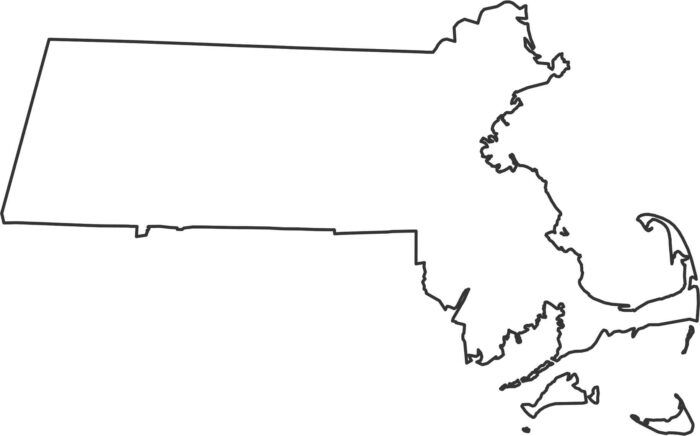
Our outline map of Massachusetts displays the Atlantic coast creating the entire eastern and southern edges with Cape Cod jutting out.

Check out Massachusetts’ 14 counties. Our county map shows Middlesex and Suffolk counties, which hold Boston and the inner suburbs.
Our map shows Beacon Hill’s tight old streets just steps from the State House. You can see every turn between the Common and the Charles.
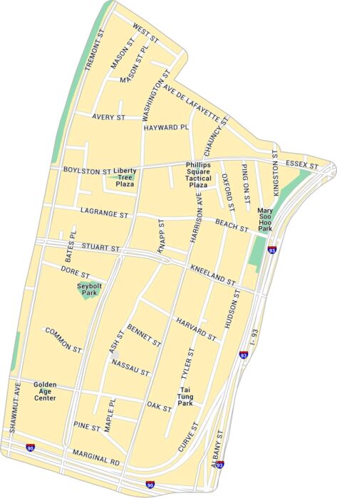
Take a look at our map of Chinatown, one of Boston’s most historic neighborhoods. It details the compact streets, highways, and parks.
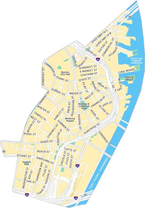
See how Downtown Boston fits together with this detailed map. It covers historic streets, waterfront areas, and local parks.
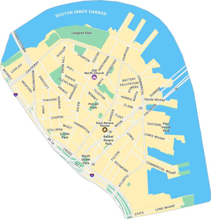
Our map of the North End shows Boston’s historic waterfront neighborhood. It displays its streets, local parks, and nearby major landmarks.
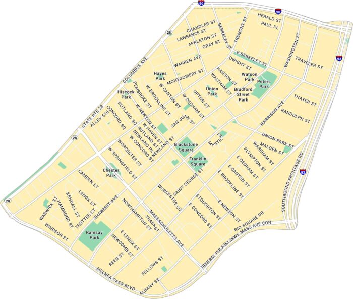
Our map of South End, Boston shows its parks, highways and streets stretching between Tremont Street and Massachusetts Avenue.