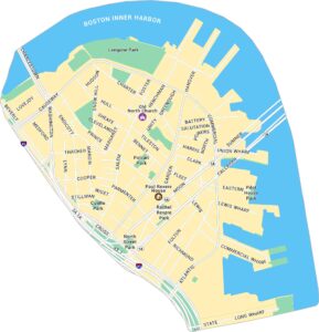
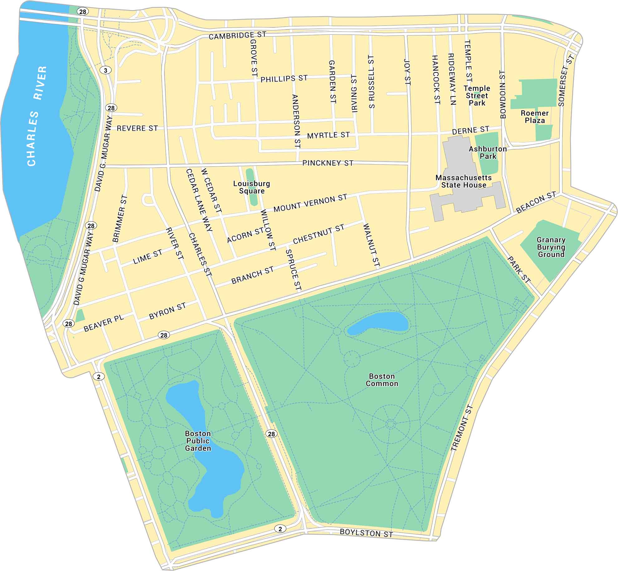
Beacon Hill Map, Boston
Our map shows Beacon Hill’s tight old streets just steps from the State House. You can see every turn between the Common and the Charles River.
Map Information
Boston Neighborhood Maps
See our neighborhood maps for a closer look of the city.
On the Map
Interstates/Highways: State Rte 28, State Rte 3, State Rte 2 Major Roads: Beacon St, Cambridge St, Charles St, Tremont St, Boylston St, Park St, Bowdoin St, Somerset St, Mount Vernon St, Pinckney St, Myrtle St, Revere St, Phillips St, David G. Mugar Way, Brimmer St, River St, Chestnut St, Walnut St, Joy St, Hancock St Rivers: Charles River Parks: Boston Common, Boston Public Garden, Granary Burying Ground, Ashburton Park, Temple Street Park, Louisburg Square Landmarks: Massachusetts State House, Roemer PlazaCity Maps of Massachusetts
Explore Boston and other urban areas in Massachusetts


