Map of Tustin, California
Our Tustin map helps you see this Orange County city. It blends Old Town history with large parks and modern neighborhoods.
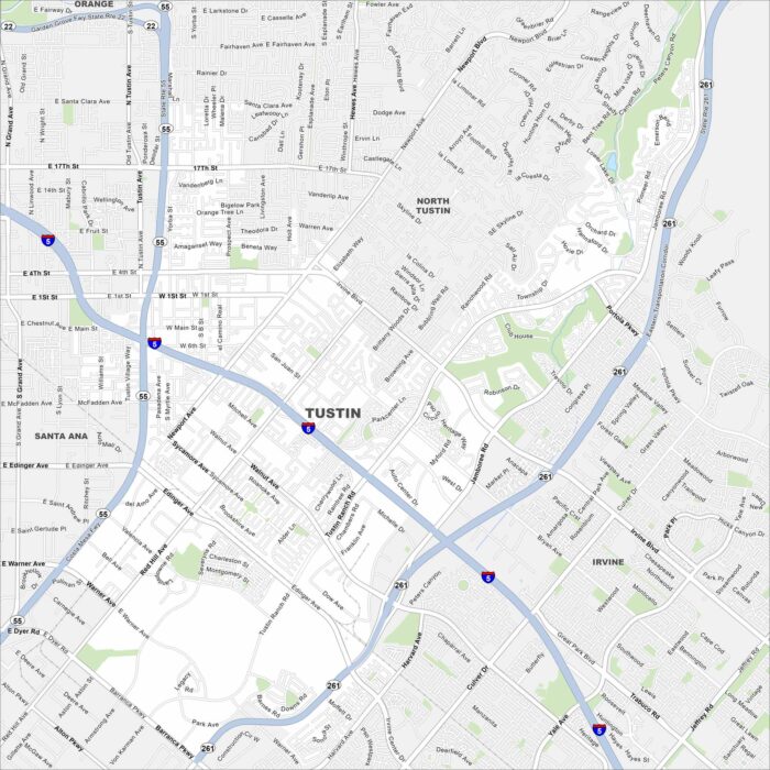
Our Tustin map helps you see this Orange County city. It blends Old Town history with large parks and modern neighborhoods.
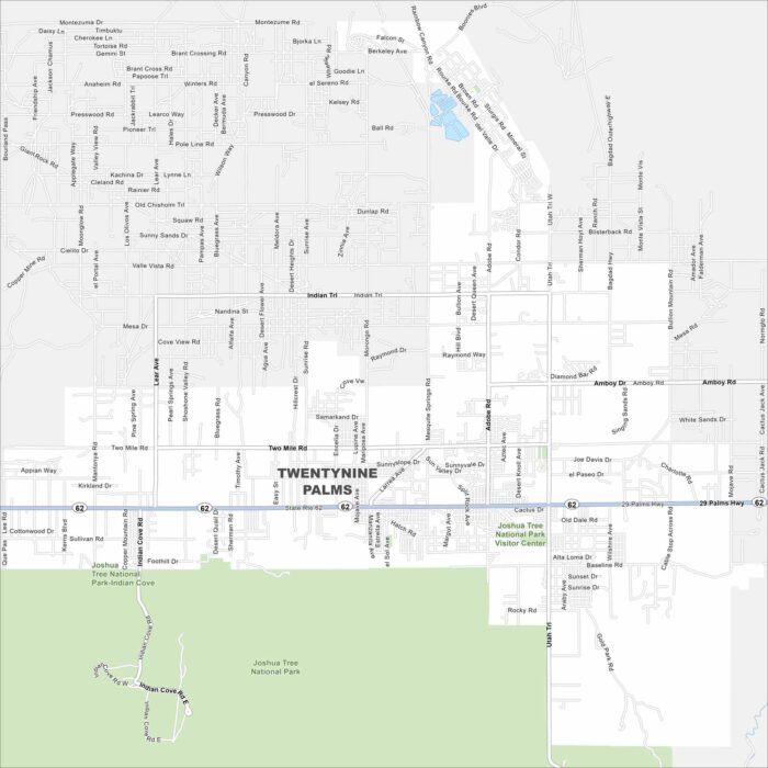
Here’s a map of Twentynine Palms in the Mojave Desert. You’ll find it just north of Joshua Tree National Park.
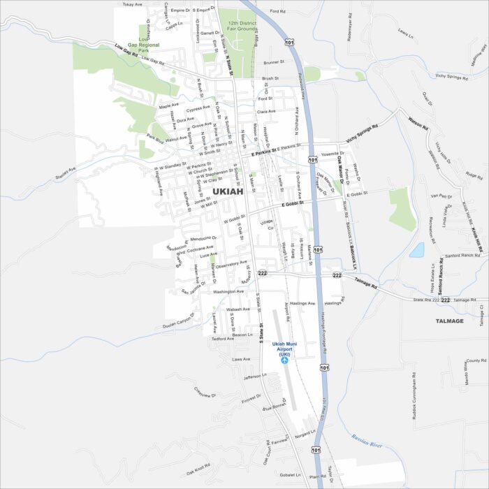
Our Ukiah map shows you this Mendocino County hub. Surrounded by vineyards and redwood country, it blends small-town life with wine country.
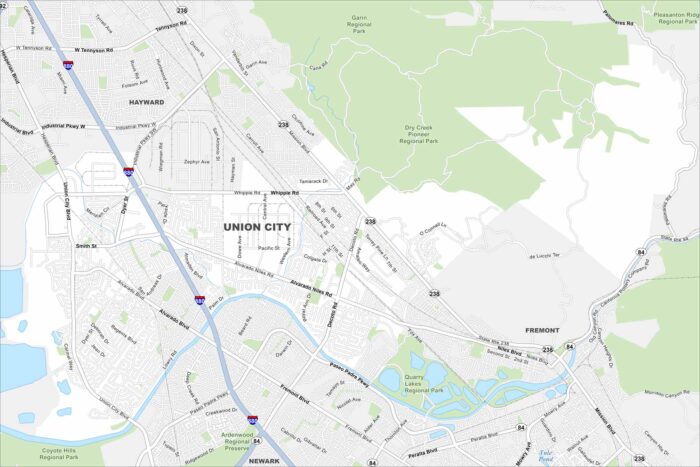
Here’s a map of Union City in the East Bay. It’s connected by BART, major freeways, and diverse neighborhoods.
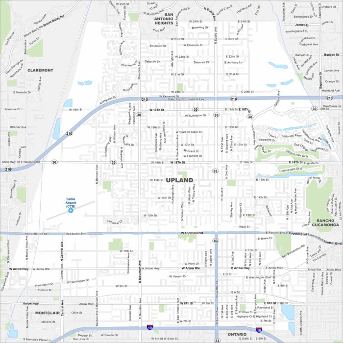
Our map of Upland shows this foothill city beneath the San Gabriel Mountains. Historic Euclid Avenue and citrus roots shape its character.
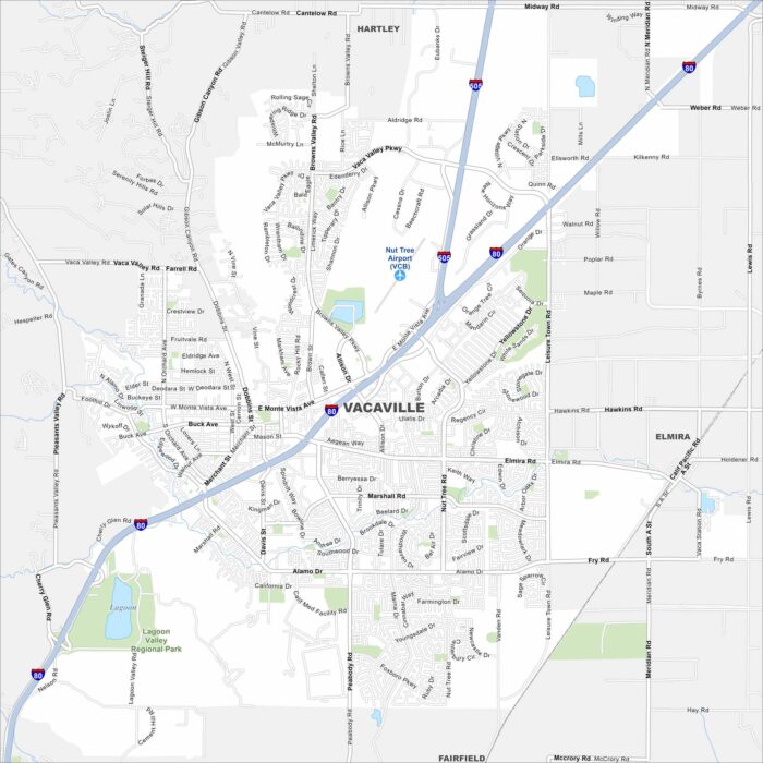
Take a look at Vacaville, located between Sacramento and the Bay Area. Our map highlights its highways, trails, and parks.
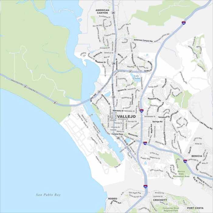
Our map of Vallejo shows you around this Bay Area port city. It’s home to Mare Island Naval Shipyard history and waterfront parks.
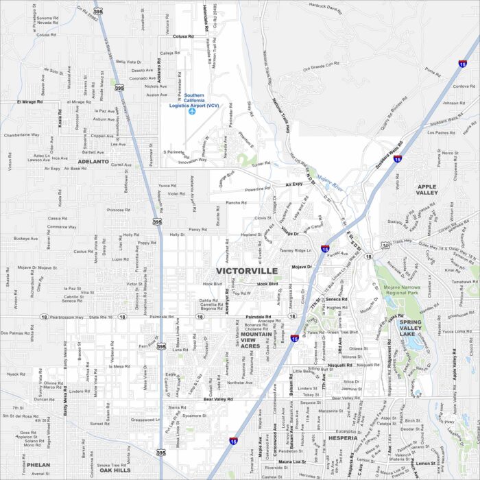
Get to know Victorville with our map of the High Desert. It’s a hub along historic Route 66 surrounded by desert landscapes.
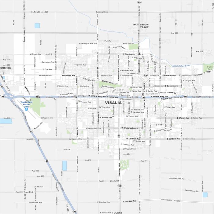
Familiarize yourself with Visalia, the gateway to Sequoia National Park. Our map shows its busy streets, parks, and valley setting.
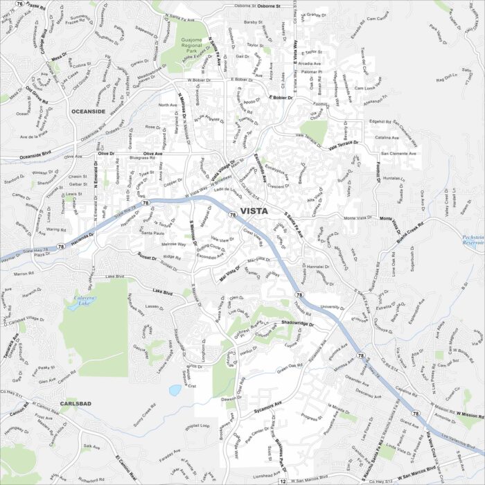
Our Vista map shows this North County San Diego city. Known for breweries, parks, and sunshine, it’s a lively coastal neighbor.
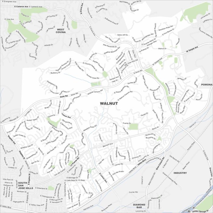
Get around Walnut with this detailed map. Tucked in the San Gabriel Valley, it’s known for quiet neighborhoods and mountain views.
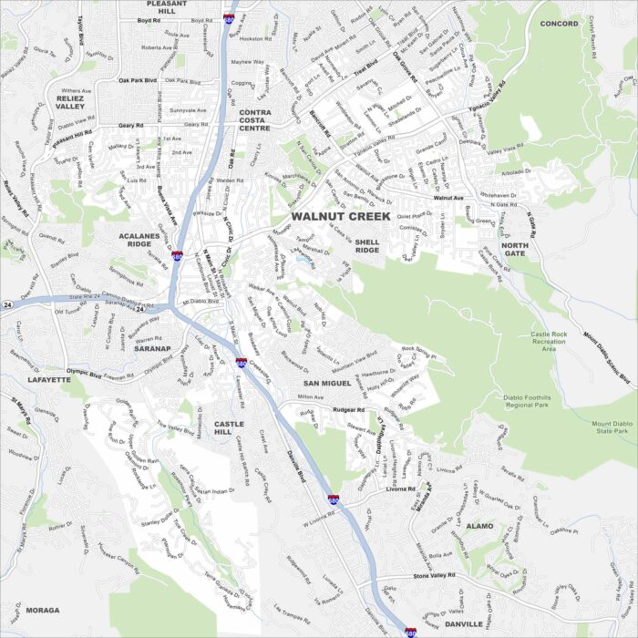
Walnut Creek is a Bay Area hub for shopping, trails, and culture. See how Walnut Creek is connected by highways, parks, and downtown streets.
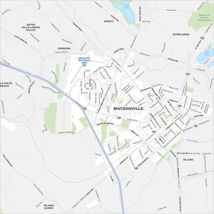
Our Watsonville map shows its Pajaro Valley location. Surrounded by farmland, it’s a hub for agriculture and close to Monterey Bay.
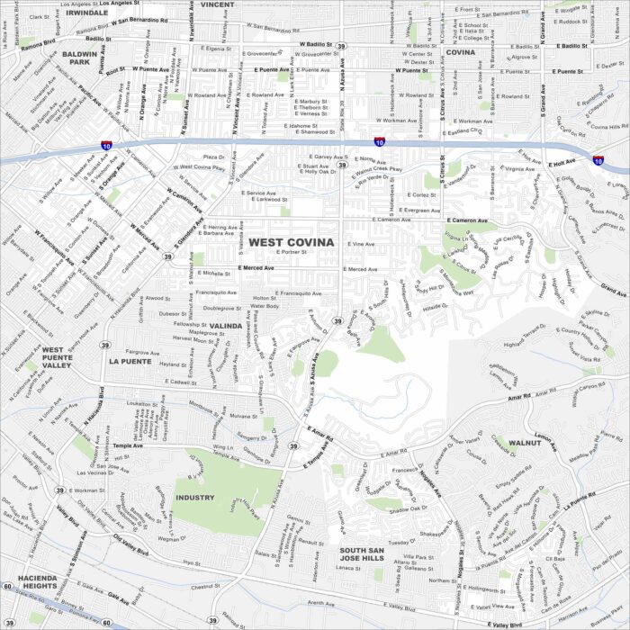
Our West Covina map highlights this San Gabriel Valley city. Shopping centers, mountain views, and suburban neighborhoods define the area.
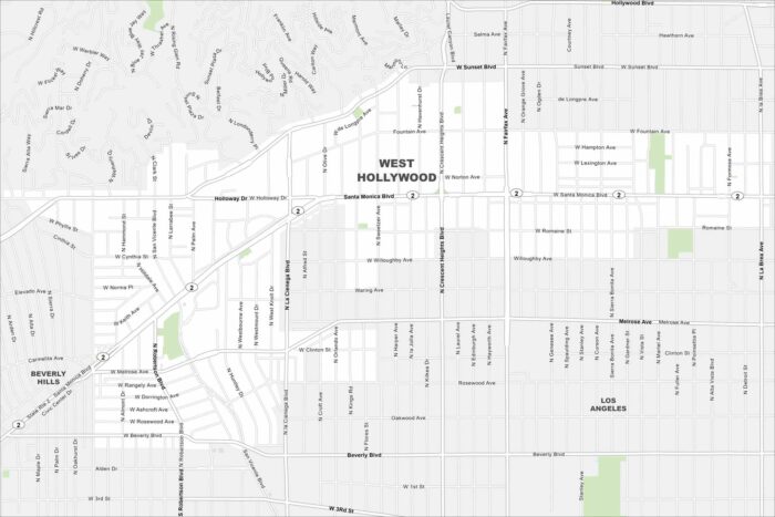
This West Hollywood map shows the Sunset Strip and Santa Monica Boulevard. Our map highlights parks, neighborhoods and walkable streets.