Map of Union City, California
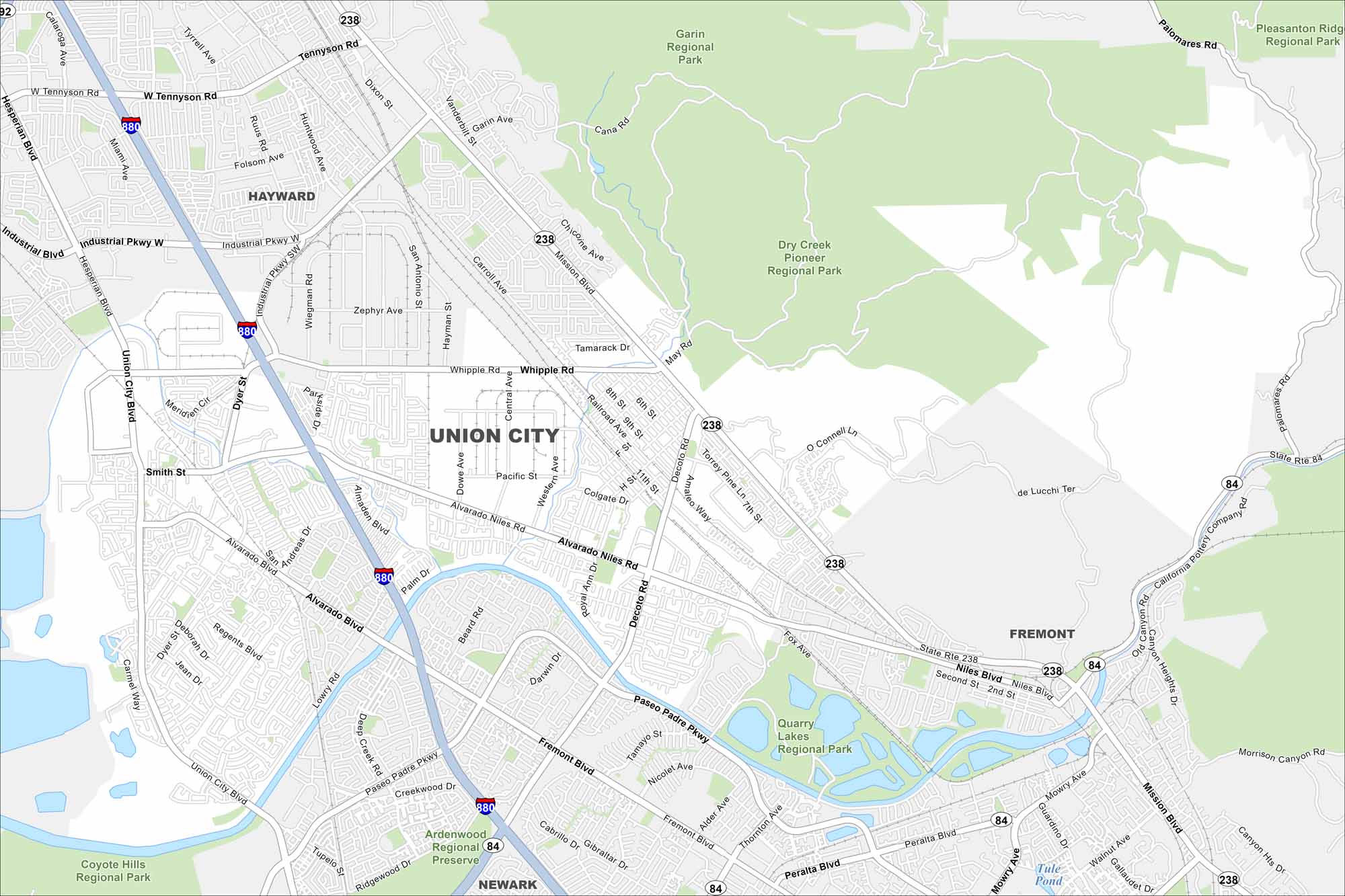
Here’s a map of Union City in the East Bay. It’s connected by BART, major freeways, and diverse neighborhoods. It’s in Alameda County part of the San Francisco Bay Area.
California State Maps
Explore California with our state maps


Map Information
On the Map
Interstates/Highways: I-880, State Rte 238, State Rte 84 Major Roads: Alvarado Niles Rd, Union City Blvd, Mission Blvd, Decoto Rd, Whipple Rd, Industrial Pkwy, Tennyson Rd, Fremont Blvd, Paseo Padre Pkwy, Hesperian Blvd, Dyer St, Smith St, Alvarado Blvd, Niles Blvd, Thornton Ave, Lowry Rd, Central Ave, Dowe Ave, Western Ave, Quarry Lakes Dr Lakes and Reservoirs: Quarry Lakes, Tule Pond Parks and Preserves: Dry Creek Pioneer Regional Park, Garin Regional Park, Quarry Lakes Regional Park, Ardenwood Regional Preserve, Coyote Hills Regional Park, Pleasanton Ridge Regional Park Nearby Communities: Hayward, Fremont, NewarkCalifornia City Maps
Here are detailed maps of California


