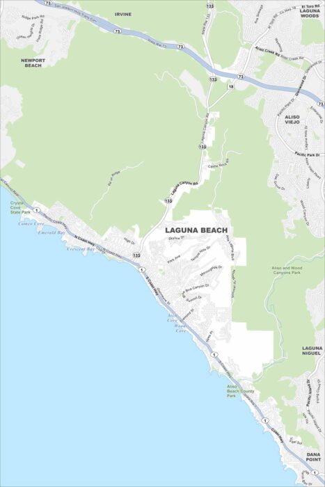
Map of Laguna Beach, California
Our map of Laguna Beach follows the coastline of the Pacific Ocean. Canyons carve through the city and beaches line the oceanfront.
Our map of Laguna Beach follows the coastline of the Pacific Ocean. Canyons carve through the city and beaches line the oceanfront.
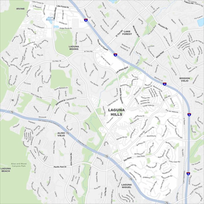
Our Laguna Hills map shows rolling hills combined with neighborhoods. Freeways frame the edges, linking it to Irvine and Mission Viejo.
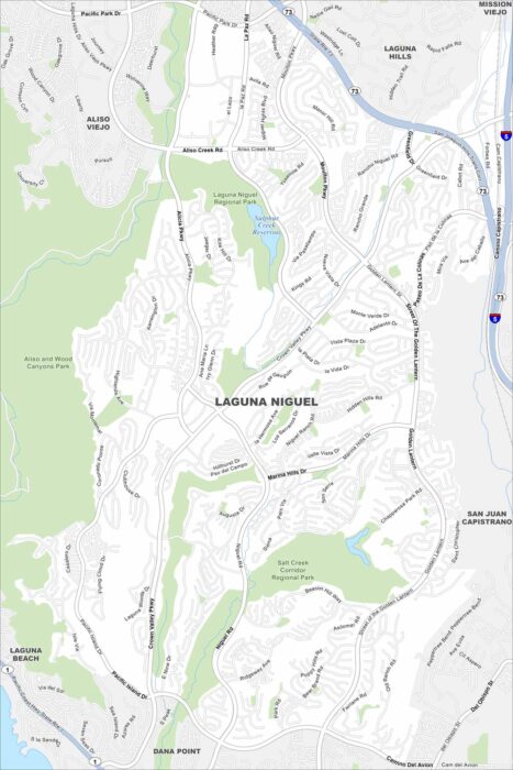
Laguna Niguel spreads out along curving canyon roads. This map highlights its open space reserves and trails.
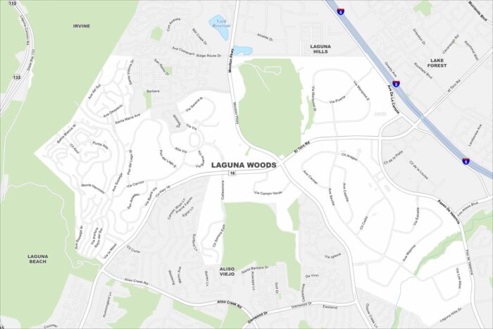
The city of Laguna Woods, California appears compact on the map. Highways surround it on nearly every side.
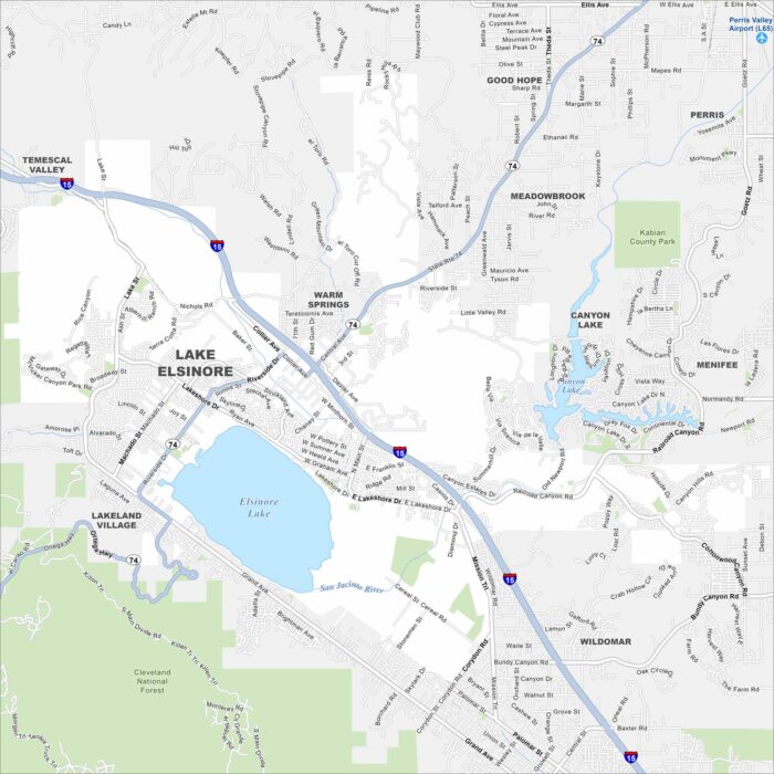
Our map highlights the massive natural lake at the heart of the city. While freeways skirt its western edge, hills rise just beyond town.
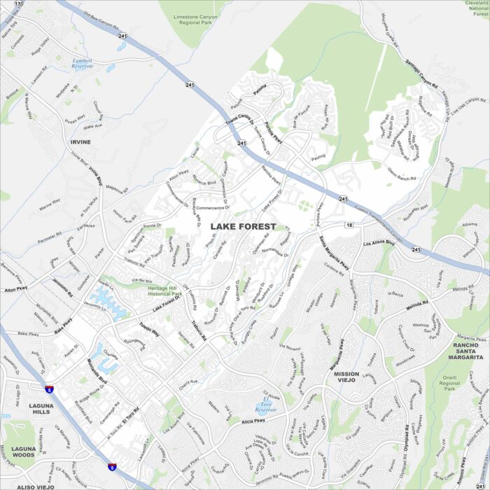
Our map of Lake Forest shows its highways and roads connecting everything. Neighborhoods wind around forested parks and man-made lakes.
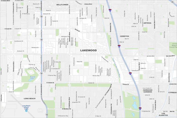
Our map of Lakewood, California reveals a dense residential road network. Freeways border the city on nearly every side.
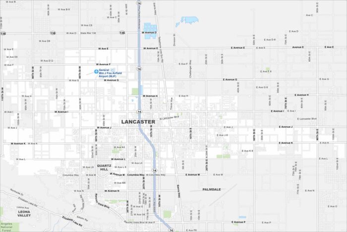
Lancaster spreads across the Antelope Valley. Wide desert streets cut a grid through the city. It’s located in Southern California.
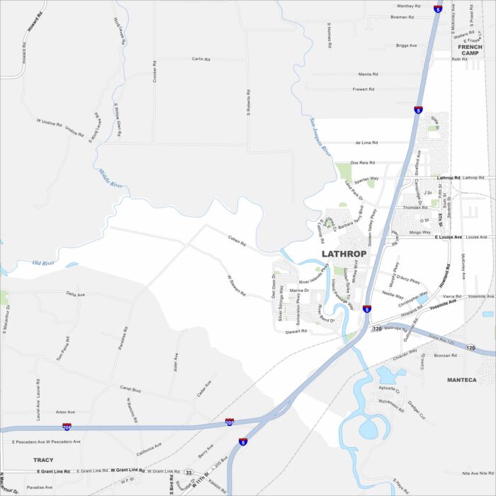
Lathrop sits at the junction of the San Joaquin River and Delta waterways. Subdivisions and warehouses dominate the map.
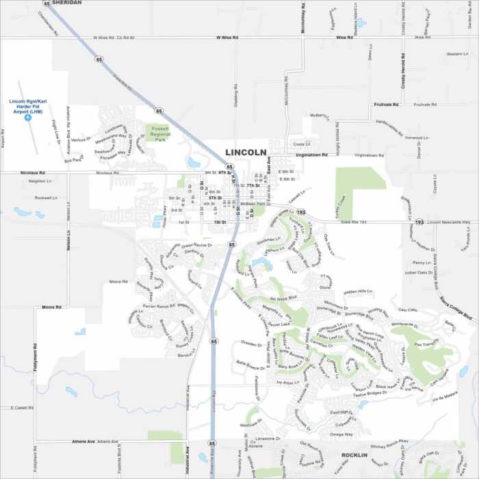
Lincoln shows up on the map at the edge of the Sierra Nevada foothills. The city blends new neighborhoods with older streets.
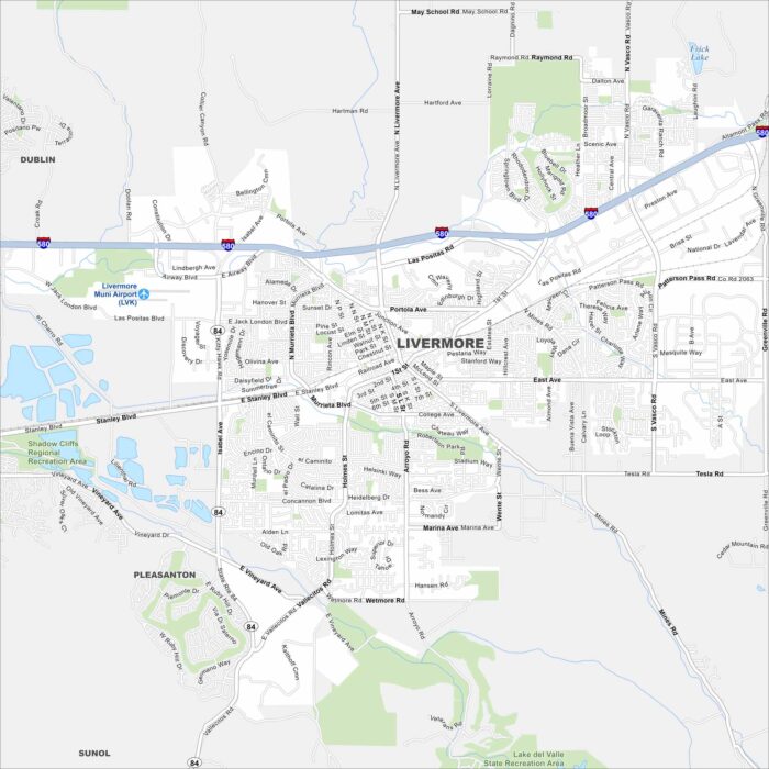
Our map of Livermore highlights its major routes and parks. Highways 580 and 84 connect it to the Bay Area.
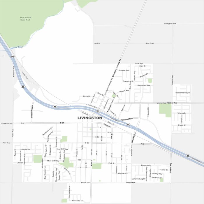
Livingston is set in the San Joaquin Valley in California. Our map shows Highway 99 cutting through town in a diagonal direction.
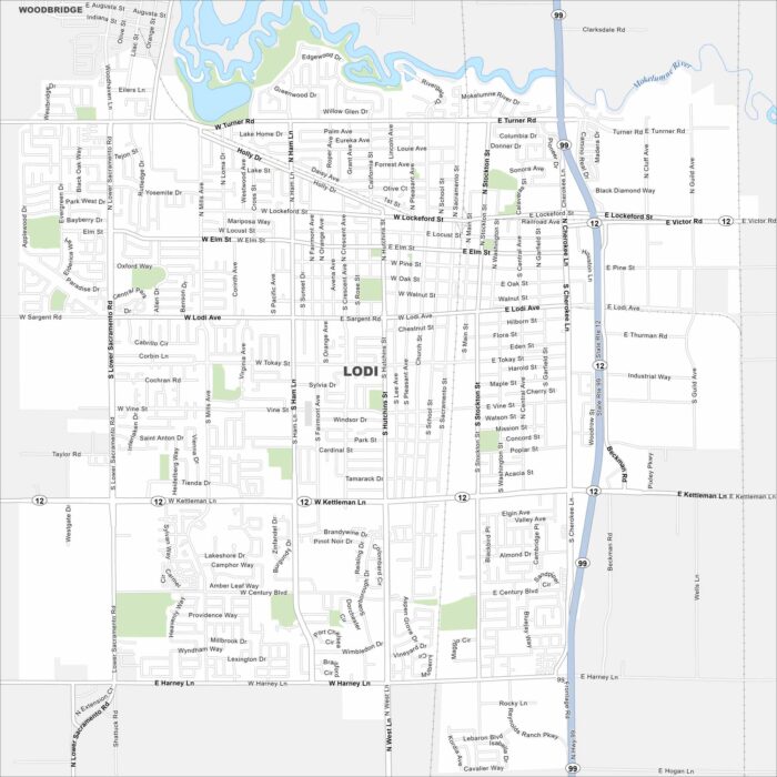
Our map of Lodi places it in the Central Valley north of Stockton. The city is part of the San Joaquin County.
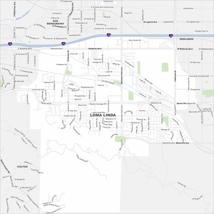
Loma Linda sits in San Bernardino County. Our map shows Interstate 10 running east-west across its neighborhoods.
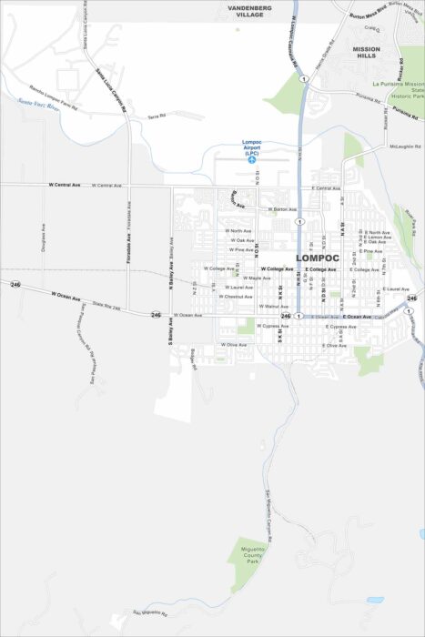
Our map of Lompoc highlights its spot in a coastal valley. Highways 1 and 246 cut through town. The city lies just inland from the Pacific.