Map of Laguna Niguel, California
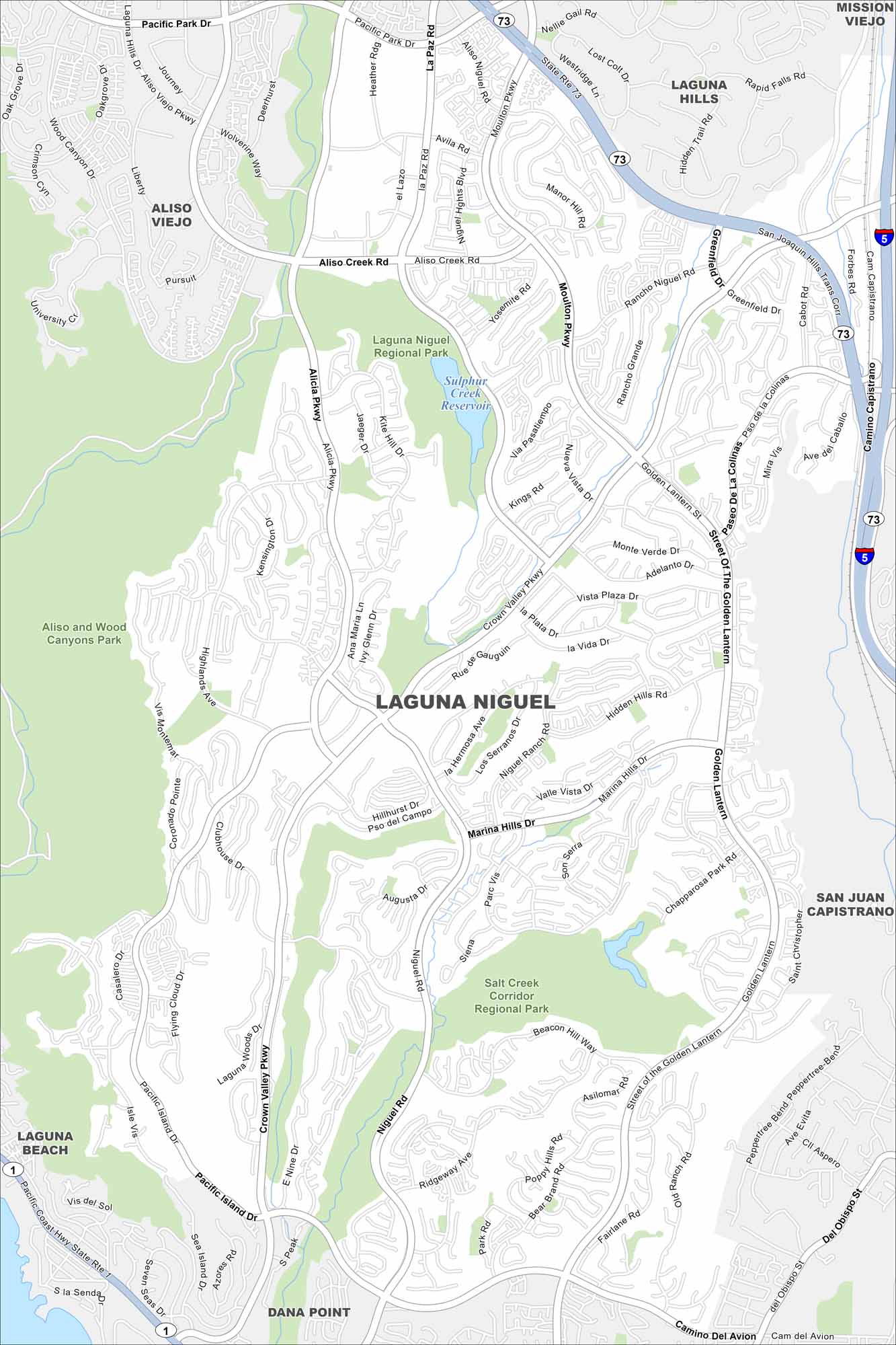
Laguna Niguel spreads out along curving canyon roads. This map highlights its open space reserves and trails. Coastal routes lead quickly to the Pacific.
California State Maps
Explore California with our state maps


Map Information
On the Map
Interstates/Highways: I-5, State Rte 73, State Rte 1 Major Roads: Crown Valley Pkwy, Alicia Pkwy, Niguel Rd, Moulton Pkwy, Aliso Creek Rd, Street of The Golden Lantern, Pacific Island Dr, Marina Hills Dr, Highlands Ave, Camino Del Avion, Golden Lantern, Beacon Hill Way, Selva Rd, Paseo de la Colinas, Greenfield Dr, La Paz Rd, Aliso Viejo Pkwy, Pacific Park Dr, Del Obispo St, Camino Capistrano Airports: Sulphur Creek Reservoir Parks and Preserves: Laguna Niguel Regional Park, Aliso and Wood Canyons Park, Salt Creek Corridor Regional Park Nearby Communities: Aliso Viejo, Laguna Hills, Mission Viejo, San Juan Capistrano, Dana Point, Laguna BeachCalifornia City Maps
Here are detailed maps of California


