Home » State Maps » South Carolina Population Map

South Carolina Population Map

South Carolina Population Density Map

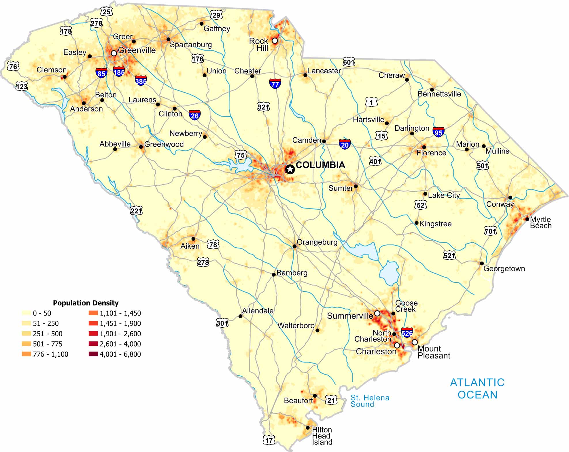
In South Carolina, population density increases near coastal areas and larger cities. Our map shows lighter settlement inland and farmland filling many gaps.

Map Information

  • Population Density Map of South Carolina
  • Data provided by NASA SEDAC Gridded Population of the World
  • Free for personal and commercial purpose. Attribution is required. How to attribute?

On the Map

South Carolina Location Map
State Capital: Columbia Major Cities: Charleston, Greenville, Mount Pleasant, Rock Hill, Summerville Cities and Towns: Abbeville, Aiken, Allendale, Anderson, Bamberg, Belton, Bennettsville, Camden, Chester, Clemson, Clinton, Conway, Darlington, Easley, Florence, Gaffney, Georgetown, Goose Creek, Greenwood, Greer, Hartsville, Hilton Head Island, Kingstree, Lake City, Lancaster, Laurens, Marion, Mullins, Myrtle Beach, Newberry, North Charleston, Orangeburg, Santee, Spartanburg, Sumter, Union, Walterboro Interstate Highways: I-20, I-26, I-77, I-85, I-95, I-126, I-185, I-385, I-526 US Routes: US-1, US-15, US-17, US-21, US-25, US-29, US-52, US-76, US-78, US-123, US-176, US-178, US-221, US-276, US-278, US-301, US-321, US-378, US-401, US-501, US-521, US-601, US-701

Leave a Reply

Your email address will not be published. Required fields are marked *