Home » State Maps » Map of New Jersey

Map of New Jersey

New Jersey Map

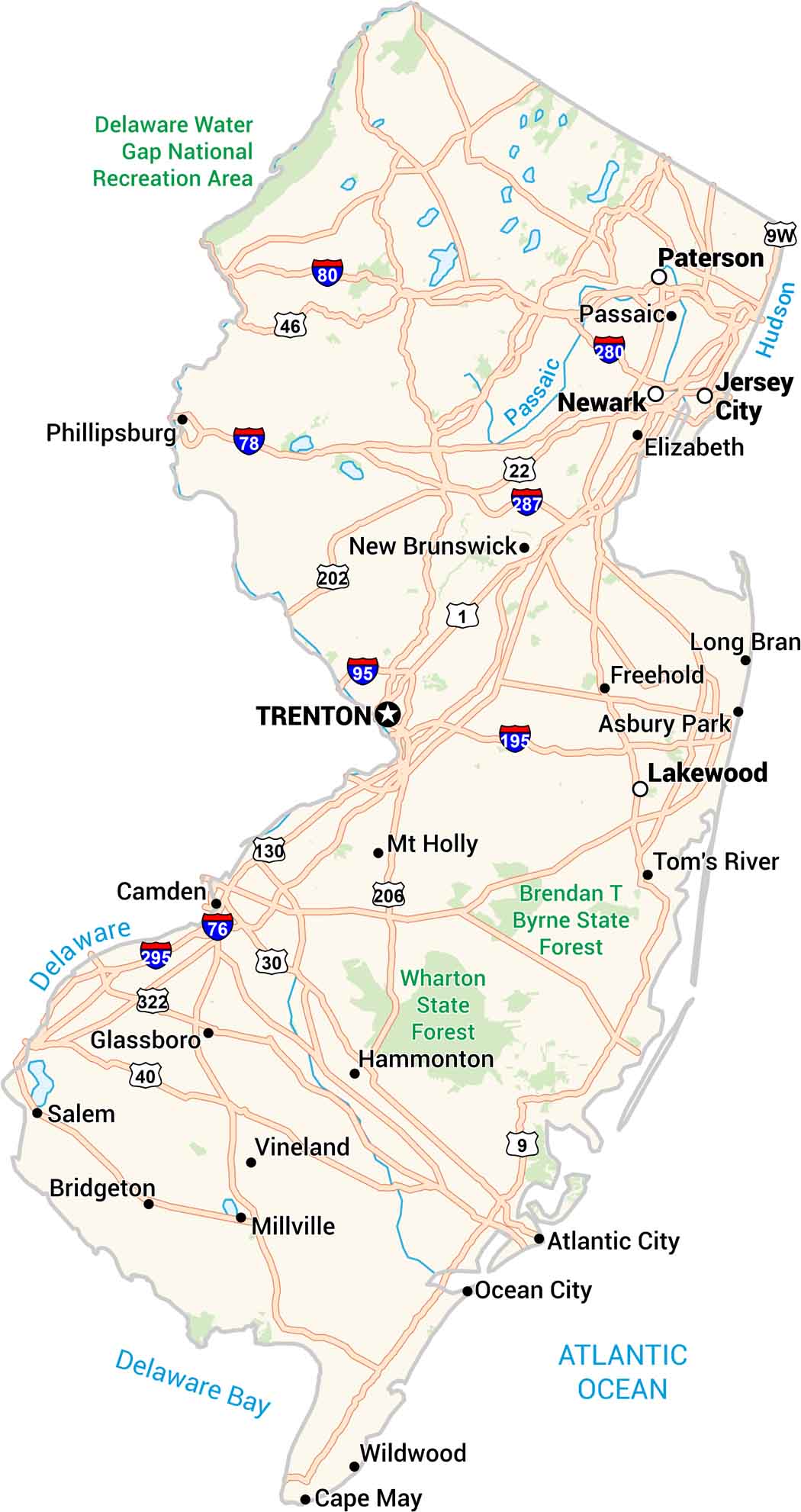
New Jersey might be small, but our map shows how packed it really is. Highways twist past cities, beaches, and pine forests. You can see the shoreline from Cape May to Sandy Hook. Newark and Jersey City sit close to the Hudson River. Every corner feels connected on our New Jersey map.

Map Information

  • State of New Jersey
  • Road Map of New Jersey
  • Free for personal and commercial purpose. Attribution is required. How to attribute?

On the Map

New Jersey Location Map
State Capital: Trenton Major Cities: Jersey City, Lakewood, Newark, Paterson Cities and Towns: Asbury Park, Atlantic City, Bridgeton, Camden, Cape May, Elizabeth, Freehold, Glassboro, Hammonton, Long Branch, Millville, Mt Holly, New Brunswick, Ocean City, Passaic, Phillipsburg, Salem, Tom’s River, Vineland, Wildwood Interstate Highways: I-76, I-78, I-80, I-95, I-195, I-280, I-287, I-295 US Routes: US-1, US-9, US-9W, US-22, US-30, US-40, US-46, US-130, US-202, US-206, US-322 Rivers and Streams: Delaware River, Hudson River, Passaic River National Parks and Forests: Brendan T Byrne State Forest, Delaware Water Gap National Recreation Area, Wharton State Forest

City Maps of New Jersey

Newark and New Jersey cities in complete detail

References

  1. Government Website of New Jersey
  2. New Jersey in Google Maps

Leave a Reply

Your email address will not be published. Required fields are marked *