Home » State Maps » Missouri Lakes and Rivers Map

Missouri Lakes and Rivers Map

Missouri Lakes and Rivers Map

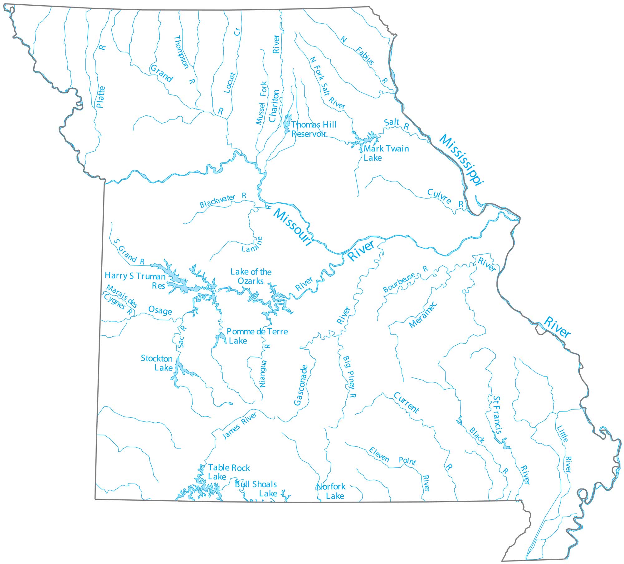
Get a snapshot of where the country’s two longest rivers meet in the middle of the continent. That’s right. Missouri is the site where the Missouri River joins the Mississippi just north of St. Louis. Our map of Missouri follows the Osage River and the wide muddy channels of the plains.

Map Information

  • Lakes and Rivers Map of Missouri
  • Original map provided by National Map. Map updated by our team.
  • Free for personal and commercial purpose. Attribution is required. How to attribute?

On the Map

Missouri Location Map
Lakes/Reservoirs: Bull Shoals Lake, Harry S Truman Reservoir, Lake of the Ozarks, Mark Twain Lake, Norfork Lake, Pomme de Terre Lake, Stockton Lake, Table Rock Lake, Thomas Hill Reservoir Rivers and Streams: Big Piney River, Black River, Blackwater River, Bourbeuse River, Chariton River, Cuivre River, Current River, Fabius River, Gasconade River, Grand River, James River, Lamine River, Little River, Marais des Cygnes River, Meramec River, Mississippi River, Missouri River, Niangua River, Osage River, Platte River, Sac River, Salt River, St Francis River, Thompson River

Leave a Reply

Your email address will not be published. Required fields are marked *