Michigan Lakes and Rivers Map
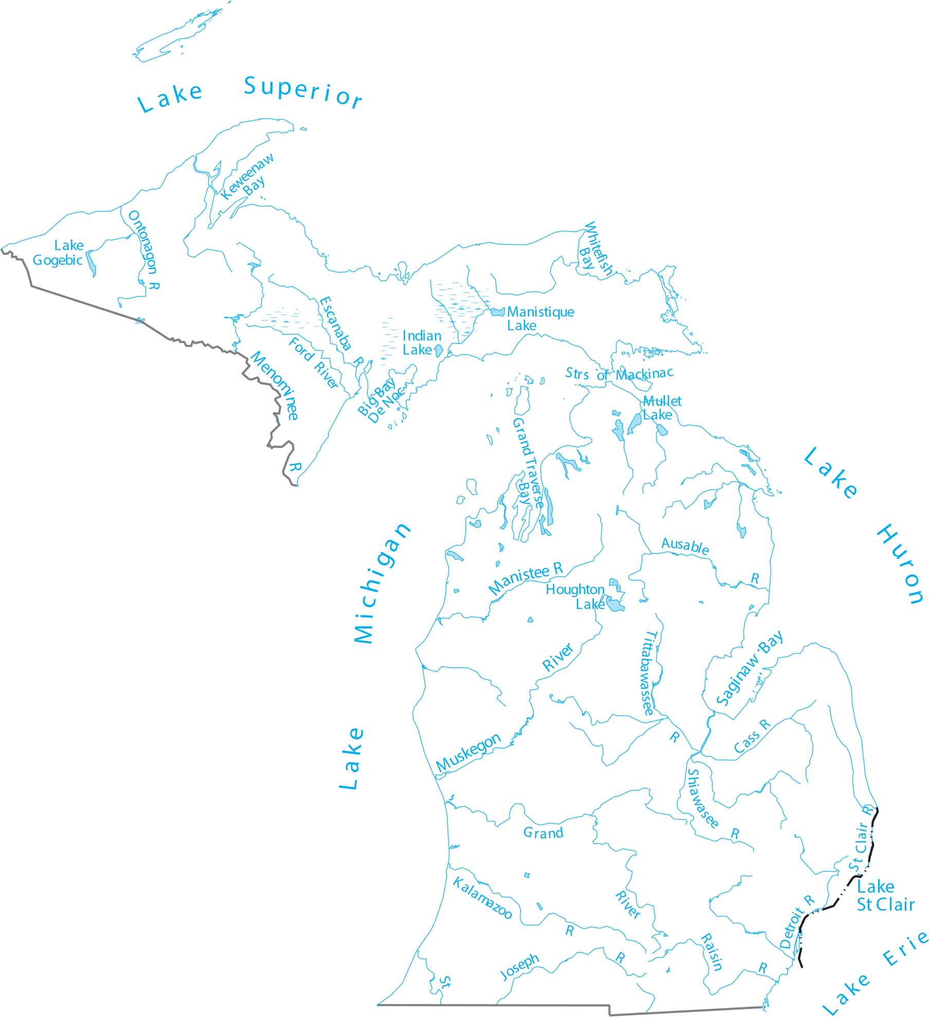
Michigan is surrounded by water, defined by four Great Lakes. Our map of Michigan shows the Great Lakes and hundreds of inland lakes. You’ll also find the long paths of the Grand and Muskegon Rivers, which empty into Lake Michigan.
Map Information
On the Map
Lakes and Rivers State Maps
Select any state map below to view its lakes and rivers map.


Michigan State Maps
Get to know Michigan with our detailed maps


