White River Map
Our map of the White River follows its winding path through the Ozarks and into eastern Arkansas. It’s especially known for trout fishing.

Our map of the White River follows its winding path through the Ozarks and into eastern Arkansas. It’s especially known for trout fishing.
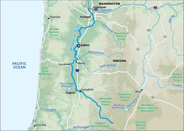
Here’s our map of the Willamette River flowing through western Oregon. It runs past Eugene, Salem, and Portland.
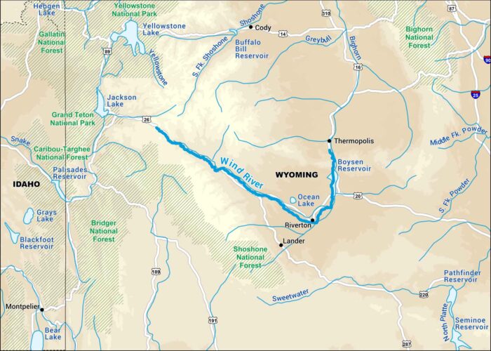
Our Wind River map highlights its run through the mountains of western Wyoming. It cuts through some of the most scenic country in the Rockies.
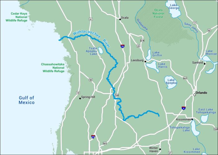
This map of the Withlacoochee River displays its slow curve through west-central Florida. It passes small rural towns on its way to the Gulf.
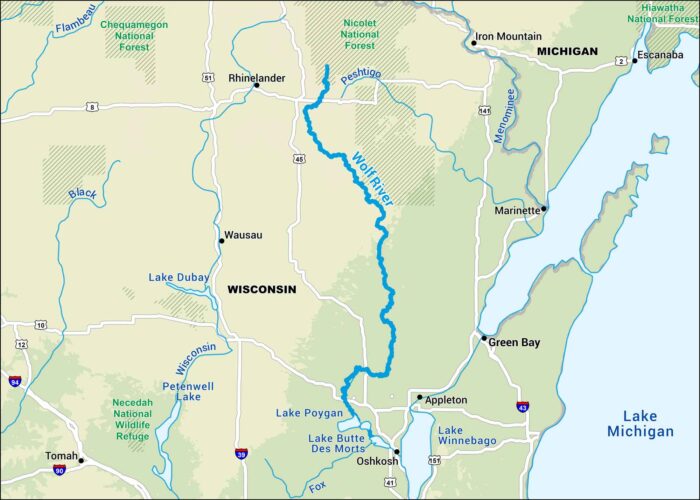
Our map of the Wolf River follows its path through northern Wisconsin. It winds past before reaching Fox River near Lake Butte des Morts.
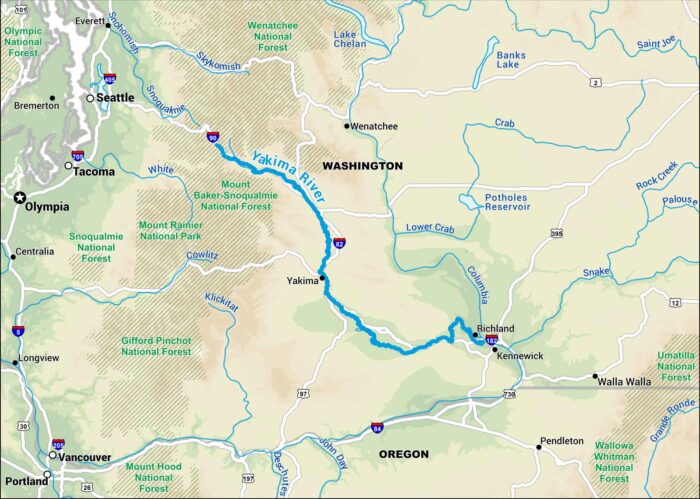
Our map of the Yakima River shows its route through central Washington. You’ll notice it passes by Richland, Kennewick and Yakima.
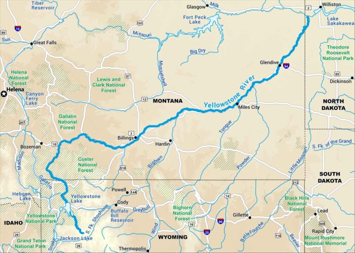
Here’s our map of the Yellowstone River running across southern Montana. It’s one of the last free-flowing rivers in the West.
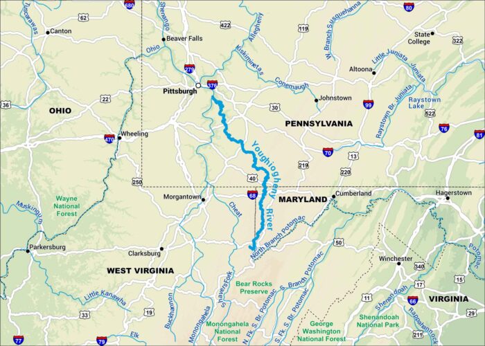
Our map of the Youghiogheny River follows its winding path through the Allegheny Mountains of southwestern Pennsylvania.
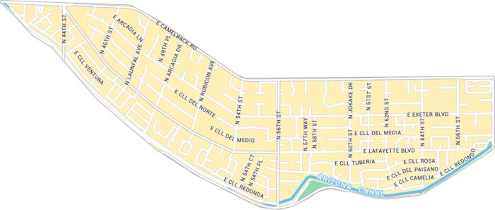
Here’s our map of Arcadia sitting under Camelback Mountain. It shows the main roads, canals, and local road that tie Phoenix and Scottsdale.
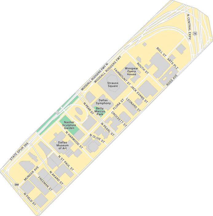
Our Dallas Arts District map focuses on the stretch near Klyde Warren Park. You’ll see the museums, concert halls, and nearby city streets.
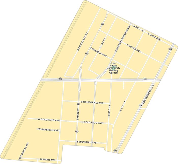
This road map of the Arts District cuts right through downtown Las Vegas. The area has a raw, creative edge that feels far from the Strip.
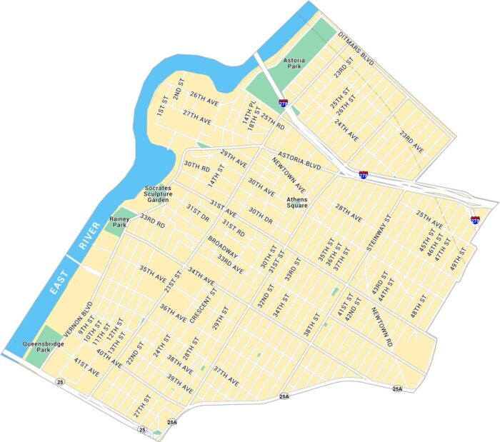
Our map of Astoria shows the road and highways near the East River. It’s one of Queens’ most diverse and lively neighborhoods.
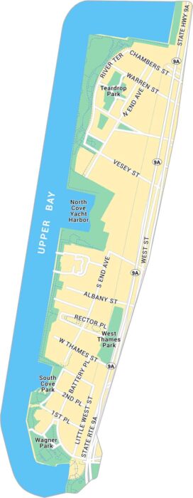
Here’s our map of Battery Park at Manhattan’s southern tip. It includes Teardrop Park, local roads, and green space that frame the skyline.
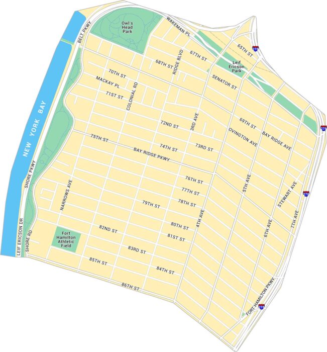
This map covers Bay Ridge along Brooklyn’s waterfront. It lays out Shore Road, local parks, and Interstate 278 at the edge of the map.
Our map shows Beacon Hill’s tight old streets just steps from the State House. You can see every turn between the Common and the Charles.