Wrangell St. Elias National Park Map
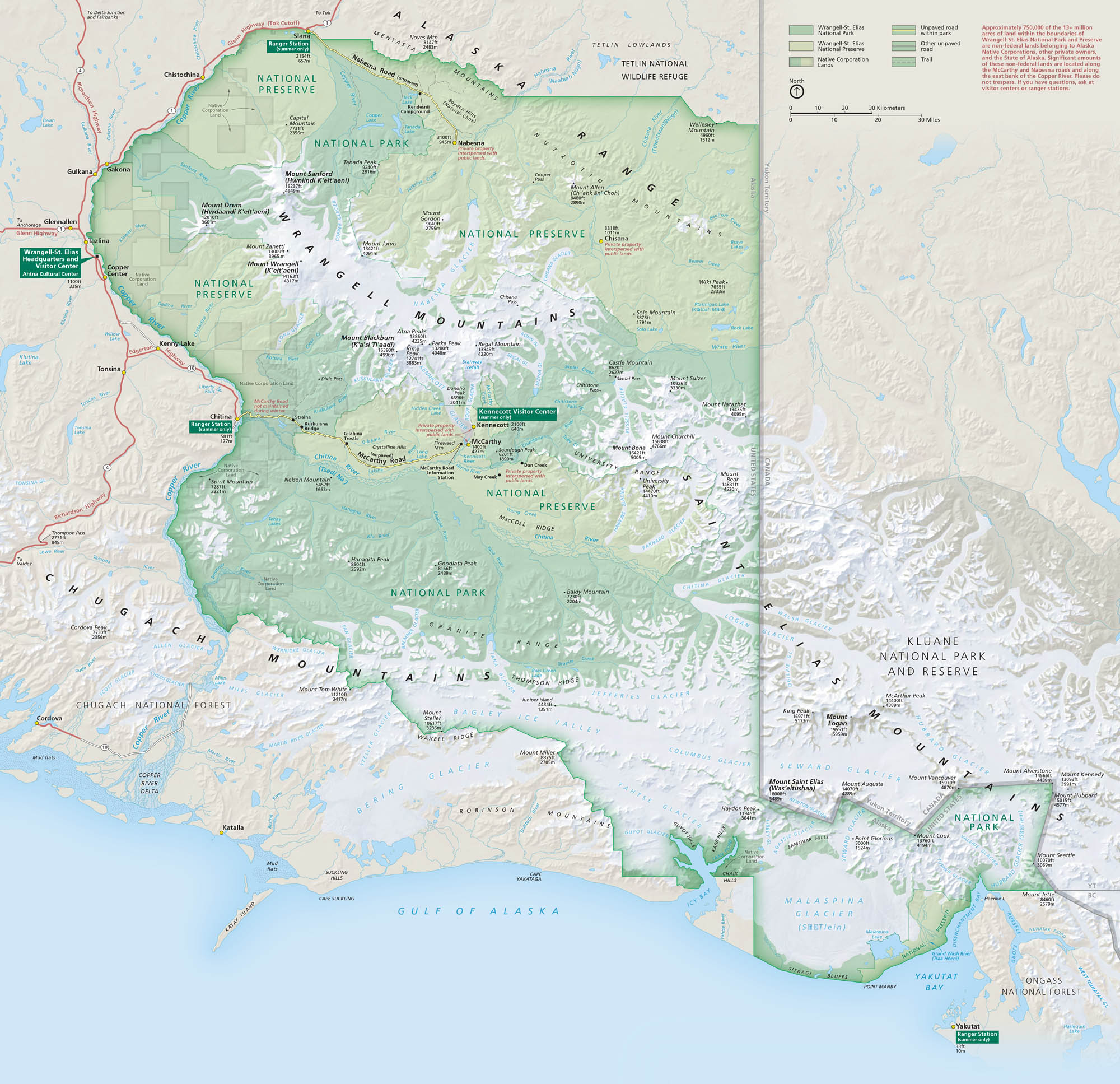
Wrangell–St. Elias is massive. It’s bigger than some countries and wilder than most. Our map lays out its glaciers, peaks, and remote roads that cut through raw Alaskan wilderness. You can also find the Copper River, Mount St. Elias and its visitor centers.
Map Information
On the Map
Parks: Wrangell-St. Elias National Park and Preserve, Tetlin National Wildlife Refuge, Kluane National Park and Reserve, Chugach National Forest, Tongass National Forest Visitor Centers: Wrangell-St. Elias Headquarters and Visitor Center, Kennecott Visitor Center, Slana Ranger Station, Chitina Ranger Station, Yakutat Ranger Station Major Roads: Edgerton Hwy, Nabesna Rd, McCarthy Rd, Richardson Hwy, Glenn Hwy, Tok Cutoff Reservoirs/Glaciers: Gulf of Alaska, Yakutat Bay, Copper River, Chitina River, Tanana River, Nizina River, Malaspina Glacier, Nabesna Glacier, Kennicott Glacier, Root Glacier, Bagley Ice Valley, Bering Glacier, Guyot Glacier, Yahtse Glacier, Hubbard Glacier Cities/Towns: Glennallen, Gakona, Gulkana, Copper Center, Chitina, McCarthy, Slana, Nabesna, Yakutat Other Landmarks: Wrangell Mountains, St. Elias Mountains, Mount St. Elias, Mount Blackburn, Mount Sanford, Mount Wrangell, Mount Drum, Mount Bona, Mount Bear, Mount Logan, KennecottNational Park Maps
Find maps of green spaces and national parks near you.


