US Virgin Islands Map
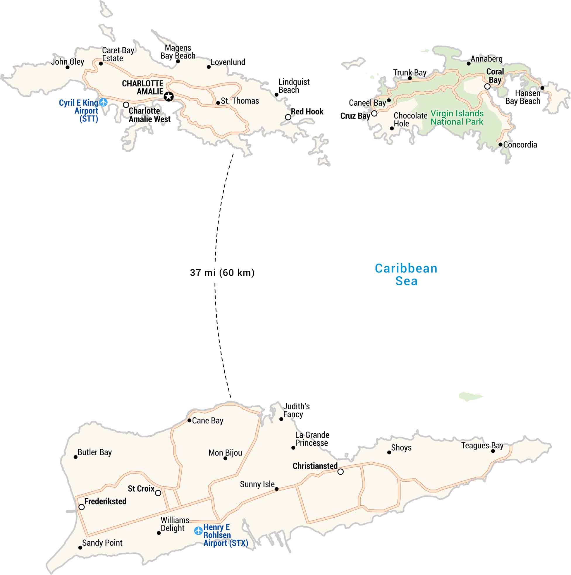
The U.S. Virgin Islands sit in the Caribbean. It’s warm and bright year-round. Our map shows St. Thomas and St. Croix. Each has beaches, harbors, and winding coastal roads. Small islands, but big views.
Map Information
On the Map
Capital City: Charlotte Amalie Cities/Towns: Charlotte Amalie West, Christiansted, Coral Bay, Cruz Bay, Frederiksted, Red Hook, St Croix Populated Places: Annaberg, Butler Bay, Cane Bay, Caneel Bay, Caret Bay Estate, Chocolate Hole, Concordia, Coral Bay, John Oley, Judith’s Fancy, La Grande Princesse, Lovenlund, Mon Bijou, Shoys, St Thomas, Sunny Isle, Williams Delight Beaches/Bays: Hansen Bay Beach, Lindquist Beach, Magens Bay Beach, Sandy Point, Teagues Bay, Trunk Bay Highways/Roads: Melvin H Evans Hwy, Centerline Rd, Queen Mary Hwy Major Waterbodies: Caribbean Sea Airports: Cyril E King Airport (STT), Henry E Rohlsen Airport (STX) Parks: Virgin Islands National ParkMetropolitan Regions
Developed areas, suburban zones, and metro regions.