Rocky Mountain National Park Map
Here’s our map of Rocky Mountain National Park. You’ll see Trail Ridge Road, campgrounds, picnic areas, restrooms and visitor centers.
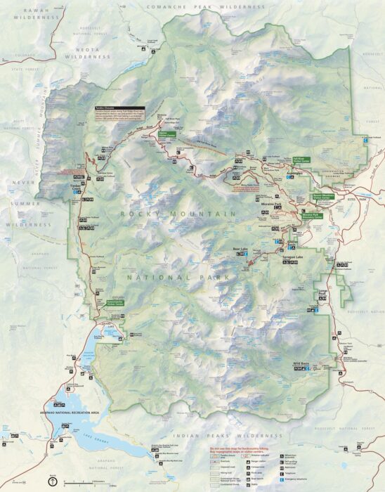
Here’s our map of Rocky Mountain National Park. You’ll see Trail Ridge Road, campgrounds, picnic areas, restrooms and visitor centers.
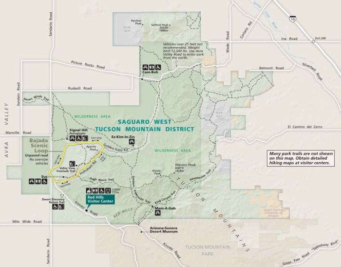
Our Saguaro National Park map shows East and West districts next to Tucson. See Speedway Boulevard, I-10, and loop roads.
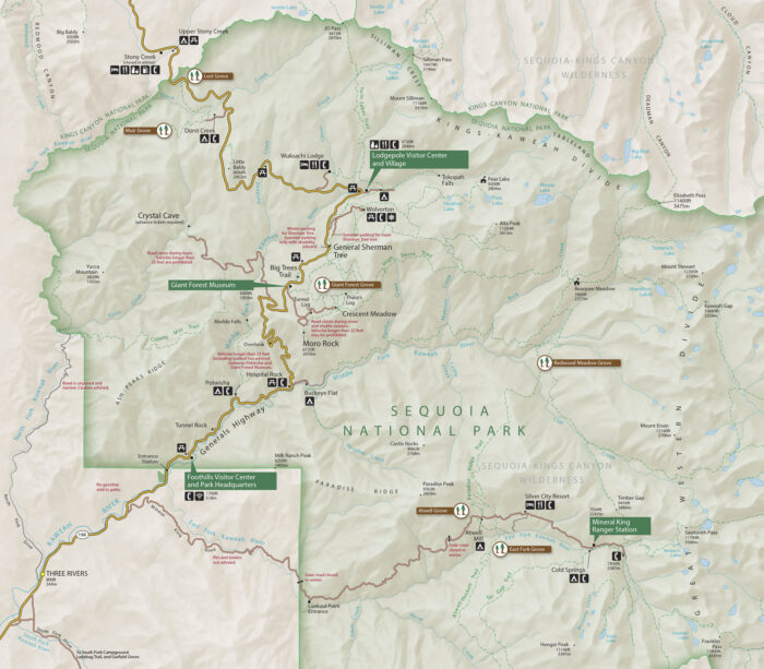
Download our map of Sequoia National Park with roads, trails, campgrounds, located in California’s Sierra Nevada.
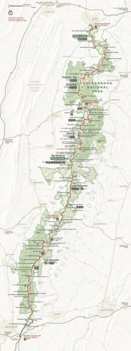
Our map of Shenandoah National Park highlights Skyline Drive journey. See entrance stations, overlooks, and connections to I-81.
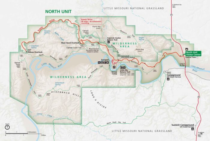
Here’s our map of North Dakota’s badlands split into North and South Units. I-94, Highway 85, and the scenic loop drives are clearly marked.
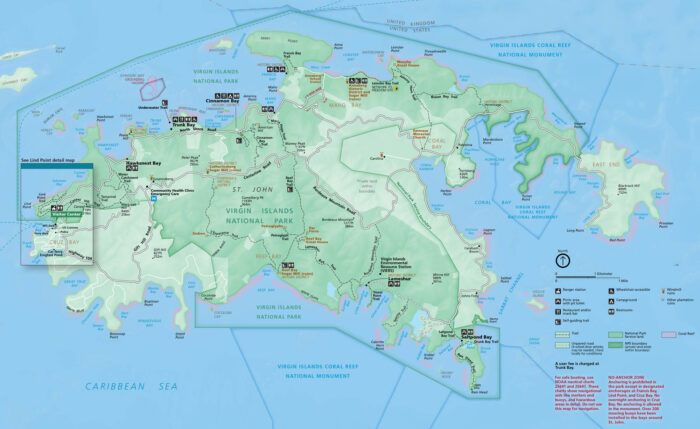
Virgin Islands National Park contains beaches, reefs, and historic ruins. Our park map shows roads, trails, bays, and campgrounds.
Step into Minnesota’s water wilderness with our map of island-studded lakes and waterways. This rare find sits on the Canadian border.
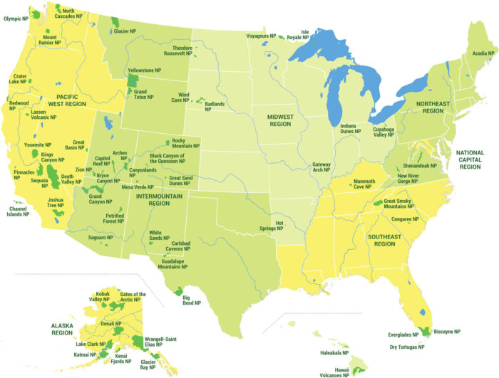
Our map showcases all 63 national parks across five distinct US regions. See national park locations, state boundaries, and regions.
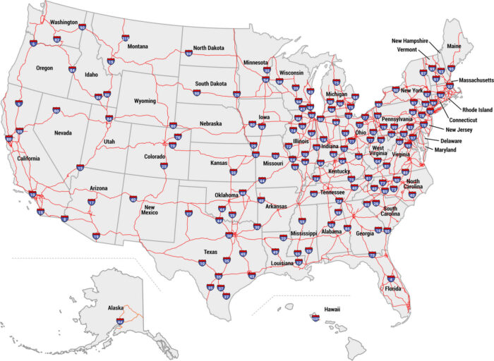
Our US interstate map displays the entire highway system with all major routes labeled. See I-5 to I-95, state boundaries, and freeways.
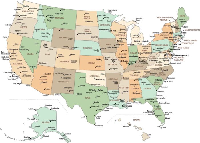
Our map highlights Washington DC, all 50 state capitals, and major cities nationwide. From coast to coast, see all of America’s big cities.
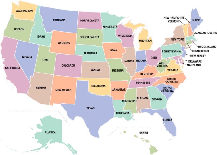
Our US states map displays all 50 states color-coded and clearly labeled. See state boundaries, Hawaii and Alaska insets.
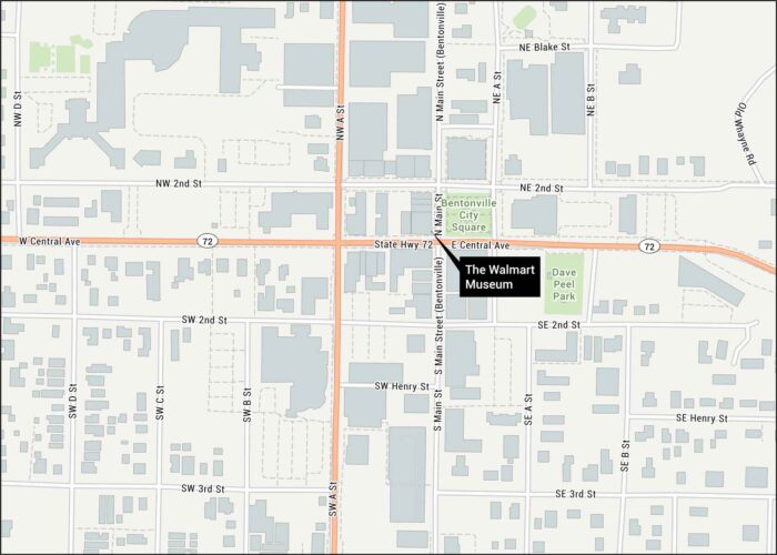
Sam Walton’s retail empire started right here on Bentonville’s town square. Our road map shows Main Street, Highway 72, and connecting roads.
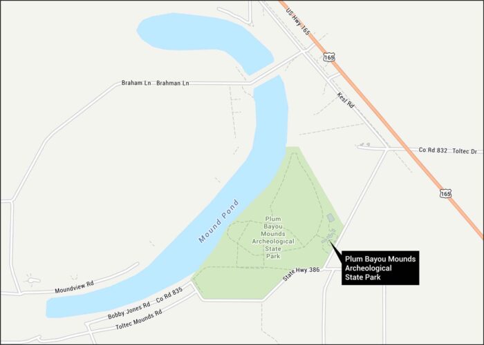
We’ve mapped out the ancient earthworks at Plum Bayou Mounds Archeological State Park in the Arkansas River lowlands.
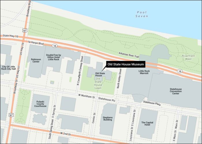
Our Old State House Museum map shows its location in Little Rock. The capitol has stood since 1833 as the state’s oldest structure.
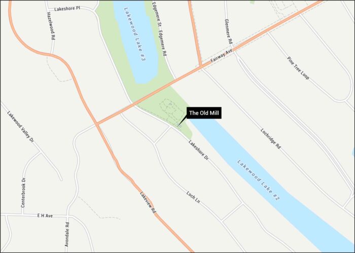
Hollywood’s favorite Arkansas backdrop sits pretty in our North Little Rock map. Lakeshore Drive, Fairway Ave, and streets are all marked.