Shenandoah National Park Map
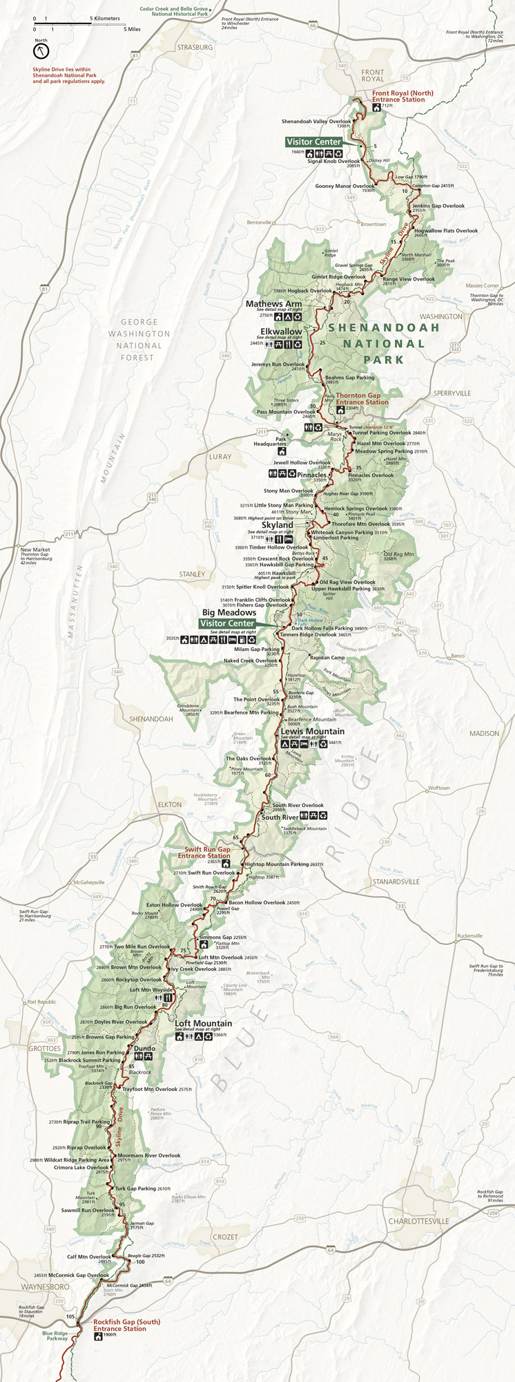
Our map of Shenandoah National Park highlights Skyline Drive’s 105-mile ridge-top journey through Virginia. See entrance stations, overlooks, and connections to I-81 and Highway 33.
Map Information
On the Map
Parks: Shenandoah National Park, George Washington National Forest Visitor Centers: Dickey Ridge Visitor Center, Big Meadows Visitor Center Highways and Roads: Skyline Drive, US Hwy 211, US Hwy 33, US Hwy 340, I-64, US Hwy 250, US Hwy 522, US Hwy 11, US Hwy 15, US Hwy 29 Major Rivers: Shenandoah River, South River, Rapidan River, Rose River, Robinson River Cities/Towns: Front Royal, Luray, Stanley, Shenandoah, Elkton, Grottoes, Waynesboro, Sperryville, Madison, Stanardsville, Charlottesville Campgrounds/Park Sites: Mathews Arm, Big Meadows, Lewis Mountain, Loft Mountain, Dundo, Skyland, Elkwallow, Panorama, Pinnacles Picnic Area, South River Picnic Area Other Landmarks: Blue Ridge, Marys Rock, Old Rag Mountain, Hawksbill, Stony Man, Thornton Gap Entrance Station, Swift Run Gap Entrance Station, Rockfish Gap Entrance Station, Front Royal Entrance StationNational Park Maps
Find maps of green spaces and national parks near you.


