Theodore Roosevelt National Park Map
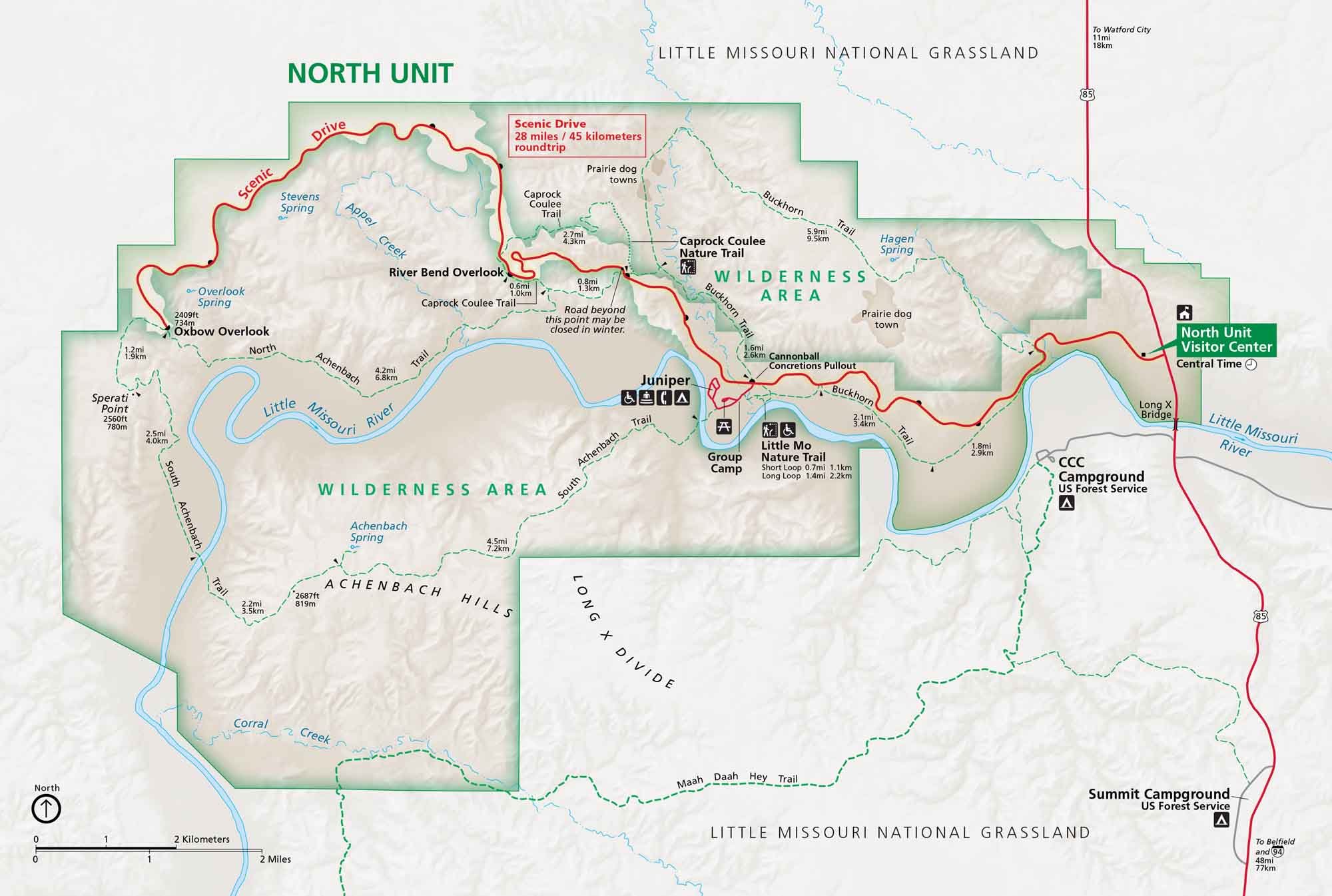
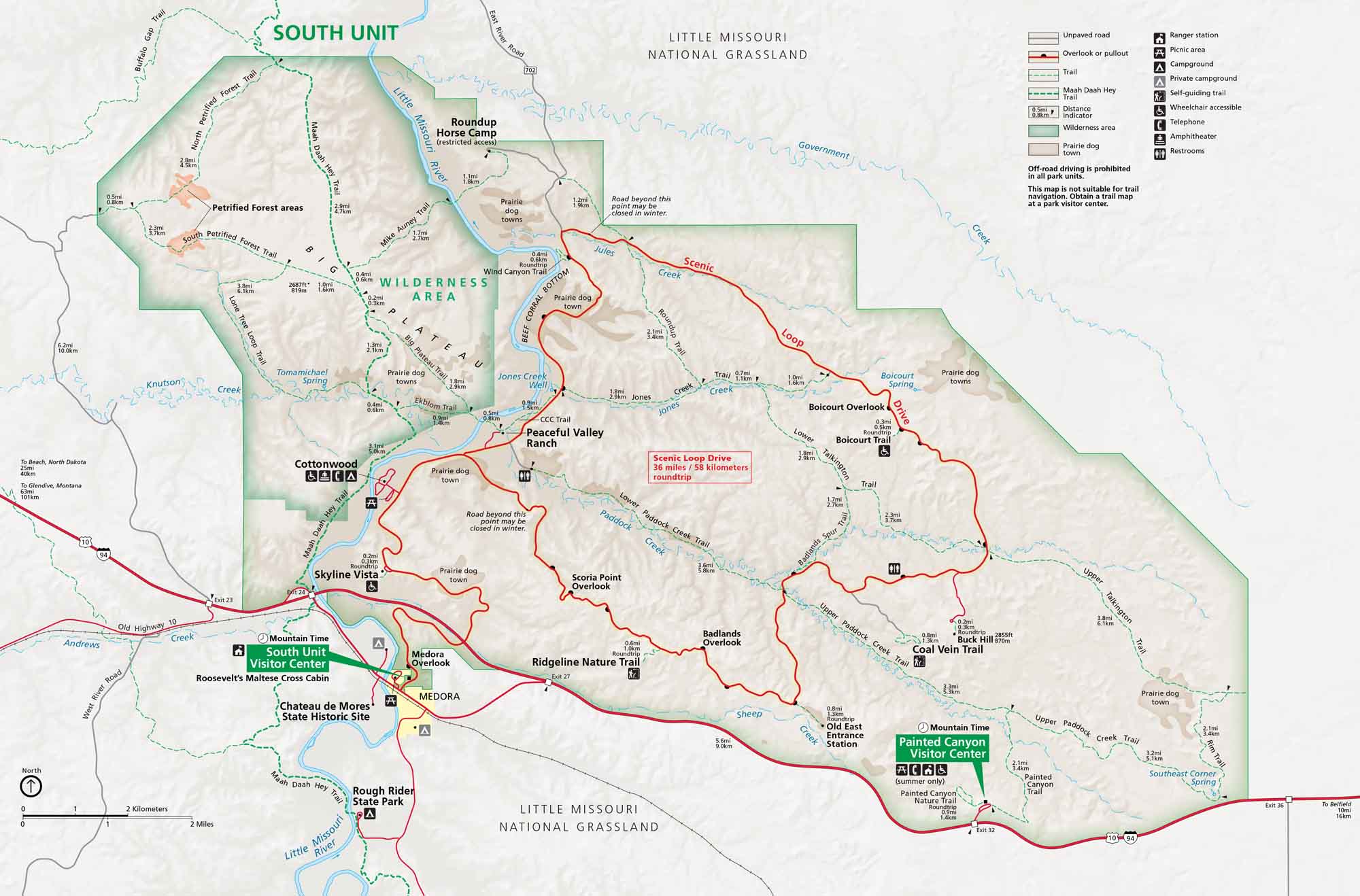
Here’s our map of North Dakota’s badlands split into North and South Units. I-94, Highway 85, and the scenic loop drives are clearly marked. Teddy Roosevelt’s ranching days in these wild badlands raised the bar for conservation nationwide.
Map Information
On the Map
Parks: Theodore Roosevelt National Park, Little Missouri National Grassland Visitor Centers: North Unit Visitor Center, South Unit Visitor Center, Painted Canyon Visitor Center Highways and Roads: Scenic Drive, US Hwy 85 Rivers/Springs: Little Missouri River, Squaw Creek, Achenbach Spring, Hagen Spring, Stevens Spring Cities/Towns: Watford City, Belfield Campgrounds/Park Sites: Juniper Campground, CCC Campground, Summit Campground, Group Camp, Little Mo Nature Trail Other Landmarks: River Bend Overlook, Oxbow Overlook, Sperati Point, Achenbach Hills, Long X Divide, Caprock Coulee Trail, Buckhorn Trail, Maah Daah Hey Trail, Cannonball Concretions PulloutNational Park Maps
Find maps of green spaces and national parks near you.


