Voyageurs National Park Map
Step into Minnesota’s water wilderness with our map of island-studded lakes and waterways. This rare find sits on the Canadian border. This is where voyageurs once paddled fur trade routes.
Map Information
On the Map
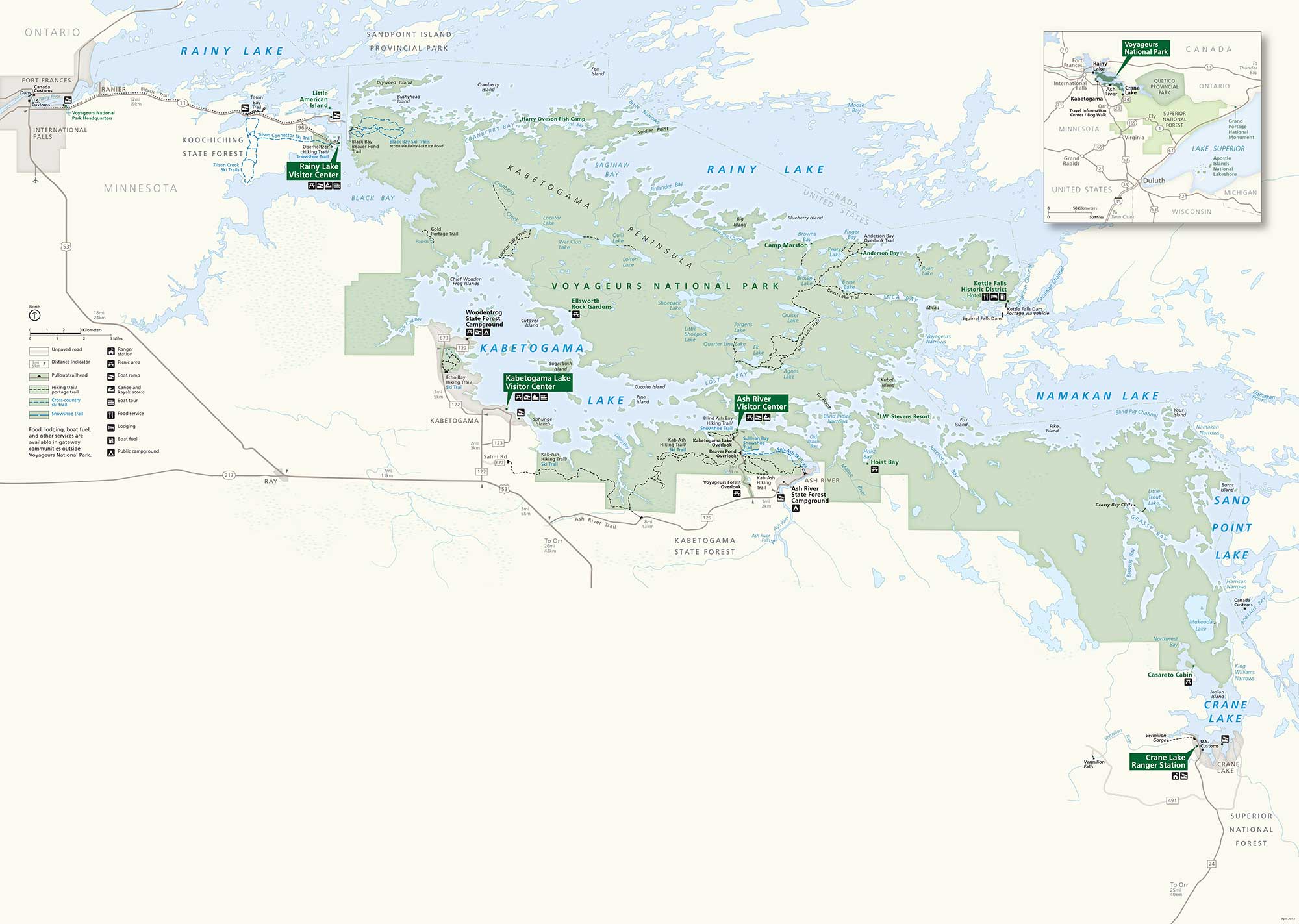
Parks: Voyageurs National Park, Koochiching State Forest, Kabetogama State Forest, Superior National Forest, Sandpoint Island Provincial Park, Quetico Provincial Park Visitor Centers: Rainy Lake Visitor Center, Kabetogama Lake Visitor Center, Ash River Visitor Center, Crane Lake Ranger Station Highways and Roads: US Hwy 53, US Hwy 71, State Rte 11, State Rte 217, State Rte 122, State Rte 129, State Rte 123, State Rte 153, Ash River Trail, Salmi Rd Rivers/Lakes: Rainy Lake, Kabetogama Lake, Namakan Lake, Sand Point Lake, Crane Lake, Black Bay, Kabetogama Bay, Sullivan Bay, Lost Bay, Saginaw Bay, War Club Lake, Quill Lake, Locator Lake, Loiten Lake, Shoepack Lake, Jorgens Lake, Quarter Line Lake, Ek Lake, Agnes Lake, Mukooda Lake, Little Trout Lake Cities/Towns: International Falls, Fort Frances, Ranier, Ray, Ash Lake, Orr, Crane Lake, Buyck Campgrounds/Park Sites: Woodenfrog State Forest Campground, Ash River State Forest Campground, Ellsworth Rock Gardens, Kettle Falls Historic District, Hoist Bay, Casareto Cabin, King Williams NarrowsOther Landmarks: Kabetogama Narrows, Namakan Narrows, Grassy Bay Cliffs, Vermilion Gorge
National Park Maps
Find maps of green spaces and national parks near you.


