Virgin Islands National Park Map
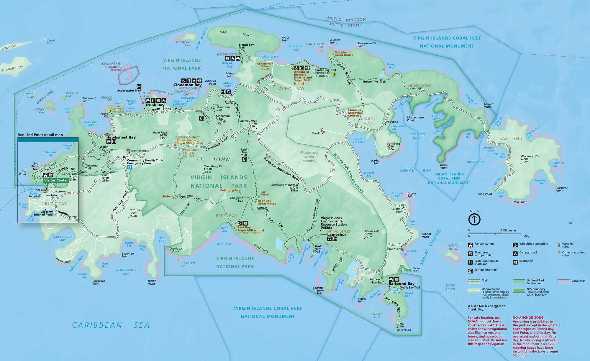
Step into clear water and bright island hills. On St. John, this national park contains beaches, reefs, and historic ruins. Our park map shows roads, trails, bays, and campgrounds.
Map Information
On the Map
Parks: Virgin Islands National Park, Virgin Islands Coral Reef National Monument Visitor Centers: Visitor Center (Cruz Bay) Major Roads: North Shore Rd, Centerline Rd, Bordeaux Mountain Rd, Gift Hill Rd, Highway 104, Highway 107 Bays and Reservoirs: Caribbean Sea, Atlantic Ocean, Cruz Bay, Hawksnest Bay, Trunk Bay, Cinnamon Bay, Maho Bay, Francis Bay, Leinster Bay, Coral Bay, Hurricane Hole, Round Bay, Lameshur Bay, Reef Bay, Fish Bay, Rendezvous Bay, Great Cruz Bay, Saltpond Bay Cities/Towns: Cruz Bay, Coral Bay Campgrounds/Park Sites: Cinnamon Bay Campground, Saltpond Bay, Lameshur, Peace Hill, Annaberg Historic District, Catherineberg Sugar Mill, Reef Bay Sugar Mill Other Landmarks: Bordeaux Mountain, St. John, Ram Head, Mary Point, East End, Lind Point, Petroglyphs, Trunk Bay Underwater TrailNational Park Maps
Find maps of green spaces and national parks near you.


