Central Illinois Map
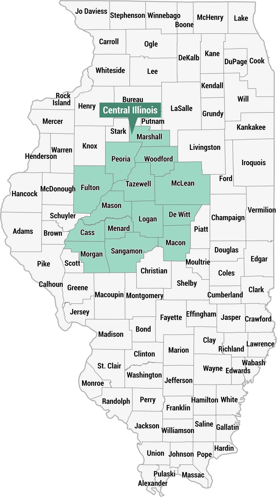
Here’s our county map highlighting the Central Illinois region in teal. You’ll find this region across the middle portion of the state. All 102 counties are labeled.
Map Information
On the Map
Central Illinois Counties (highlighted in teal): Marshall, Peoria, Woodford, Fulton, Tazewell, McLean, Mason, Logan, De Witt, Cass, Menard, Macon, Morgan, SangamonReferences
Metropolitan Regions
Developed areas, suburban zones, and metro regions.