California Regions Map
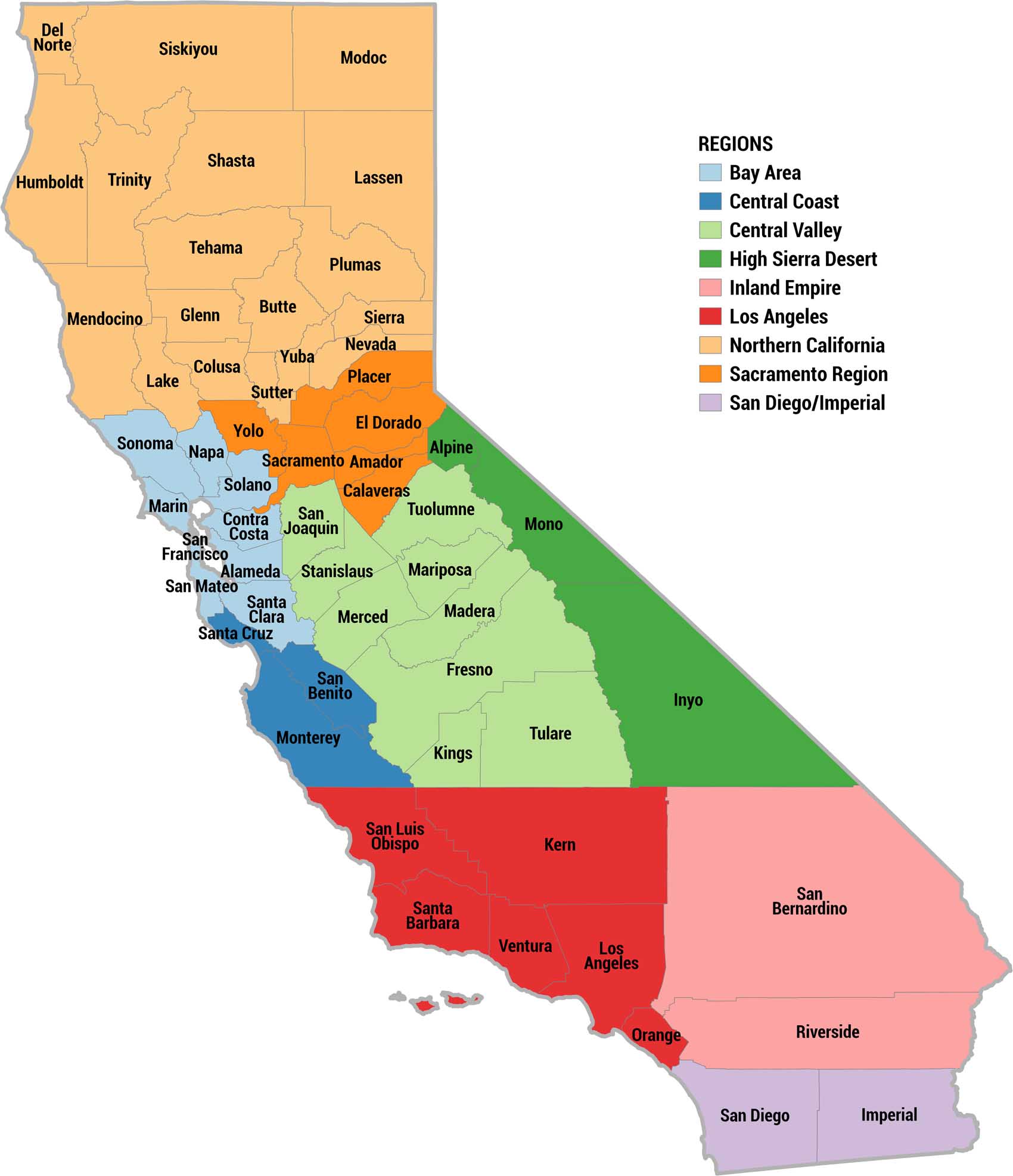
Our color-coded map divides California into 9 official regions. We’re showing each one with a distinct color as part of the legend on the right. All 58 counties are labeled.
Map Information
On the Map
Here are the counties that belong to each California region:
|
Region |
County Names |
|
Bay Area |
Alameda, Contra Costa, San Mateo, Santa Clara, Napa, Sonoma, Solano, Marin, San Francisco |
|
Central Coast |
San Benito, Monterey, Santa Cruz |
|
Central Valley |
Fresno, Merced, Tulare, Madera, Mariposa, Stanislaus, San Joaquin, Kings, Tuolumne |
|
High Sierra Desert |
Alpine, Mono, Inyo |
|
Inland Empire |
San Bernardino, Riverside |
|
Los Angeles |
Orange, San Luis Obispo, Kern, Santa Barbara, Ventura, Los Angeles |
|
Northern California |
Humboldt, Lake, Nevada, Yuba, Mendocino, Sutter, Plumas, Siskiyou, Sierra, Shasta, Colusa, Lassen, Glenn, Tehama, Modoc, Trinity, Butte, Del Norte |
|
Sacramento Region |
Amador, Yolo, Calaveras, Placer, El Dorado, Sacramento |
|
San Diego/Imperial |
San Diego, Imperial |
Metropolitan Regions
Developed areas, suburban zones, and metro regions.