Coachella Valley Map
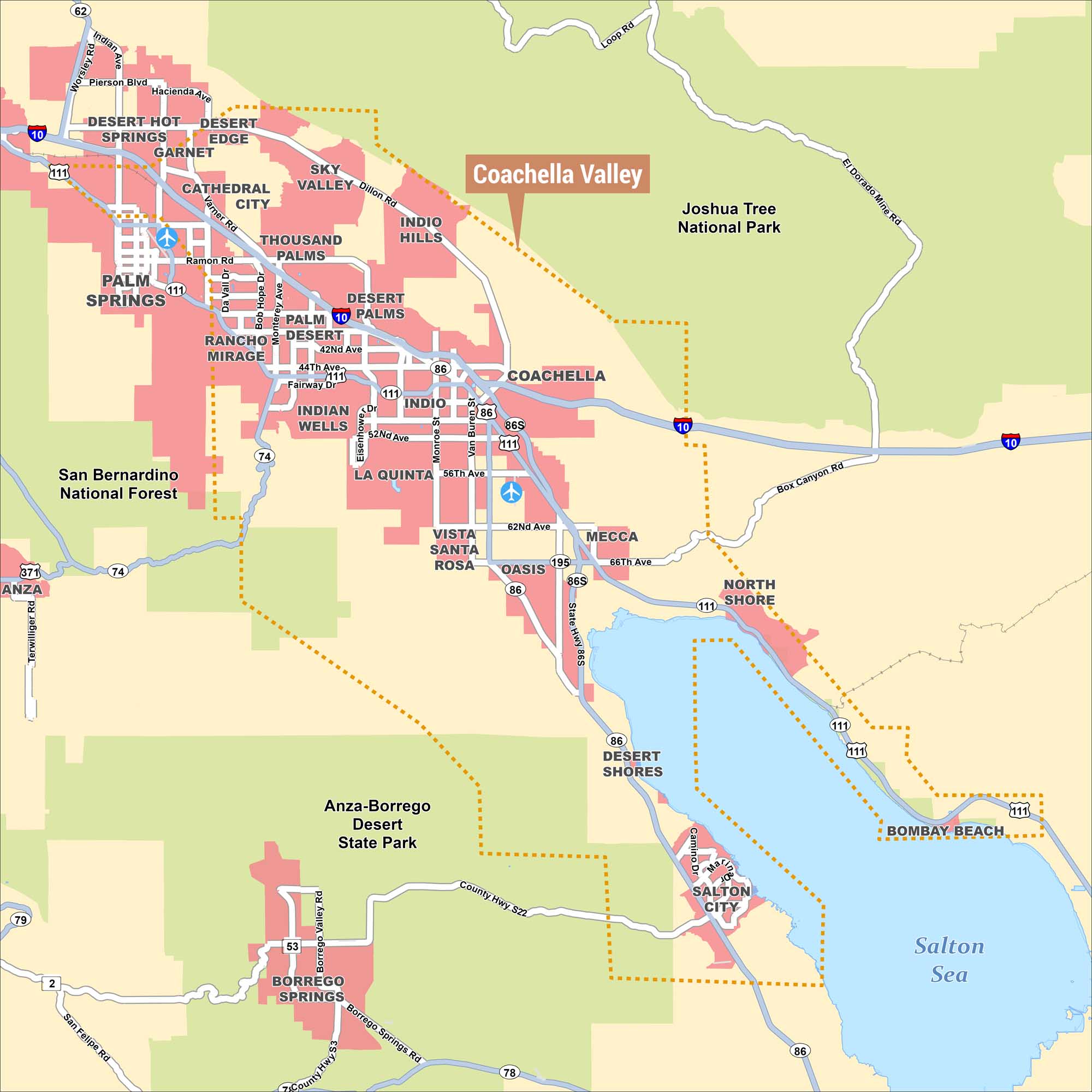
This is a detailed map of the Coachella Valley in southern California, with the valley boundary outlined in an orange dashed line. The Salton Sea anchors the southeastern corner, with major national and state parks surrounding the region. Incorporated cities and urban areas are shown in pink.
Map Information
On the Map
Cities/Communities: Palm Springs, Desert Hot Springs, Garnet, Desert Edge, Cathedral City, Sky Valley, Rancho Mirage, Palm Desert, Thousand Palms, Indio Hills, Desert Palms, Indian Wells, Indio, La Quinta, Coachella, Vista Santa Rosa, Oasis, Mecca, North Shore, Desert Shores, Bombay Beach, Salton City, Borrego Springs, Anza Parks and Protected Areas: Joshua Tree National Park, San Bernardino National Forest, Anza-Borrego Desert State Park Major Highways: I-10, US-74, US-86, US-86S, US-111, CA-62, CA-79, CA-195, CA-371 Roads: Indian Ave, Worsley Rd, Pierson Blvd, Hacienda Ave, Dillon Rd, Verner Rd, Ramon Rd, Da Vall Dr, Bob Hope Dr, Monterey Ave, 42nd Ave, 44th Ave, Fairway Dr, Eisenhower Dr, 52nd Ave, Monroe St, Van Buren St, 56th Ave, 62nd Ave, 66th Ave, Loop Rd, El Dorado Mine Rd, Box Canyon Rd, State Hwy 86S, Camino Dr, Borrego Valley Rd, Borrego Springs Rd, County Hwy S22, San Felipe Rd Lakes/Reservoirs: Salton SeaReferences
Natural Region Maps
Geographic landforms, wilderness zones, deserts, mountain ranges, and terrain.