Kentucky Population Map
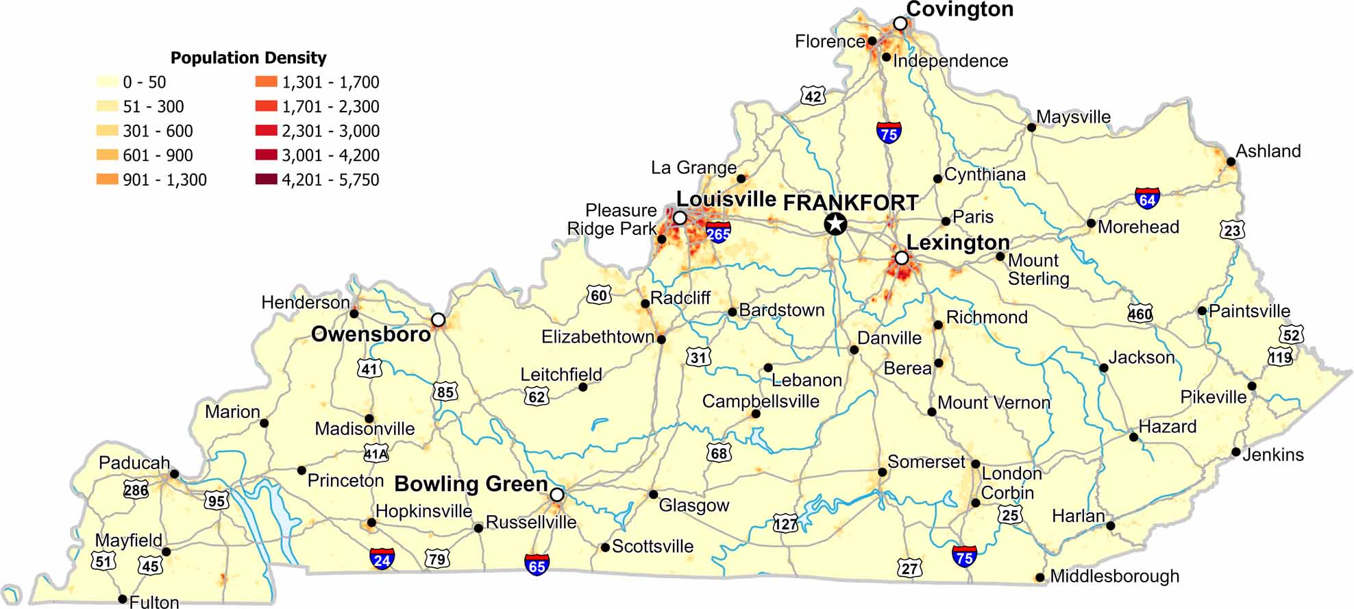
See population patterns in our density map of Kentucky. Our map shows Appalachian terrain limiting eastern growth. Valleys host most settlements, as northern and central areas appear denser.
Map Information
On the Map
Kentucky State Maps
Our Kentucky maps reveal the Bluegrass State


State Population Maps
Select any state map below to view its population density map.


