Kansas Precipitation Map
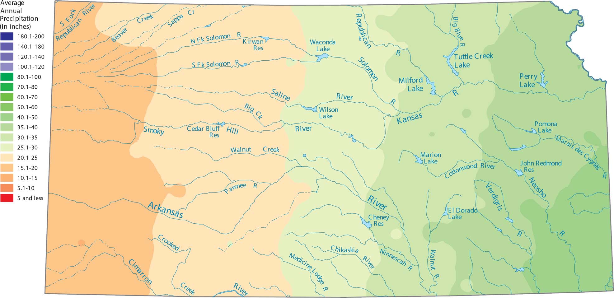
Eastern Kansas appears wetter on the map than the High Plains. Our precipitation map of Kansas shows this steady transition. The reason is because the western part sits higher and farther from Gulf moisture sources.
Map Information
State Precipitation Maps
Select any state map below to view its precipitation map.


Kansas State Maps
Explore every corner of Kansas with our state maps


