Iowa Lakes and Rivers Map
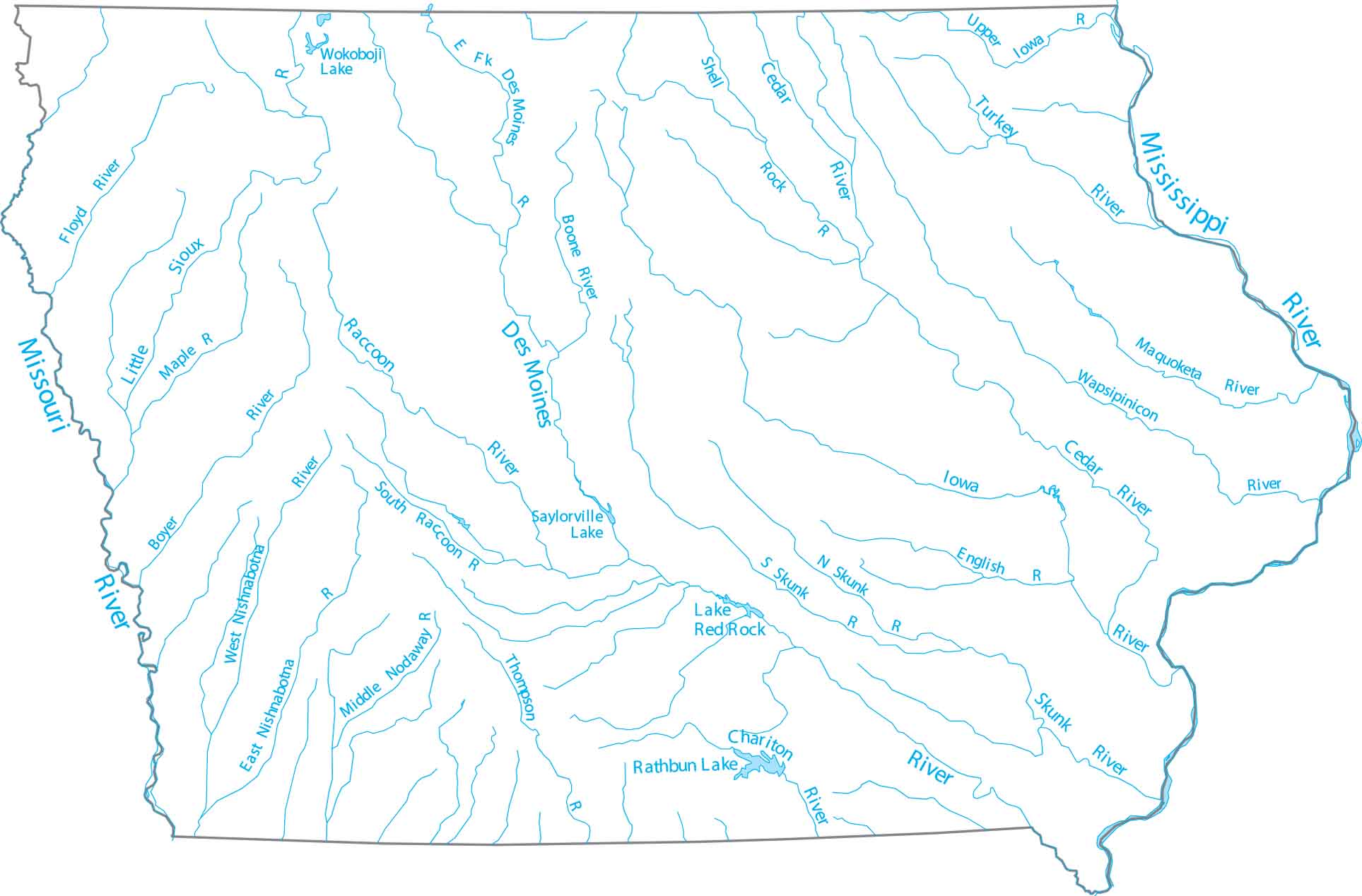
Our map of Iowa lakes and rivers highlights the Mississippi and Missouri rivers that frame the state. You’ll find the Des Moines River flowing southeast and natural lakes throughout the state. Iowa is the only state with western and eastern borders as navigable rivers.
Map Information
On the Map
Lakes and Rivers State Maps
Select any state map below to view its lakes and rivers map.


