Colorado Precipitation Map
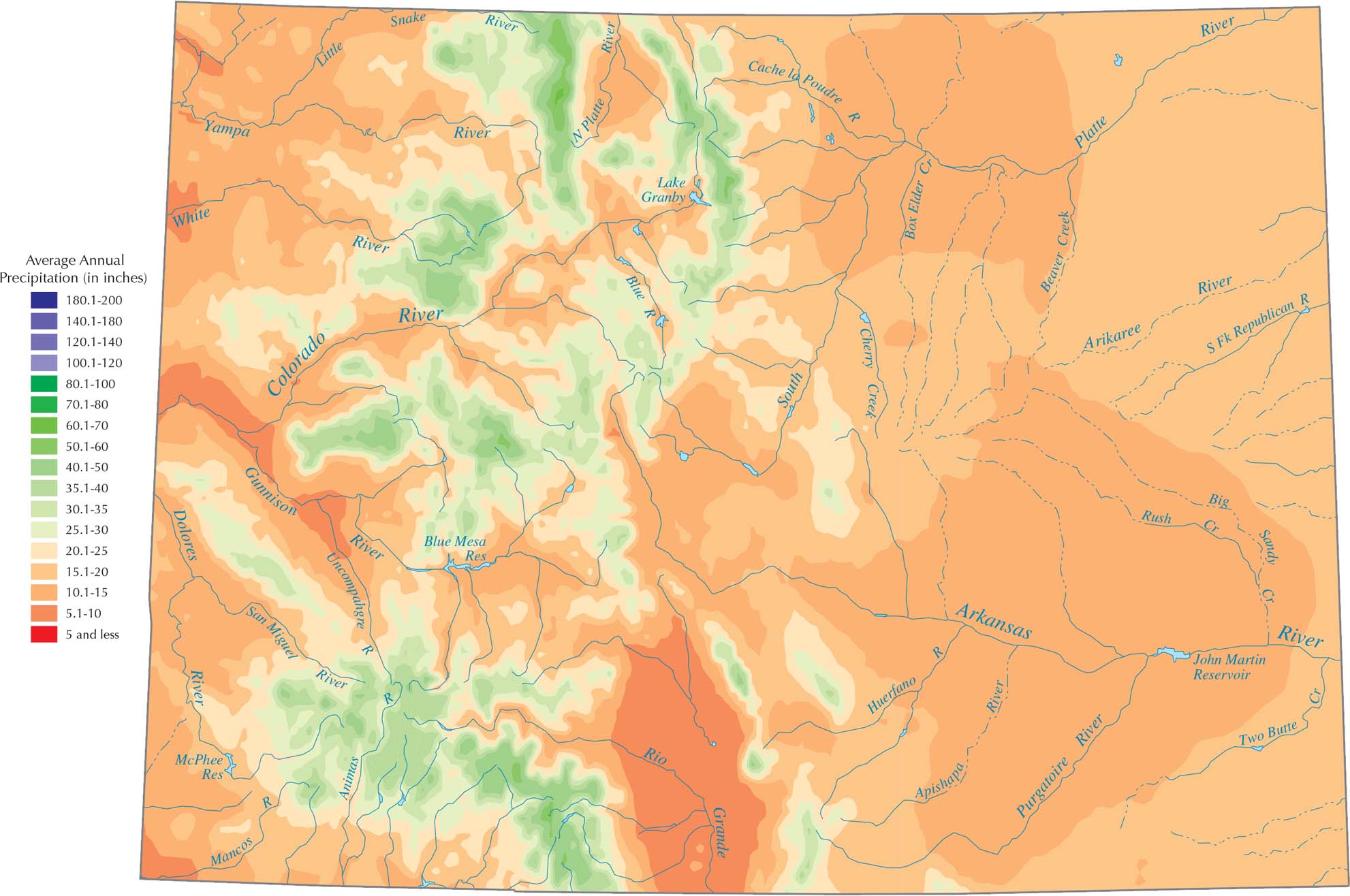
Colorado is drier overall because it sits far from oceans. Our precipitation map of Colorado shows that the highest peaks in the Rockies get the most water. It mostly comes as heavy winter snow. The eastern half of the state is much drier because the high mountains squeeze the moisture out of the air before it moves east.
Map Information
State Precipitation Maps
Select any state map below to view its precipitation map.


Colorado State Maps
Browse Colorado with our detailed state maps


