North Cascades National Park Map
North Cascades National Park has jagged peaks, deep forests, and turquoise lakes. Our map has trails, overlooks, roads, and campgrounds.
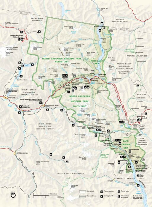
North Cascades National Park has jagged peaks, deep forests, and turquoise lakes. Our map has trails, overlooks, roads, and campgrounds.
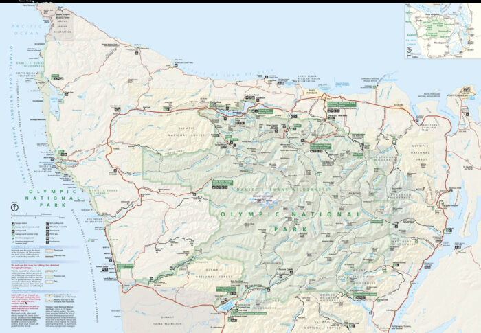
Olympic National Park is spread across Washington’s Olympic Peninsula. Our park map shows trails, roads, campgrounds, beaches, and more.
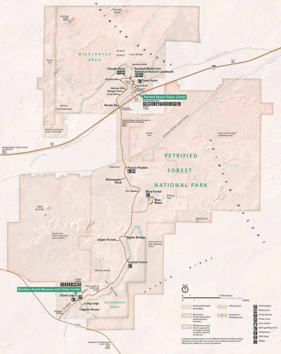
Petrified Forest National Park feels otherworldly. Stretching across northeastern Arizona, our park map shows trails, roads and more.
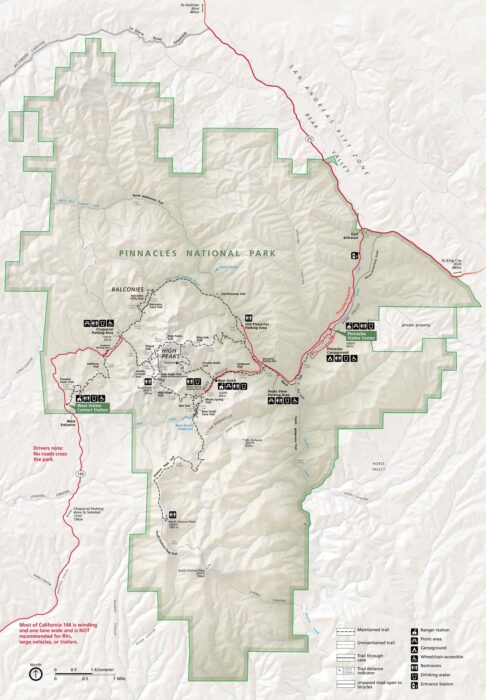
Pinnacles National Park mixes rugged cliffs, caves, and canyons. Our map shows trails, parking, roads, campgrounds, and nearby access points.
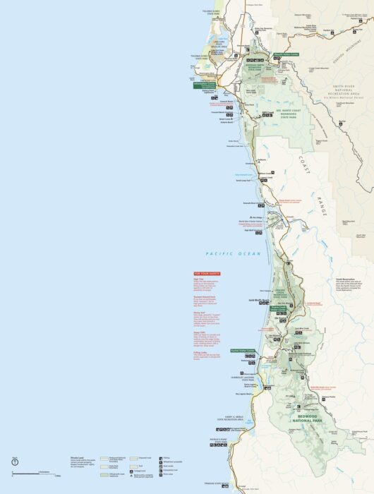
Our map highlights Redwood National and State Parks with the tallest trees on Earth. You’ll see Highway 101 and Newton B. Drury Scenic Parkway
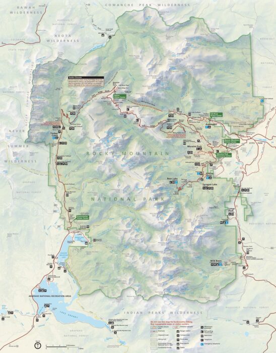
Here’s our map of Rocky Mountain National Park. You’ll see Trail Ridge Road, campgrounds, picnic areas, restrooms and visitor centers.
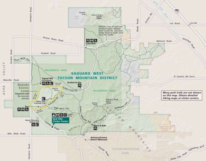
Our Saguaro National Park map shows East and West districts next to Tucson. See Speedway Boulevard, I-10, and loop roads.
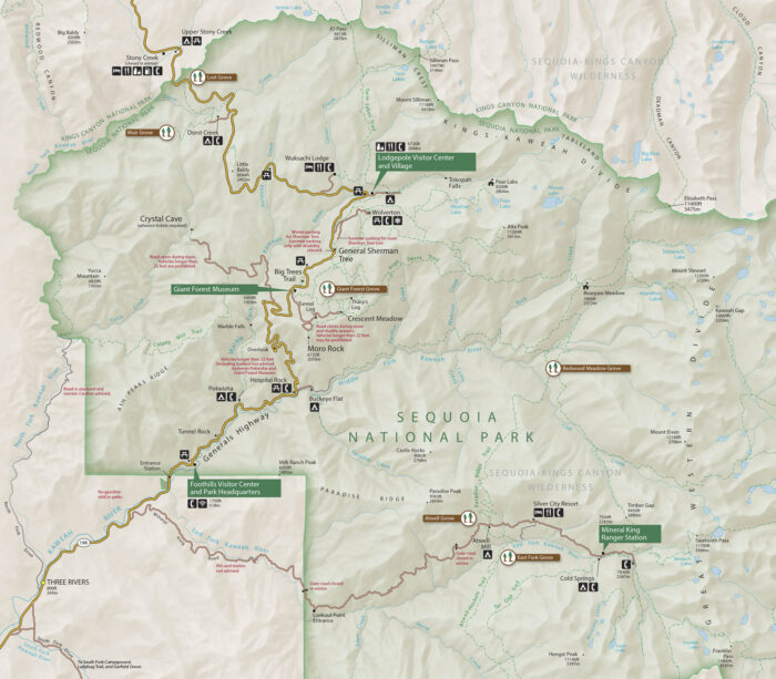
Download our map of Sequoia National Park with roads, trails, campgrounds, located in California’s Sierra Nevada.
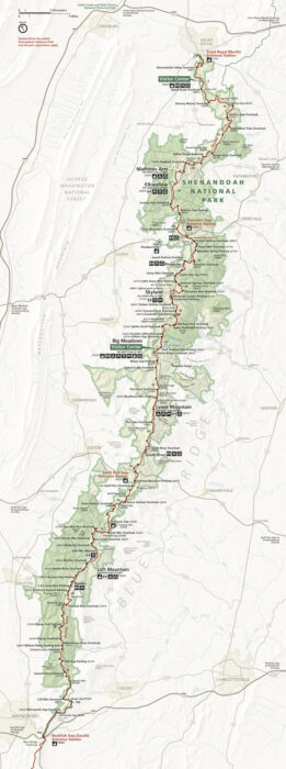
Our map of Shenandoah National Park highlights Skyline Drive journey. See entrance stations, overlooks, and connections to I-81.
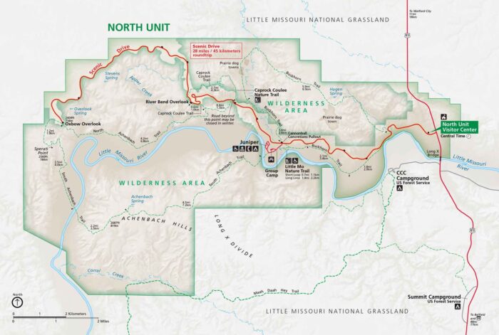
Here’s our map of North Dakota’s badlands split into North and South Units. I-94, Highway 85, and the scenic loop drives are clearly marked.
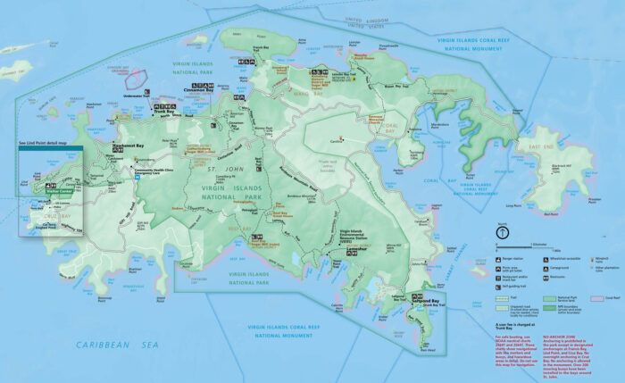
Virgin Islands National Park contains beaches, reefs, and historic ruins. Our park map shows roads, trails, bays, and campgrounds.
Step into Minnesota’s water wilderness with our map of island-studded lakes and waterways. This rare find sits on the Canadian border.
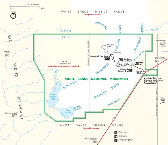
White Sands National Park kind of feels like it’s on another planet. Our map displays the dunes that stretch for miles.
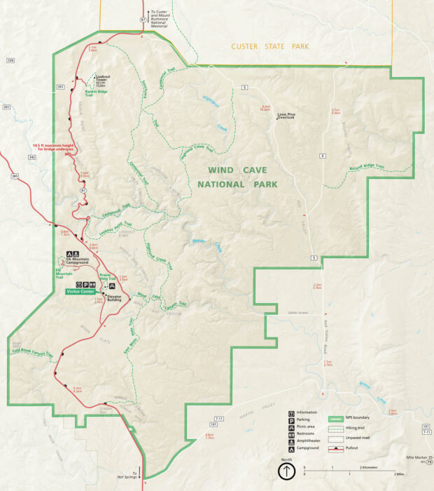
Wind Cave National Park is quiet on the surface but vast below. Our map shows the rolling prairies, forested hills, and the maze of trails.
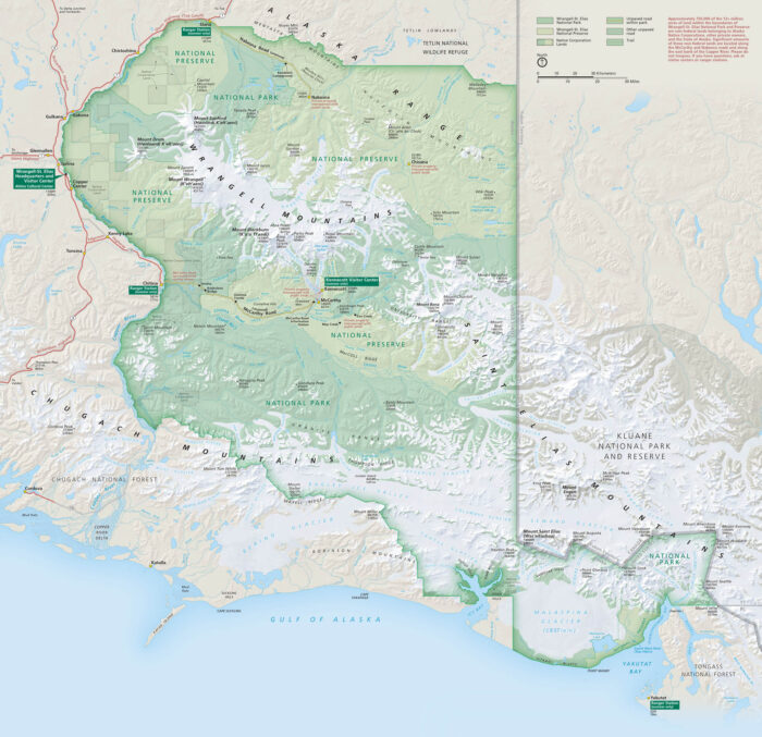
Wrangell–St. Elias is massive. It’s bigger than some countries and wilder than most. Our map lays out its glaciers, peaks, and remote roads.