Historic District Map, Savannah
In the heart of Savannah, the Historic District spreads out under oak trees and old brick buildings. This map shows all there is to know.
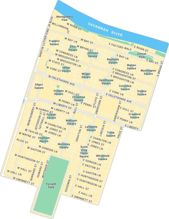
In the heart of Savannah, the Historic District spreads out under oak trees and old brick buildings. This map shows all there is to know.
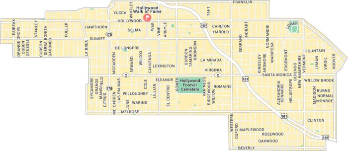
Hollywood sits in the heart of Los Angeles, cut through by Sunset and Hollywood Boulevard. Our map shows its main streets and highways.
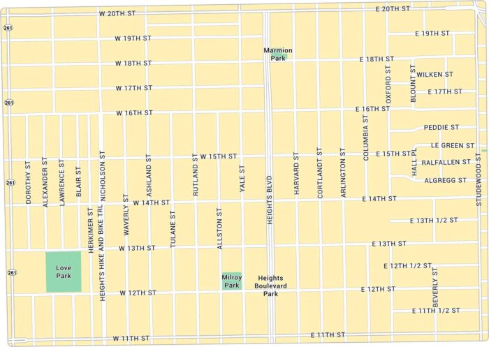
Houston Heights rises just above downtown with a bit of a small-town feel. Our map lays out its green corners and main routes.
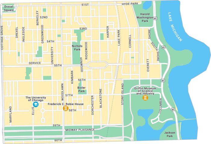
Hyde Park runs along Lake Michigan with a mix of campus streets, museums, and old trees. Our map lays out its wide blocks and roads.
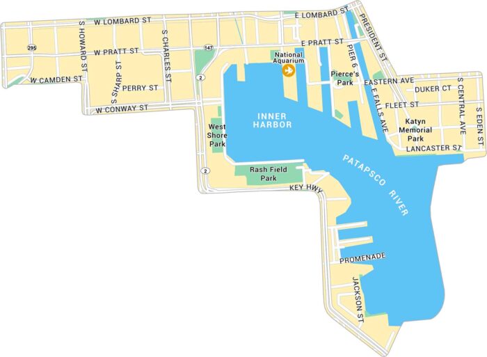
Inner Harbor is located along Baltimore’s waterfront, just south of downtown. Our map outlines the harbor, streets, and nearby attractions.
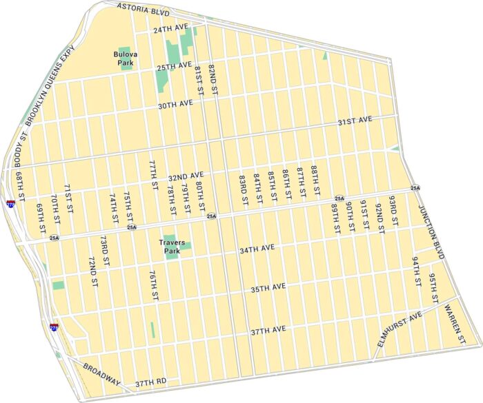
Jackson Heights sits in central Queens, between Roosevelt and Astoria Boulevard. This map shows its highways, streets and parks.
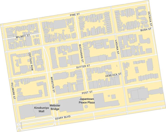
Japantown sits in central San Francisco, just west of Van Ness Avenue. This map shows its main plaza, surrounding streets, and nearby parks.
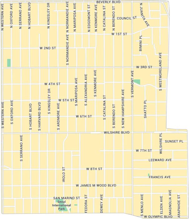
Koreatown sits just west of downtown Los Angeles. From Wilshire to 3rd Street, this map lays out major boulevards and nearby parks.
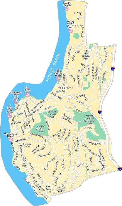
North of downtown San Diego, La Jolla stretches along coves facing the Pacific. The map shows its winding streets, beaches, and parks.
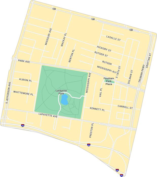
Our map of Lafayette Square shows the historic St. Louis neighborhood. It’s centered around the park with its surrounding streets.
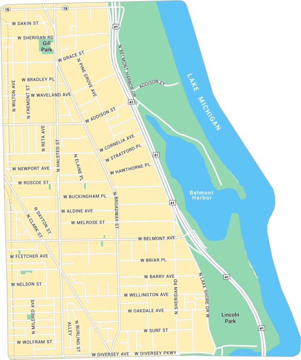
Our map of Lake View East shows the lakefront neighborhood north of downtown Chicago. See it on our map with streets and parks.
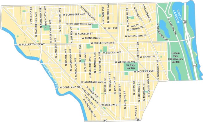
Discover Lincoln Park with our road map. It’s bound by Chicago River to the west and Lake Michigan to the east.
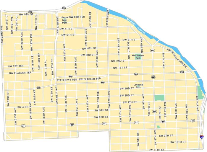
Our map of Little Havana shows the neighborhood just west of downtown Miami. Set along the Miami River, you’ll find major roads and highways.
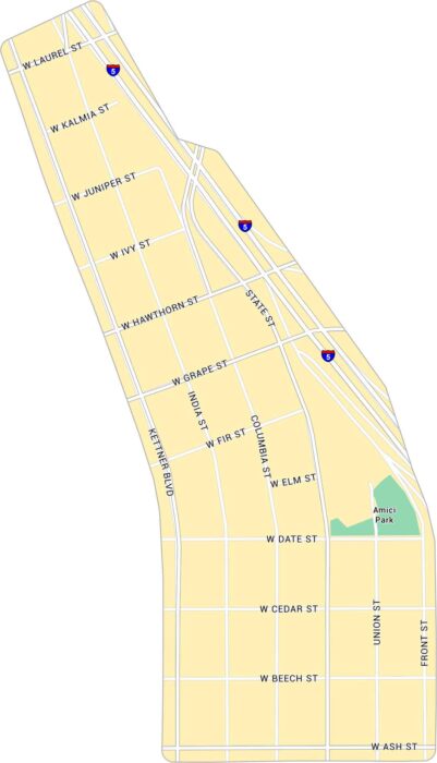
Our map of Little Italy shows this neighborhood just north of downtown San Diego. You’ll find its main streets, close to the waterfront area.
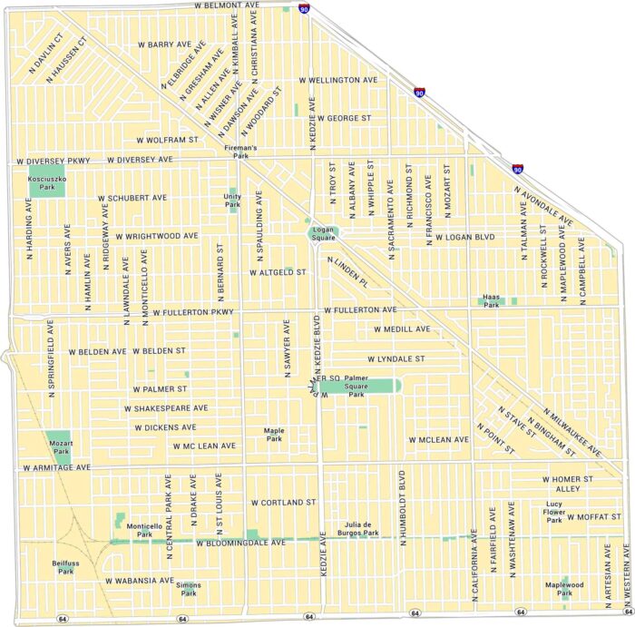
Our map of Logan Square shows this northwest Chicago neighborhood. It highlights main streets, parks, and the square itself.