US Election 1836 Map
In 1836, the presidency was wide open as Martin Van Buren ran to succeed Andrew Jackson. See our US election 1836 map to see the results.
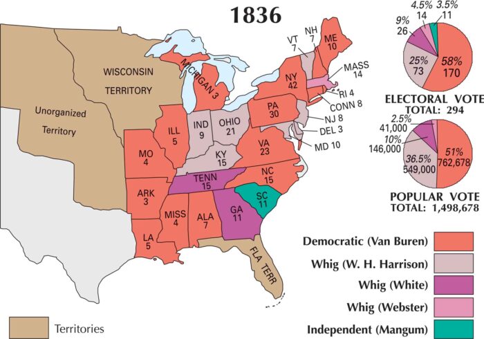
In 1836, the presidency was wide open as Martin Van Buren ran to succeed Andrew Jackson. See our US election 1836 map to see the results.
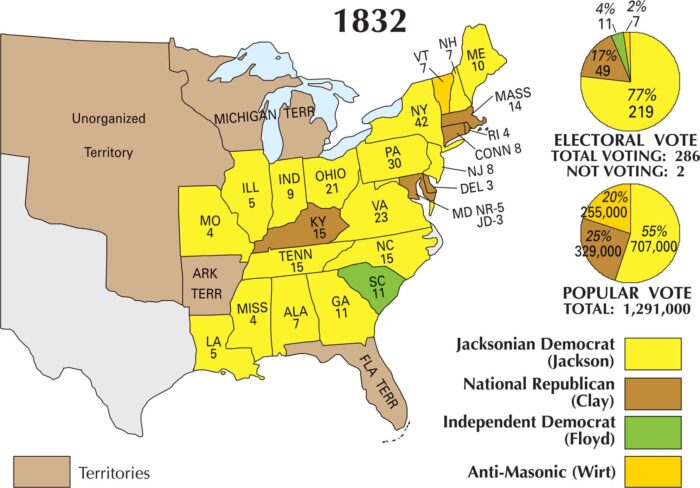
Our US election 1832 map shows Jackson sweeping most of the country, especially the South and West. Clay held a few pockets in New England.
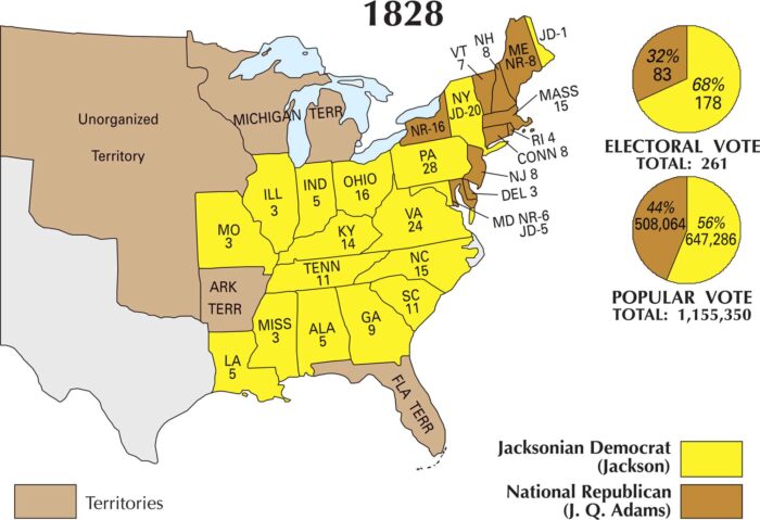
Our US election 1828 map shows Andrew Jackson’s victory. He dominated the South and much of the West. Adams held on mostly in New England.
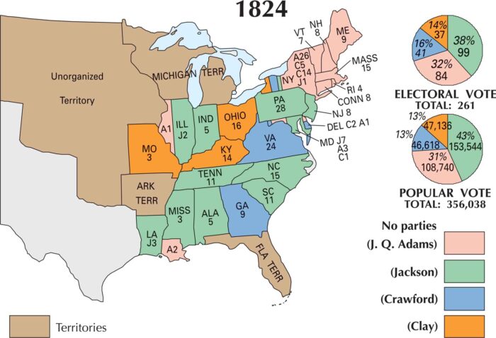
The 1824 election was a political free-for-all. Four men ran for president and Andrew Jackson won. This map tells the story of that chaos.
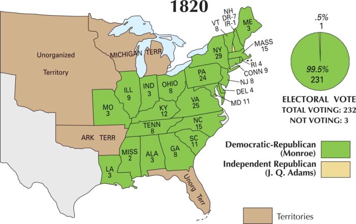
In 1820, James Monroe ran virtually unopposed. Our 1820 US election map captures his overwhelming win without a serious challenger.
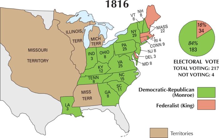
James Monroe was the Democratic-Republican candidate that coasted to victory. On our 1816 US election map, Monroe nearly sweeps it all.
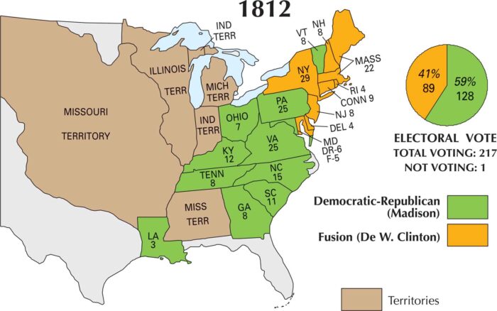
In 1812, the country was at war and deeply divided over it. Our 1812 US election map captures the results with James Madison as the winner.
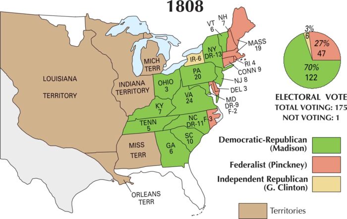
Come 1808, the Jefferson era was winding down. James Madison stepped into the spotlight. Our 1808 US election map shows Madison’s victory.
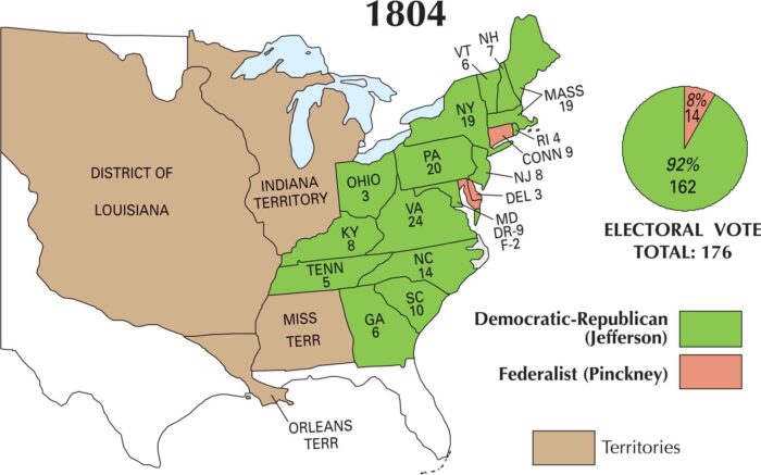
Looking at our US 1804 election map, Thomas Jefferson’s dominance is obvious. He swept nearly every state and cemented a landslide victory.
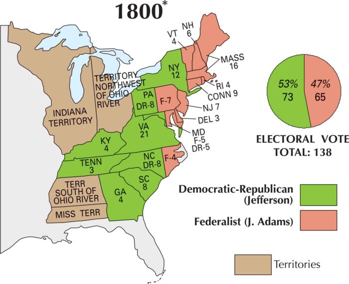
On this map, you can see how sharply the nation split. Jefferson won the election with support coming from the South and western states.
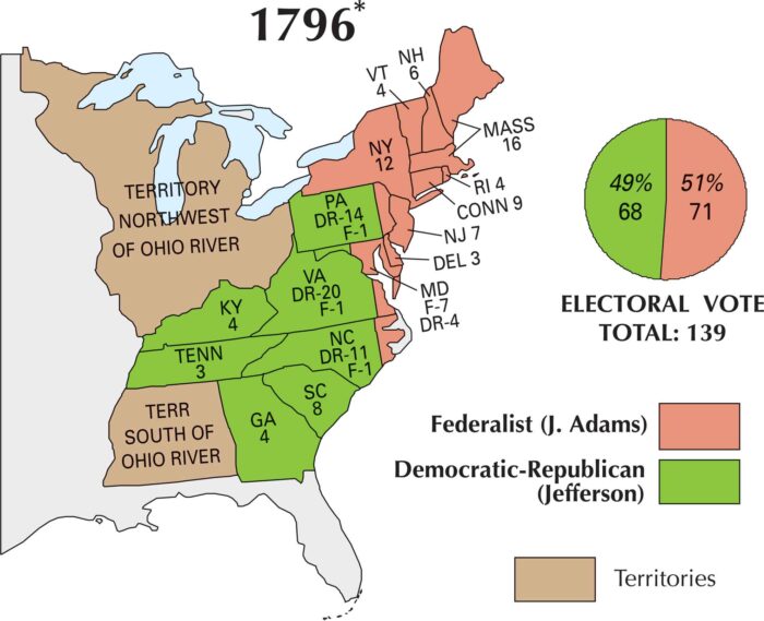
By 1796, the U.S. finally had a real political showdown. This map marks the country’s first competitive presidential race with Adams winning.
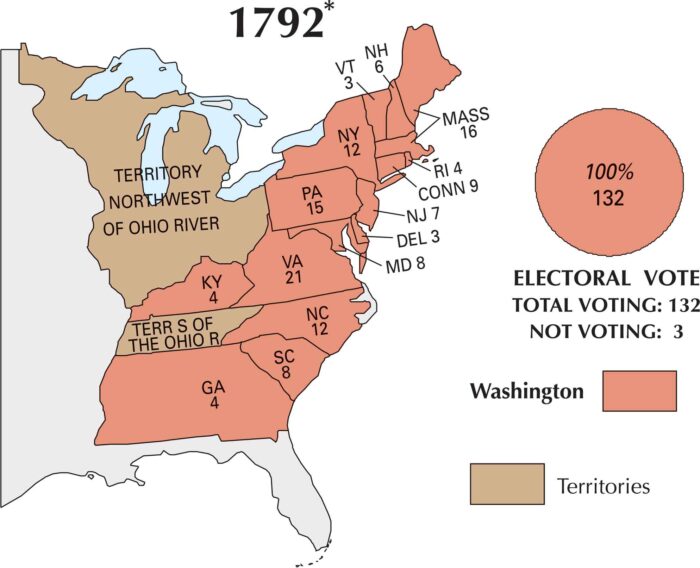
Once again, George Washington became president of the United States. Our 1792 US election map shows a country taking shape politically.
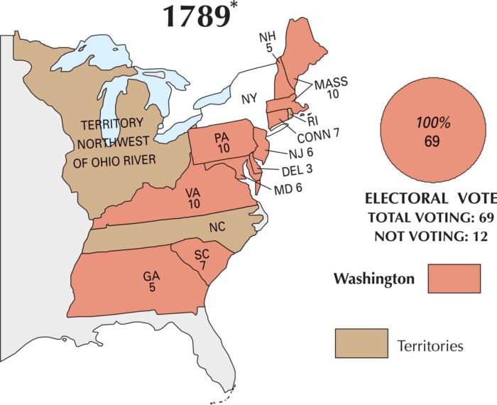
This map shows how the country was just getting started in the US election of 1789. George Washington was the clear and unanimous choice.
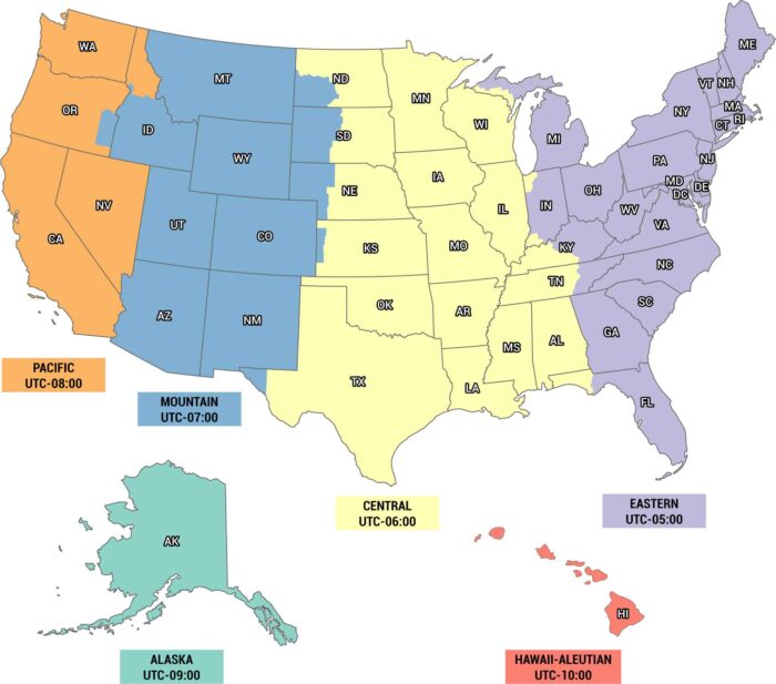
Time is different depending on where you are. Eastern, Central, Mountain, Pacific, Alaska and Hawaii time zones are on our US timezone map.
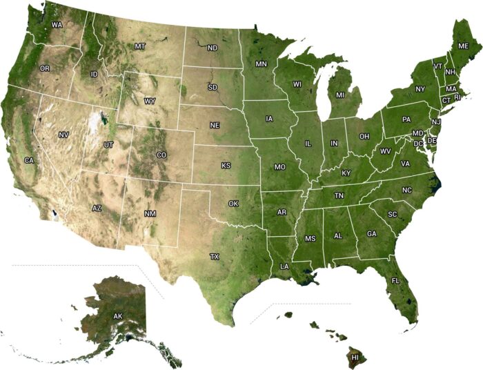
From above, the U.S. looks wild and alive. From the west to east coast, it’s a view that makes you realize how big this country really is.